Atm nearby ATM
Coronavirus disease (COVID-19) Situation
confirmed cases
10128845
deaths
130841
Argentina
Atm nearby ATM
ATM
2215, Avenida Cabildo, C1428, Comuna 13, Buenos Aires, AR Argentina
contacts phone
:
+54
Latitude:
-34.5607924
, Longitude:
-58.4575148
larger map & directions
read more
nearest Atm
139 m
ATM
Ciudad de La Paz 2175, C1428CPI
Atm
read more
199 m
Peru Services Courier
C1428AAS, Avenida Cabildo 2370
Atm
read more
283 m
ATM - Banelco
Echeverría 2357
Atm
read more
342 m
ATM
Avenida Cabildo 2543, 1428, Belgrano
Atm
read more
343 m
ATM
Juramento 2095, C1428DNG
Atm
read more
357 m
ATM
Avenida Cabildo 1939, Buenos Aires
Atm
read more
425 m
ATM
Avenida Cabildo 1872, C1428AAN
Atm
read more
486 m
ATM
Mariscal Antonio José de Sucre 2162, C1428DVL
Atm
read more
541 m
ATM
La Pampa 2477, 1428
Atm
read more
600 m
ATM
La Pampa 2103, C1428EAK
Atm
read more
605 m
ATM
Avenida Cabildo 1732, C1426ABR
Atm
read more
606 m
ATM
Avenida Cabildo 2754, 1428
Atm
read more
620 m
ATM
Avenida Cabildo 1741, 1426
Atm
read more
766 m
ATM
Avenida Cabildo 2902, C1429AAN
Atm
read more
809 m
ATM
Avenida Cabildo 2945, Buenos Aires
Atm
read more
843 m
ATM
C1428AAT, Av. Cabildo 2971, C1429AAA
Atm
read more
856 m
ATM
Avenida Cabildo 1546, C1426ABP
Atm
read more
906 m
ATM
Crámer 1710, C1426APD
Atm
read more
982 m
Santander Río
Avenida del Libertador 6156
Atm
read more
1.016 km
ATM HSBC
Avenida Cabildo 3086, Buenos Aires
Atm
read more
1.061 km
ATM
Avenida del Libertador 6335, C1428ARG
Atm
read more
1.067 km
Santander Río ATM Banelco
Avenida del Libertador 6375
Atm
read more
1.076 km
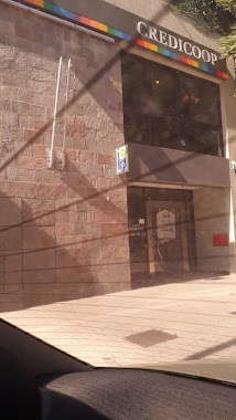
Red Link Credicoop
Avenida del Libertador 6335
Atm
read more
1.206 km
Link
Céspedes 2376
Atm
read more
1.351 km
ATM
Avenida Cabildo 1020, C1426AAX
Atm
read more
📑
all categories
Accounting
Administrative area level 1
Administrative area level 2
Airport
Amusement park
Aquarium
Art gallery
Atm
Bakery
Bank
Bar
Beauty salon
Bicycle store
Book store
Bowling alley
Bus station
Cafe
Campground
Car dealer
Car rental
Car repair
Car wash
Casino
Cemetery
Church
City hall
Clothing store
Colloquial area
Convenience store
Country
Courthouse
Dentist
Department store
Doctor
Electrician
Electronics store
Embassy
Establishment
Finance
Fire station
Florist
Food
Funeral home
Furniture store
Gas station
General contractor
Grocery or supermarket
Gym
Hair care
Hardware store
Health
Hindu Temple
Home goods store
Hospital
Insurance agency
Intersection
Jewelry store
Laundry
Lawyer
Library
Light rail station
Liquor store
Local government office
Locality
Locksmith
Lodging
Meal delivery
Meal takeaway
Mosque
Movie rental
Movie theater
Moving company
Museum
Natural feature
Neighborhood
Night club
Painter
Park
Parking
Pet store
Pharmacy
Physiotherapist
Place of worship
Plumber
Point of interest
Police
Political
Post office
Premise
Real estate agency
Restaurant
Roofing contractor
Route
Rv park, camping
School
Shoe store
Shopping mall
Spa
Stadium
Storage
Store
Subpremise
Subway station
Supermarket
Synagogue
Taxi stand
Train station
Transit station
Travel agency
University
Veterinary care
Zoo
sublocality level 1
sublocality level 3
↑