Atm nearby Atm Banco Patagonia
Coronavirus disease (COVID-19) Situation
confirmed cases
10128845
deaths
130841
Argentina
Atm nearby Atm Banco Patagonia
Atm Banco Patagonia
700, Avenida Luis María Campos, C1426, Comuna 14, Buenos Aires, AR Argentina
contacts phone
:
+54
Latitude:
-34.5703749
, Longitude:
-58.435647
larger map & directions
read more
nearest Atm
168 m
ATM
Avenida Luis María Campos 813, C1426BOG
Atm
read more
180 m
Cajero automatico citi
Avenida Luis María Campos 539
Atm
read more
320 m
Atm Banco Santander Rio
El Solar Shopping, Arce 940
Atm
read more
461 m
Banelco Macro
Avenida Luis María Campos 1029
Atm
read more
547 m
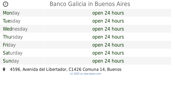
Banco Galicia
C1426BWT, Avenida del Libertador 4596
Atm
read more
618 m
Estacion Ministro Carranza Subte D
Avenida Santa Fe 5300
Atm
read more
655 m
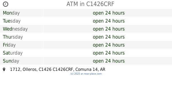
ATM
Olleros 1712, C1426CRF
Atm
read more
674 m
ATM
Olleros 1747, 1426, Palermo
Atm
read more
729 m
Banelco
Avenida Luis María Campos 1201
Atm
read more
793 m
Cajero Automático Banelco
Avenida Cabildo 745
Atm
read more
796 m
Cajero Link Banco Ciudad Subte Olleros
Avenida Cabildo C1426AAH, Buenos Aires
Atm
read more
802 m
Cajero Automático Banelco
Avenida Cabildo 769
Atm
read more
910 m
ATM
Avenida Luis María Campos 1349, C1426BOL
Atm
read more
913 m
ATM
Avenida Santa Fe 5000, C1425BHY
Atm
read more
916 m
ATM
Avenida Cabildo 850, C1426AAV
Atm
read more
940 m
Banelco BBVA Francés
C1425FWG, Bonpland 2461
Atm
read more
947 m
ATM
Avenida Cabildo 935, Buenos Aires
Atm
read more
958 m
Banelco
Avenida Luis María Campos 1383
Atm
read more
975 m
Moche Peruano Fu-kei & Sushi Bar
Nicaragua 5901, Buenos Aires
Atm
read more
1.004 km
Banelco
Avenida Luis María Campos 1407
Atm
read more
1.031 km
ATM
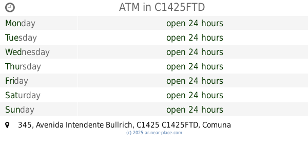
Portal Palermo Shopping, Avenida Intendente Bullrich 345, C1425FTD
Atm
read more
1.033 km
ATM
Avenida Federico Lacroze 2668, 1426
Atm
read more
1.095 km
Atm Banco Santander Rio
Avenida Santa Fe 4838
Atm
read more
1.105 km
ATM
Avenida Santa Fe 4820, 1425
Atm
read more
1.288 km
Santander Río
Avenida Juan Bautista Justo 5979
Atm
read more
📑
all categories
Accounting
Administrative area level 1
Administrative area level 2
Airport
Amusement park
Aquarium
Art gallery
Atm
Bakery
Bank
Bar
Beauty salon
Bicycle store
Book store
Bowling alley
Bus station
Cafe
Campground
Car dealer
Car rental
Car repair
Car wash
Casino
Cemetery
Church
City hall
Clothing store
Colloquial area
Convenience store
Country
Courthouse
Dentist
Department store
Doctor
Electrician
Electronics store
Embassy
Establishment
Finance
Fire station
Florist
Food
Funeral home
Furniture store
Gas station
General contractor
Grocery or supermarket
Gym
Hair care
Hardware store
Health
Hindu Temple
Home goods store
Hospital
Insurance agency
Intersection
Jewelry store
Laundry
Lawyer
Library
Light rail station
Liquor store
Local government office
Locality
Locksmith
Lodging
Meal delivery
Meal takeaway
Mosque
Movie rental
Movie theater
Moving company
Museum
Natural feature
Neighborhood
Night club
Painter
Park
Parking
Pet store
Pharmacy
Physiotherapist
Place of worship
Plumber
Point of interest
Police
Political
Post office
Premise
Real estate agency
Restaurant
Roofing contractor
Route
Rv park, camping
School
Shoe store
Shopping mall
Spa
Stadium
Storage
Store
Subpremise
Subway station
Supermarket
Synagogue
Taxi stand
Train station
Transit station
Travel agency
University
Veterinary care
Zoo
sublocality level 1
sublocality level 3
↑