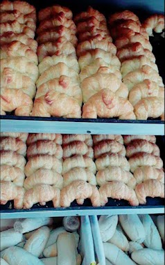
Bakery nearby Arturo A. Fretes
Coronavirus disease (COVID-19) Situation
confirmed cases
10128845
deaths
130841
Argentina
Bakery nearby Arturo A. Fretes
Arturo A. Fretes
302, Cuzco, C1408, Comuna 9, Buenos Aires, AR Argentina
contacts phone
:
+54 11 4644-3913
Latitude:
-34.6362741
, Longitude:
-58.5281556
larger map & directions
read more
nearest Bakery
150 m
Hiromi
C1408BND, Gana 218
Bakery
read more
415 m
Panadería Confitería Doña Anita
Avenida General Paz 27, Gran Buenos Aires, Ciudadela
Bakery
read more
442 m
Repostería Europea Sol Palmeras
Avenida Juan Bautista Justo 9483
Bakery
read more
455 m
Trattoria Lito's
Plaza Liniers Shopping Center, Coronel Ramón Lorenzo Falcón 7115
Bakery
read more
464 m
La Artesana
Coronel Ramón Lorenzo Falcón 7178
Bakery
read more
468 m
El Mago
R. L. Falcon 7174
Bakery
read more
489 m
Bom House
Carhué 54
Bakery
read more
499 m
Kiosco Jorge
Avenida General Paz 10716
Bakery
read more
563 m
Panadería La Dulzura
Coronel Ramón Lorenzo Falcón 6935
Bakery
read more
564 m
Confitería y Panadería la Dulzura
Coronel Ramón Lorenzo Falcón 6935
Bakery
read more
565 m
La Confianza
Carhué 141
Bakery
read more
569 m
Confitería Bin Bin
Carhué 149
Bakery
read more
577 m
Medialunas de la Nonna
Cosquín 97
Bakery
read more
611 m
Sabor Guaraní
Coronel Ramón Lorenzo Falcón 6887
Bakery
read more
613 m
Europan
Coronel Ramón Lorenzo Falcón 6885
Bakery
read more
637 m
Las Medialunas del Abuelo
Av Rivadvia 11164
Bakery
read more
693 m
La Nueva Colón
Montiel 244
Bakery
read more
753 m
San Francisco
Avenida Lisandro de la Torre 70
Bakery
read more
802 m
De Luca Patricia E
Argentina
Bakery
read more
803 m
La Panería de Liniers
Ventura Bosch 6996
Bakery
read more
988 m
La Porteña confitería
Arregui 6343
Bakery
read more
1.024 km
PANADERIA MONSERRAT
Avenida Rivadavia 12392, B1702CHT
Bakery
read more
1.025 km
Panadería Monserrat
Ciudadela
Bakery
read more
1.043 km
Panadería Delicias Artesanales
Ventura Bosch 6611
Bakery
read more
1.072 km
CHISAP
José Ignacio Rucci 415, Ciudadela
Bakery
read more
📑
all categories
Accounting
Administrative area level 1
Administrative area level 2
Airport
Amusement park
Aquarium
Art gallery
Atm
Bakery
Bank
Bar
Beauty salon
Bicycle store
Book store
Bowling alley
Bus station
Cafe
Campground
Car dealer
Car rental
Car repair
Car wash
Casino
Cemetery
Church
City hall
Clothing store
Colloquial area
Convenience store
Country
Courthouse
Dentist
Department store
Doctor
Electrician
Electronics store
Embassy
Establishment
Finance
Fire station
Florist
Food
Funeral home
Furniture store
Gas station
General contractor
Grocery or supermarket
Gym
Hair care
Hardware store
Health
Hindu Temple
Home goods store
Hospital
Insurance agency
Intersection
Jewelry store
Laundry
Lawyer
Library
Light rail station
Liquor store
Local government office
Locality
Locksmith
Lodging
Meal delivery
Meal takeaway
Mosque
Movie rental
Movie theater
Moving company
Museum
Natural feature
Neighborhood
Night club
Painter
Park
Parking
Pet store
Pharmacy
Physiotherapist
Place of worship
Plumber
Point of interest
Police
Political
Post office
Premise
Real estate agency
Restaurant
Roofing contractor
Route
Rv park, camping
School
Shoe store
Shopping mall
Spa
Stadium
Storage
Store
Subpremise
Subway station
Supermarket
Synagogue
Taxi stand
Train station
Transit station
Travel agency
University
Veterinary care
Zoo
sublocality level 1
sublocality level 3
↑