Bakery nearby Don Armando
Coronavirus disease (COVID-19) Situation
confirmed cases
10128845
deaths
130841
Argentina
Bakery nearby Don Armando
Don Armando
2467-2475, Avenida Córdoba, C1120, Comuna 2, Buenos Aires, AR Argentina
contacts phone
:
+54
Latitude:
-34.5992604
, Longitude:
-58.402005
larger map & directions
read more
nearest Bakery
191 m
La Argentina
Azcuénaga 727
Bakery
read more
196 m
Panadería Confitería Ganz
Calle Paso 719
Bakery
read more
205 m
Costumbres Argentinas
Avenida Pueyrredón 1081
Bakery
read more
238 m
Mica
Larrea 946
Bakery
read more
302 m
Abril- Confiteria Y Panaderia
Av Gral Juan M. de Pueyrredon, Capital Federal, Capital Federal
Bakery
read more
304 m
Panadería - confitería Ronzino Recoleta
Avenida Pueyrredón 1178
Bakery
read more
373 m
Mr Miga
Avenida Pueyrredón 1262
Bakery
read more
388 m
Rieiro Sara
Presidente José Evaristo Uriburu 671
Bakery
read more
646 m
Confitería Yaiza
Arenales 2211
Bakery
read more
681 m
Delicity
Marcelo Torcuato de Alvear 1906
Bakery
read more
688 m
Las Medialunas del Abuelo
Laprida 1062
Bakery
read more
732 m
Panadería Man
Boulogne Sur Mer 493
Bakery
read more
766 m
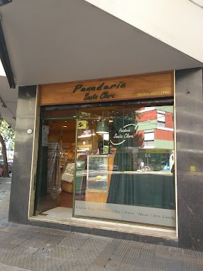
Panadería Santa Clara
Arenales 2699
Bakery
read more
776 m
HOPE Congress
Junín 394
Bakery
read more
784 m
Costumbres Argentinas
Avenida Corrientes 3020
Bakery
read more
909 m
Del Carmen
Viamonte 1774
Bakery
read more
936 m
Panaderia los Molinos
Presidente Teniente General Juan Domingo Perón 2659
Bakery
read more
944 m
Gobelli
Sarmiento 2007
Bakery
read more
974 m
La Barcelonesa
Sarmiento 2000
Bakery
read more
979 m
MIGUITAS
Presidente José Evaristo Uriburu 198
Bakery
read more
982 m
Costumbres Argentinas
ADV, Rodríguez Peña 1084, Buenos Aires
Bakery
read more
1.037 km
La Esperanza
Teniente General Juan Domingo Perón 2124
Bakery
read more
1.15 km
La Exposición
Presidente Teniente General Juan Domingo Perón 1966-1902, C1040AAD
Bakery
read more
1.195 km
La felicidad
Charcas 3251, C1425BMO
Bakery
read more
1.228 km
Winner
Avenida General Las Heras 1832
Bakery
read more
📑
all categories
Accounting
Administrative area level 1
Administrative area level 2
Airport
Amusement park
Aquarium
Art gallery
Atm
Bakery
Bank
Bar
Beauty salon
Bicycle store
Book store
Bowling alley
Bus station
Cafe
Campground
Car dealer
Car rental
Car repair
Car wash
Casino
Cemetery
Church
City hall
Clothing store
Colloquial area
Convenience store
Country
Courthouse
Dentist
Department store
Doctor
Electrician
Electronics store
Embassy
Establishment
Finance
Fire station
Florist
Food
Funeral home
Furniture store
Gas station
General contractor
Grocery or supermarket
Gym
Hair care
Hardware store
Health
Hindu Temple
Home goods store
Hospital
Insurance agency
Intersection
Jewelry store
Laundry
Lawyer
Library
Light rail station
Liquor store
Local government office
Locality
Locksmith
Lodging
Meal delivery
Meal takeaway
Mosque
Movie rental
Movie theater
Moving company
Museum
Natural feature
Neighborhood
Night club
Painter
Park
Parking
Pet store
Pharmacy
Physiotherapist
Place of worship
Plumber
Point of interest
Police
Political
Post office
Premise
Real estate agency
Restaurant
Roofing contractor
Route
Rv park, camping
School
Shoe store
Shopping mall
Spa
Stadium
Storage
Store
Subpremise
Subway station
Supermarket
Synagogue
Taxi stand
Train station
Transit station
Travel agency
University
Veterinary care
Zoo
sublocality level 1
sublocality level 3
↑