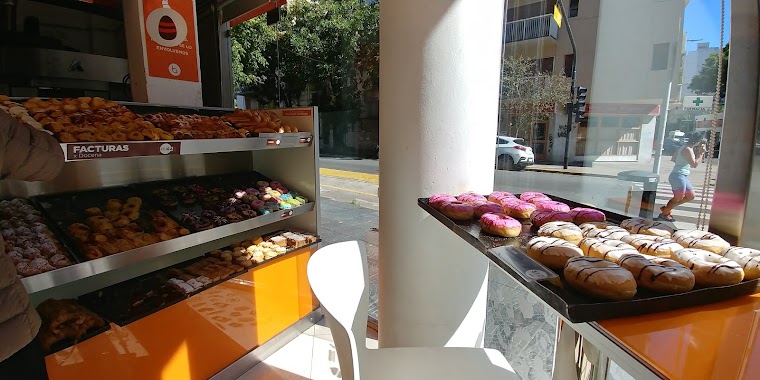
Bakery nearby Panadería La Armonia
Argentina
Bakery nearby Panadería La Armonia
Panadería La Armonia
3376, Juncal, 1425, Comuna 14, Buenos Aires, AR Argentina
contacts phone
:
+54
Latitude:
-34.584888
, Longitude:
-58.411442
larger map & directions
read more
nearest Bakery
214 m
Olten
Julián Álvarez 2577
Bakery
read more
321 m
Costumbres Argentinas
Avenida Santa Fe 3534
Bakery
read more
365 m
HOPE MARKET
DHL, Julián Álvarez 2466
Bakery
read more
370 m
Suevia
Jerónimo Salguero 1944
Bakery
read more
514 m
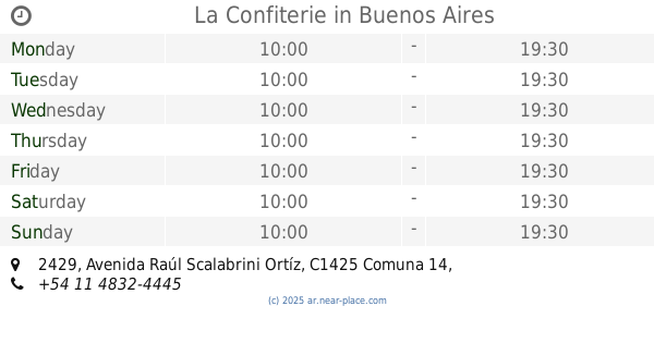
La Confiterie
Avenida Raúl Scalabrini Ortíz 2429
Bakery
read more
529 m
Galileo
Billinghurst 2315
Bakery
read more
667 m
Kailab Patisserie
Ortiz de Ocampo 2635, Buenos Aires
Bakery
read more
725 m
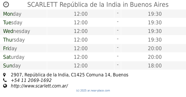
SCARLETT República de la India
República de la India 2907
Bakery
read more
740 m
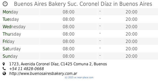
Buenos Aires Bakery Suc. Coronel Díaz
Avenida Coronel Díaz 1723
Bakery
read more
771 m
Panadería La Nueva Almendra
Güemes 4202-4216
Bakery
read more
789 m
La felicidad
Charcas 3251, C1425BMO
Bakery
read more
797 m
La Belle Dulce & Bistró
C1425BRZ, Paraguay 3758
Bakery
read more
804 m
Bellaria
Julián Álvarez 2097
Bakery
read more
808 m
PUNTA PALERMO
Paraguay 3920
Bakery
read more
835 m
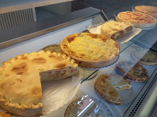
Todo Tartas
General Lucio Norberto Mansilla 3410
Bakery
read more
859 m
La Nueva San Agustín
Avenida General Las Heras 2915
Bakery
read more
879 m
Panadería Punta Palermo
General Lucio Norberto Mansilla 3318
Bakery
read more
967 m
Piccolo Pane
Jorge Luis Borges 2409
Bakery
read more
983 m
Saint Honoré
Peña 2665
Bakery
read more
992 m
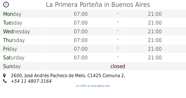
La Primera Porteña
José Andrés Pacheco de Melo 2600
Bakery
read more
1.064 km
Semillaarg
Avenida Raúl Scalabrini Ortíz 3560, Buenos Aires
Bakery
read more
1.064 km
Super Miga
French 2649
Bakery
read more
1.067 km
Confiteria Augustus
Jerónimo Salguero 3083
Bakery
read more
1.069 km
PESCE
Jerónimo Salguero 3083
Bakery
read more
1.086 km
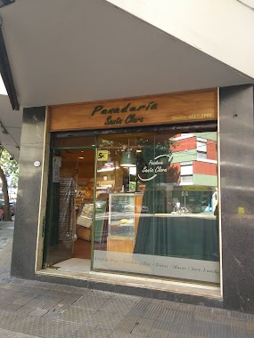
Panadería Santa Clara
Arenales 2699
Bakery
read more
📑
all categories
Accounting
Administrative area level 1
Administrative area level 2
Airport
Amusement park
Aquarium
Art gallery
Atm
Bakery
Bank
Bar
Beauty salon
Bicycle store
Book store
Bowling alley
Bus station
Cafe
Campground
Car dealer
Car rental
Car repair
Car wash
Casino
Cemetery
Church
City hall
Clothing store
Colloquial area
Convenience store
Country
Courthouse
Dentist
Department store
Doctor
Electrician
Electronics store
Embassy
Establishment
Finance
Fire station
Florist
Food
Funeral home
Furniture store
Gas station
General contractor
Grocery or supermarket
Gym
Hair care
Hardware store
Health
Hindu Temple
Home goods store
Hospital
Insurance agency
Intersection
Jewelry store
Laundry
Lawyer
Library
Light rail station
Liquor store
Local government office
Locality
Locksmith
Lodging
Meal delivery
Meal takeaway
Mosque
Movie rental
Movie theater
Moving company
Museum
Natural feature
Neighborhood
Night club
Painter
Park
Parking
Pet store
Pharmacy
Physiotherapist
Place of worship
Plumber
Point of interest
Police
Political
Post office
Premise
Real estate agency
Restaurant
Roofing contractor
Route
Rv park, camping
School
Shoe store
Shopping mall
Spa
Stadium
Storage
Store
Subpremise
Subway station
Supermarket
Synagogue
Taxi stand
Train station
Transit station
Travel agency
University
Veterinary care
Zoo
sublocality level 1
sublocality level 3
↑