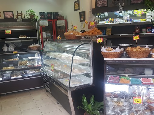
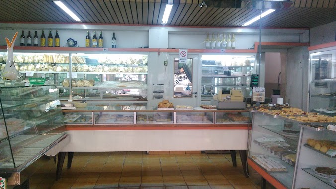
Bakery nearby San Antonio
Coronavirus disease (COVID-19) Situation
confirmed cases
10128845
deaths
130841
Argentina
Bakery nearby San Antonio
San Antonio
3201, Burela, C1431, Comuna 12, Buenos Aires, AR Argentina
contacts phone
:
+54
Latitude:
-34.5707015
, Longitude:
-58.4974655
larger map & directions
read more
nearest Bakery
299 m
Los Angeles
Lavoisier 3367
Bakery
read more
495 m
La Milagrosa
Avenida Triunvirato 5487
Bakery
read more
508 m
Craquelins
Avenida Triunvirato 5477
Bakery
read more
531 m
Las Medialunas del Abuelo
Avenida Triunvirato 5359
Bakery
read more
606 m
Algo dulce por favor
Avenida Triunvirato 5247
Bakery
read more
622 m
Las Violetas
Nahuel Huapi 5300
Bakery
read more
646 m
Dulces Artesanías
Iberá 5174
Bakery
read more
690 m
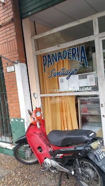
Panadería Santiago
Núñez 5384
Bakery
read more
737 m
KOOK
Burela 2570, C1431EHD
Bakery
read more
779 m
La Casa De Maga - Medialunas
Doctor Pedro Ignacio Rivera 5151
Bakery
read more
790 m
La Casa de los Churros
Doctor Pedro Ignacio Rivera 5190
Bakery
read more
806 m
Cincuenta Cincuenta
Quesada 5050
Bakery
read more
821 m
confitería y panadería Kantuta
Quesada 5050, Buenos Aires
Bakery
read more
859 m
La Aurora
Avenida de los Constituyentes 6135
Bakery
read more
873 m
La Paz
Iberá 5000
Bakery
read more
887 m
Quinteros Juan Carlos
Avenida Congreso 4903
Bakery
read more
887 m
Panadería La Familiar
Avenida Congreso 4903
Bakery
read more
904 m
Azahares y Canela
General José Gervasio Artigas 5508
Bakery
read more
979 m
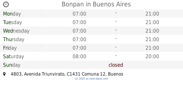
Bonpan
Avenida Triunvirato 4803
Bakery
read more
1.021 km
Lourdes
Avenida Albarellos 2626
Bakery
read more
1.069 km
Via Dolce
Avenida Triunvirato 4702
Bakery
read more
1.112 km
La Estrella Azul
Galván 3550
Bakery
read more
1.142 km
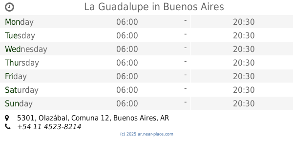
La Guadalupe
Olazábal 5301
Bakery
read more
1.16 km
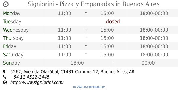
Signiorini - Pizza y Empanadas
Avenida Olazábal 5267
Bakery
read more
1.164 km
Picake Pastelería
C1431DQQ, Bucarelli 2219
Bakery
read more
📑
all categories
Accounting
Administrative area level 1
Administrative area level 2
Airport
Amusement park
Aquarium
Art gallery
Atm
Bakery
Bank
Bar
Beauty salon
Bicycle store
Book store
Bowling alley
Bus station
Cafe
Campground
Car dealer
Car rental
Car repair
Car wash
Casino
Cemetery
Church
City hall
Clothing store
Colloquial area
Convenience store
Country
Courthouse
Dentist
Department store
Doctor
Electrician
Electronics store
Embassy
Establishment
Finance
Fire station
Florist
Food
Funeral home
Furniture store
Gas station
General contractor
Grocery or supermarket
Gym
Hair care
Hardware store
Health
Hindu Temple
Home goods store
Hospital
Insurance agency
Intersection
Jewelry store
Laundry
Lawyer
Library
Light rail station
Liquor store
Local government office
Locality
Locksmith
Lodging
Meal delivery
Meal takeaway
Mosque
Movie rental
Movie theater
Moving company
Museum
Natural feature
Neighborhood
Night club
Painter
Park
Parking
Pet store
Pharmacy
Physiotherapist
Place of worship
Plumber
Point of interest
Police
Political
Post office
Premise
Real estate agency
Restaurant
Roofing contractor
Route
Rv park, camping
School
Shoe store
Shopping mall
Spa
Stadium
Storage
Store
Subpremise
Subway station
Supermarket
Synagogue
Taxi stand
Train station
Transit station
Travel agency
University
Veterinary care
Zoo
sublocality level 1
sublocality level 3
↑