Bakery nearby Troche
Coronavirus disease (COVID-19) Situation
confirmed cases
10128845
deaths
130841
Argentina
Bakery nearby Troche
Troche
609, Avenida Escalada, C1407, Comuna 9, Buenos Aires, AR Argentina
contacts phone
:
+54 11 2006-1958
Latitude:
-34.6435763
, Longitude:
-58.4970739
larger map & directions
read more
nearest Bakery
14 m
Panaderia y Confiteria Troche
Avenida Escalada 617, Buenos Aires
Bakery
read more
96 m
Panificadora Esparis
Avenida Escalada 553
Bakery
read more
234 m
El Viejo Torino
Avenida Juan Bautista Alberdi 4902
Bakery
read more
385 m
Panadería y Confitería El Maná
HAO, Avenida Juan Bautista Alberdi 4744
Bakery
read more
392 m
Güiraldes
Bragado 4999
Bakery
read more
597 m
Confitería Tío Juan
Avenida Juan Bautista Alberdi 5414
Bakery
read more
602 m
PANADERÍA Villa Luro
Basualdo 326
Bakery
read more
632 m
Vía Dante
Coronel Ramón Lorenzo Falcón 5201
Bakery
read more
672 m
Panadería y Confitería La Nueva Spiga
Donizetti 38
Bakery
read more
674 m
Panadería de Pan & Cia.
Manzoni 28
Bakery
read more
690 m
El Sol Guarani
Leopardi
Bakery
read more
691 m
Panaderia El Sol Guarani
Argentina
Bakery
read more
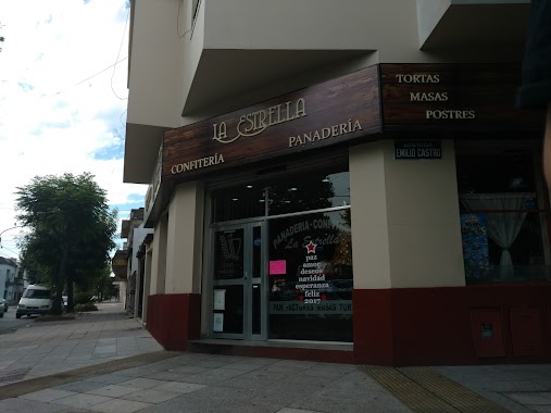
750 m
La Estrella
y, Avenida Emilio Castro
Bakery
read more
759 m
Panadería Dulcinea
Avenida Lope de Vega 13
Bakery
read more
834 m
Fuentes Encina
Guardia Nacional 96
Bakery
read more
837 m
Medialunas del Abuelo
Avenida Juan Bautista Alberdi 5695, AAH
Bakery
read more
837 m
Las Medialunas del Abuelo
Avenida Juan Bautista Alberdi 5695
Bakery
read more
912 m
Confitería Tío Juan
C1440CLI, Avenida Emilio Castro 5955
Bakery
read more
942 m
ORFANO
Avenida Directorio 4899
Bakery
read more
945 m
Las Medialunas de Maga
Coronel Ramón Lorenzo Falcón 5616
Bakery
read more
953 m
Ave Fénix
Avenida Larrazábal
Bakery
read more
966 m
La Argentinatta
Avenida Emilio Castro 5998
Bakery
read more
992 m
Panadería y Confitería Victoria
Avenida Lope de Vega 303
Bakery
read more
997 m
Facturas & Cía.
Avenida Directorio 4682
Bakery
read more
1.212 km
Nueva Suiza
Avenida Olivera 29
Bakery
read more
📑
all categories
Accounting
Administrative area level 1
Administrative area level 2
Airport
Amusement park
Aquarium
Art gallery
Atm
Bakery
Bank
Bar
Beauty salon
Bicycle store
Book store
Bowling alley
Bus station
Cafe
Campground
Car dealer
Car rental
Car repair
Car wash
Casino
Cemetery
Church
City hall
Clothing store
Colloquial area
Convenience store
Country
Courthouse
Dentist
Department store
Doctor
Electrician
Electronics store
Embassy
Establishment
Finance
Fire station
Florist
Food
Funeral home
Furniture store
Gas station
General contractor
Grocery or supermarket
Gym
Hair care
Hardware store
Health
Hindu Temple
Home goods store
Hospital
Insurance agency
Intersection
Jewelry store
Laundry
Lawyer
Library
Light rail station
Liquor store
Local government office
Locality
Locksmith
Lodging
Meal delivery
Meal takeaway
Mosque
Movie rental
Movie theater
Moving company
Museum
Natural feature
Neighborhood
Night club
Painter
Park
Parking
Pet store
Pharmacy
Physiotherapist
Place of worship
Plumber
Point of interest
Police
Political
Post office
Premise
Real estate agency
Restaurant
Roofing contractor
Route
Rv park, camping
School
Shoe store
Shopping mall
Spa
Stadium
Storage
Store
Subpremise
Subway station
Supermarket
Synagogue
Taxi stand
Train station
Transit station
Travel agency
University
Veterinary care
Zoo
sublocality level 1
sublocality level 3
↑