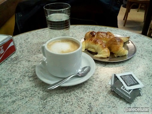
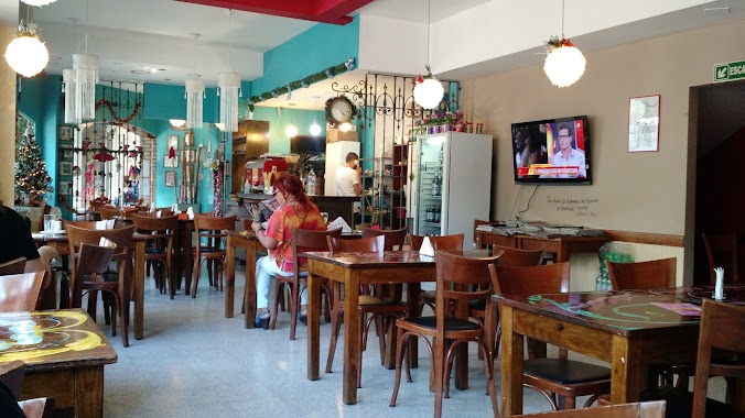
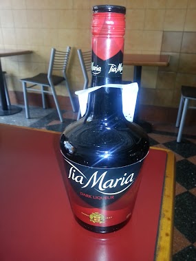
Bar nearby Amancay
Coronavirus disease (COVID-19) Situation
confirmed cases
10128845
deaths
130841
Argentina
Bar nearby Amancay
Amancay
3001, Avenida Independencia, C1225, Comuna 3, Buenos Aires, AR Argentina
contacts phone
:
+54 11 4932-7909
Latitude:
-34.619509
, Longitude:
-58.40795
larger map & directions
read more
nearest Bar
141 m
PARRILLA ALVARITO
México 3055
Bar
read more
633 m
~MALU~ Pizza-Café
Carlos Calvo 2438
Bar
read more
638 m
Pausa Restó Bar
Avenida Jujuy 1130
Bar
read more
656 m
Bar De Tapas Vinos Y Cervezas
Maza 846, C1220ABH
Bar
read more
668 m
Tinta Roja - Espacio Multieventos
General Urquiza 1248
Bar
read more
730 m
tombre 4 sala de teatro
México 3554
Bar
read more
739 m
El Ranchito
Moreno 2738
Bar
read more
742 m
Bar de Cao
Av. Independencia 2400
Bar
read more
781 m
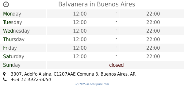
Balvanera
Adolfo Alsina 3007
Bar
read more
839 m
El gusto es nuestro
Adolfo Alsina 2800
Bar
read more
866 m
Billares Alenjo
Avenida Boedo 801-859
Bar
read more
907 m
Cristobalino
Avenida Hipólito Yrigoyen 3152, Buenos Aires
Bar
read more
913 m
Che JUAREZ
Avenida Hipólito Yrigoyen 3199
Bar
read more
983 m
La cautiva pool
Catamarca 38 C1213ABB
Bar
read more
994 m
Parrilla La Alegría
Pavón 2757
Bar
read more
1.007 km
Fernando Andres Cano
México
Bar
read more
1.011 km
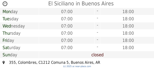
El Siciliano
Colombres 355
Bar
read more
1.016 km
Lucas Bar
24 de Noviembre 1422
Bar
read more
1.04 km
Bar Medina
México 2184
Bar
read more
1.055 km
Vinoteca Brindis
Avenida San Juan 3630/34
Bar
read more
1.119 km
El Franjamar
Moreno 2291
Bar
read more
1.14 km
Sin City Bar
Carlos Calvo 3778, C1230ABN
Bar
read more
1.148 km
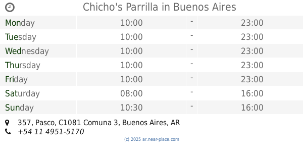
Chicho's Parrilla
Pasco 357
Bar
read more
1.23 km
Global Vinos
Argentina
Bar
read more
1.292 km
Patagonia Bar
Adolfo Alsina 2200
Bar
read more
📑
all categories
Accounting
Administrative area level 1
Administrative area level 2
Airport
Amusement park
Aquarium
Art gallery
Atm
Bakery
Bank
Bar
Beauty salon
Bicycle store
Book store
Bowling alley
Bus station
Cafe
Campground
Car dealer
Car rental
Car repair
Car wash
Casino
Cemetery
Church
City hall
Clothing store
Colloquial area
Convenience store
Country
Courthouse
Dentist
Department store
Doctor
Electrician
Electronics store
Embassy
Establishment
Finance
Fire station
Florist
Food
Funeral home
Furniture store
Gas station
General contractor
Grocery or supermarket
Gym
Hair care
Hardware store
Health
Hindu Temple
Home goods store
Hospital
Insurance agency
Intersection
Jewelry store
Laundry
Lawyer
Library
Light rail station
Liquor store
Local government office
Locality
Locksmith
Lodging
Meal delivery
Meal takeaway
Mosque
Movie rental
Movie theater
Moving company
Museum
Natural feature
Neighborhood
Night club
Painter
Park
Parking
Pet store
Pharmacy
Physiotherapist
Place of worship
Plumber
Point of interest
Police
Political
Post office
Premise
Real estate agency
Restaurant
Roofing contractor
Route
Rv park, camping
School
Shoe store
Shopping mall
Spa
Stadium
Storage
Store
Subpremise
Subway station
Supermarket
Synagogue
Taxi stand
Train station
Transit station
Travel agency
University
Veterinary care
Zoo
sublocality level 1
sublocality level 3
↑