Bar nearby Biersal BREWERY
Argentina
Bar nearby Biersal BREWERY
Biersal BREWERY
2198, Avenida Salvador María del Carril, Comuna 15, Buenos Aires, AR Argentina
contacts phone
:
+54 11 4572-2934
website:
www.facebook.com
Latitude:
-34.5857955
, Longitude:
-58.4901361
larger map & directions
read more
nearest Bar
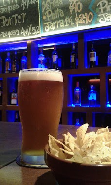
Biersal Cervecería Artesanal
C1419GZA, Avenida Salvador María del Carril 2198
Bar
read more
171 m
El Faro
Avenida de los Constituyentes 4099
Bar
read more
172 m
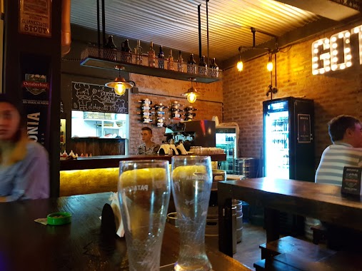
Gott - Burger & Beer
Avenida de los Constituyentes 4101
Bar
read more
242 m
PULPERÍA SIGLO XX
Avenida de los Constituyentes 3939
Bar
read more
383 m
Dorian Café y Bar
Avenida Salvador María del Carril 2498
Bar
read more
404 m
Solano's Factory
Mariscal Francisco Solano López 2144, C1419HQB
Bar
read more
680 m
Oliverio
La Pampa 5501-5547
Bar
read more
699 m
Bar Dublin
Avenida General Mosconi 2433
Bar
read more
760 m
Vinos Irina
José Cubas 2729
Bar
read more
782 m
Bar
3450,, Avenida de los Constituyentes 3402
Bar
read more
794 m
Boulevardier Bar
C1431DVN, Andonaegui 2076
Bar
read more
808 m
Rosti
Avenida General Mosconi 2581
Bar
read more
905 m
Choppería Matu's
Avenida Salvador María del Carril 2900
Bar
read more
967 m
Maldita Malta
Avenida Olazábal 5241
Bar
read more
967 m
Bar Franklin
5800, C1431BZT, Franklin D. Roosevelt 5748
Bar
read more
1.012 km
Butan Bar
C1431CIO, Mendoza 5207
Bar
read more
1.019 km
Solanas Futbol
Avenida Francisco Beiró 2835
Bar
read more
1.051 km
TEMPLO DEL CONEJO
C1427DEN, Llerena 3052
Bar
read more
1.06 km
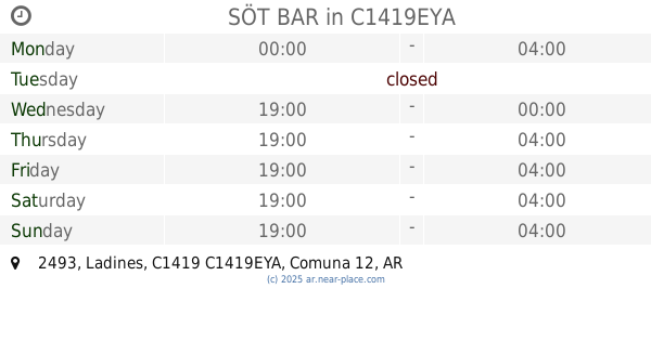
SÖT BAR
Ladines 2493, C1419EYA
Bar
read more
1.109 km
Vintage Pizza's
La Pampa 5097
Bar
read more
1.111 km
Hamelin Cervecería
Habana 3019
Bar
read more
1.179 km
Lo de Josu
Doctor Pedro Ignacio Rivera 5850, C1431BWB
Bar
read more
1.18 km
El Templo del Rocanroll
Doctor Pedro Ignacio Rivera 5850, C1431BWB C1431BWB
Bar
read more
1.201 km
Lo de Rober
General José Gervasio Artigas 5139
Bar
read more
1.25 km
Cultrum
Avenida Triunvirato 4205
Bar
read more
📑
all categories
Accounting
Administrative area level 1
Administrative area level 2
Airport
Amusement park
Aquarium
Art gallery
Atm
Bakery
Bank
Bar
Beauty salon
Bicycle store
Book store
Bowling alley
Bus station
Cafe
Campground
Car dealer
Car rental
Car repair
Car wash
Casino
Cemetery
Church
City hall
Clothing store
Colloquial area
Convenience store
Country
Courthouse
Dentist
Department store
Doctor
Electrician
Electronics store
Embassy
Establishment
Finance
Fire station
Florist
Food
Funeral home
Furniture store
Gas station
General contractor
Grocery or supermarket
Gym
Hair care
Hardware store
Health
Hindu Temple
Home goods store
Hospital
Insurance agency
Intersection
Jewelry store
Laundry
Lawyer
Library
Light rail station
Liquor store
Local government office
Locality
Locksmith
Lodging
Meal delivery
Meal takeaway
Mosque
Movie rental
Movie theater
Moving company
Museum
Natural feature
Neighborhood
Night club
Painter
Park
Parking
Pet store
Pharmacy
Physiotherapist
Place of worship
Plumber
Point of interest
Police
Political
Post office
Premise
Real estate agency
Restaurant
Roofing contractor
Route
Rv park, camping
School
Shoe store
Shopping mall
Spa
Stadium
Storage
Store
Subpremise
Subway station
Supermarket
Synagogue
Taxi stand
Train station
Transit station
Travel agency
University
Veterinary care
Zoo
sublocality level 1
sublocality level 3
↑