Bar nearby BROUWEN BIER
Coronavirus disease (COVID-19) Situation
confirmed cases
10128845
deaths
130841
Argentina
Bar nearby BROUWEN BIER
BROUWEN BIER
1389, Calle 16, B1900, La Plata, La Plata, AR Argentina
contacts phone
:
+54
website:
brouwenbier.faceboock.com
Latitude:
-34.9297378
, Longitude:
-57.9506275
larger map & directions
read more
nearest Bar
267 m
BRUCE Beer & Food
Diagonal 75, La Plata
Bar
read more
333 m
Exposición
B1900BTT, Calle 59 1152-1200, La Plata
Bar
read more
352 m
Hendrix
Diagonal 74 1900, La Plata
Bar
read more
370 m
Chido
B1900CAT, Diagonal 74 2118-2200, La Plata
Bar
read more
478 m
9 Pasos Food & Drink
Plaza Hipólito Yrigoyen 75, La Plata
Bar
read more
530 m
La Plata
Diagonal 75 584, La Plata
Bar
read more
627 m
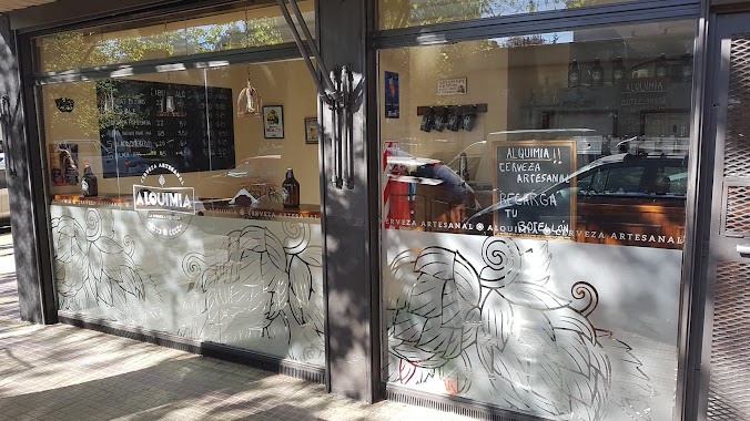
Alquimia Cerveza artesanal
La Plata
Bar
read more
636 m
La Vermucería
Calle 16, La Plata
Bar
read more
654 m
Weizen-Haus
Calle 57 884, La Plata
Bar
read more
659 m
Cinco Sabios
Avenida 13 1540, La Plata
Bar
read more
742 m
Amberes Cervezas Artesanales
Calle 63 827, La Plata
Bar
read more
745 m
Galpon
Avenida 60 1325, La Plata
Bar
read more
748 m
Cinco Sabios
B1900BHS, Calle 55 1189, La Plata
Bar
read more
752 m
The Five Wisemen
Avenida 19 1096, La Plata
Bar
read more
798 m
Hurry Up
12 y 13, Calle 56 895, La Plata
Bar
read more
858 m
Theater - Bar La Plata
Calle 58 770, La Plata
Bar
read more
877 m
Hummingbird Art and Culture
Calle 10 1305, La Plata
Bar
read more
877 m
Colibrí Arte y Cultura
Calle 10 1305, La Plata
Bar
read more
881 m
Bar De Agrupacion Politica KOKINA La Plata
Calle 10 1200, La Plata
Bar
read more
881 m
Bar De Agrupacion Politica KOKINA La Plata
Calle 10 Bis 1200, La Plata
Bar
read more
920 m
Pino Roberto
Calle 12 1064, La Plata
Bar
read more
972 m
The Brothers House
Calle 11, La Plata
Bar
read more
1.239 km
El Surtidor Cervecero
B1900FKI, Diagonal 73 2106, La Plata
Bar
read more
1.294 km
Estación Growler
B1904CLB, Avenida 7 1400, La Plata
Bar
read more
1.349 km
Chelas
B1904CVQ, Calle 17 1845, La Plata
Bar
read more
📑
all categories
Accounting
Administrative area level 1
Administrative area level 2
Airport
Amusement park
Aquarium
Art gallery
Atm
Bakery
Bank
Bar
Beauty salon
Bicycle store
Book store
Bowling alley
Bus station
Cafe
Campground
Car dealer
Car rental
Car repair
Car wash
Casino
Cemetery
Church
City hall
Clothing store
Colloquial area
Convenience store
Country
Courthouse
Dentist
Department store
Doctor
Electrician
Electronics store
Embassy
Establishment
Finance
Fire station
Florist
Food
Funeral home
Furniture store
Gas station
General contractor
Grocery or supermarket
Gym
Hair care
Hardware store
Health
Hindu Temple
Home goods store
Hospital
Insurance agency
Intersection
Jewelry store
Laundry
Lawyer
Library
Light rail station
Liquor store
Local government office
Locality
Locksmith
Lodging
Meal delivery
Meal takeaway
Mosque
Movie rental
Movie theater
Moving company
Museum
Natural feature
Neighborhood
Night club
Painter
Park
Parking
Pet store
Pharmacy
Physiotherapist
Place of worship
Plumber
Point of interest
Police
Political
Post office
Premise
Real estate agency
Restaurant
Roofing contractor
Route
Rv park, camping
School
Shoe store
Shopping mall
Spa
Stadium
Storage
Store
Subpremise
Subway station
Supermarket
Synagogue
Taxi stand
Train station
Transit station
Travel agency
University
Veterinary care
Zoo
sublocality level 1
sublocality level 3
↑