Bar nearby Bruchi
Argentina
Bar nearby Bruchi
Bruchi
B1640 Martínez, Buenos Aires, Argentina
contacts phone
:
+54
Latitude:
-34.4897144
, Longitude:
-58.4988963
larger map & directions
read more
nearest Bar
70 m
La Cantina
Albarellos 2023, Gran Buenos Aires
Bar
read more
218 m
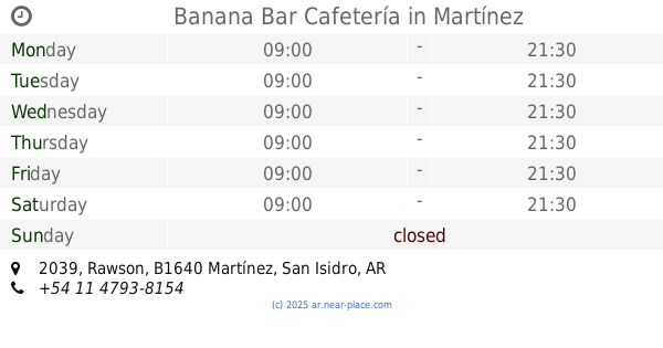
Banana Bar Cafetería
BDB, Rawson 2039, Martínez
Cafe
Bar
Restaurant
Food
Point of interest
Establishment
read more
219 m
Colomer Erica Mariel
Hipólito Yrigoyen 48, Martínez
Bar
read more
247 m
Rol
Avenida Santa Fe 2277, San Isidro
Bar
read more
267 m
Cunningham Irish Pub
General Alvear 303, San Isidro
Bar
read more
276 m
El Escondite Bar
B1640IFK, Avenida Santa Fe 2309, Martínez
Bar
read more
326 m
El Patio Martinez
Emilio Lamarca 322, Martínez
Shopping mall
Bar
Restaurant
Food
Point of interest
Establishment
read more
386 m
El Fondo Cervecero
Hipólito Yrigoyen 181, Martínez
Bar
read more
438 m
ROL bar
B1640IFQ, Avenida Santa Fe 1614, Martínez
Bar
read more
460 m
Maria Lucrecia Medina
Juncal 11, Martínez
Bar
read more
474 m
Poroto Bar
Juncal 11, San Isidro
Bar
read more
658 m
Remake Restó Bar
Avenida Santa Fe 1434, Martínez
Bar
read more
689 m
Goyeneche Bar
Gral. Pirán 100-2, B1640GKB, Martínez
Bar
read more
872 m
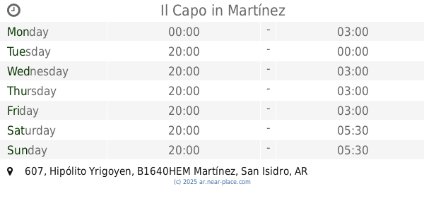
Il Capo
Hipólito Yrigoyen 607, Martínez
Bar
read more
890 m
Almacen Inguz
B1640EKH, Vieytes 616, Martínez
Bar
read more
948 m
El Loco Stanley
B1636HHW, Avenida Maipú 4182, Olivos
Bar
read more
1.018 km
Cerveza Corona
Corrientes 711 B1640HNO, Martínez
Bar
read more
1.093 km
Umma
Avenida del Libertador 14092, Martínez
Bar
read more
1.12 km
Company Bar
Avenida del Libertador 13797, Martínez
Bar
read more
1.128 km
La Bataraza
Guillermo Rawson 3889, La Lucila
Bar
read more
1.153 km
Berlina Jack Flash
Avenida del Libertador 14199, Martínez
Bar
read more
1.156 km
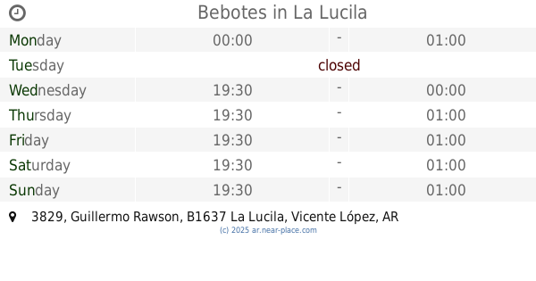
Bebotes
B1637AGM, Guillermo Rawson 3829, La Lucila
Bar
read more
1.172 km
Biae Cossee
General Alvear 1136, Martínez
Bar
read more
1.182 km
Florinda
Rawson 3799 B1637AGK, La Lucila
Bar
read more
1.183 km
Pehuenes
Díaz Vélez 699, Gran Buenos Aires
Bar
read more
📑
all categories
Accounting
Administrative area level 1
Administrative area level 2
Airport
Amusement park
Aquarium
Art gallery
Atm
Bakery
Bank
Bar
Beauty salon
Bicycle store
Book store
Bowling alley
Bus station
Cafe
Campground
Car dealer
Car rental
Car repair
Car wash
Casino
Cemetery
Church
City hall
Clothing store
Colloquial area
Convenience store
Country
Courthouse
Dentist
Department store
Doctor
Electrician
Electronics store
Embassy
Establishment
Finance
Fire station
Florist
Food
Funeral home
Furniture store
Gas station
General contractor
Grocery or supermarket
Gym
Hair care
Hardware store
Health
Hindu Temple
Home goods store
Hospital
Insurance agency
Intersection
Jewelry store
Laundry
Lawyer
Library
Light rail station
Liquor store
Local government office
Locality
Locksmith
Lodging
Meal delivery
Meal takeaway
Mosque
Movie rental
Movie theater
Moving company
Museum
Natural feature
Neighborhood
Night club
Painter
Park
Parking
Pet store
Pharmacy
Physiotherapist
Place of worship
Plumber
Point of interest
Police
Political
Post office
Premise
Real estate agency
Restaurant
Roofing contractor
Route
Rv park, camping
School
Shoe store
Shopping mall
Spa
Stadium
Storage
Store
Subpremise
Subway station
Supermarket
Synagogue
Taxi stand
Train station
Transit station
Travel agency
University
Veterinary care
Zoo
sublocality level 1
sublocality level 3
↑