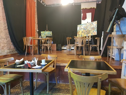
Bar nearby Cocaine City Buenos Aires
Coronavirus disease (COVID-19) Situation
confirmed cases
10128845
deaths
130841
Argentina
Bar nearby Cocaine City Buenos Aires
Cocaine City Buenos Aires
1733, Jorge Newbery, C1426, C1426CXE, Comuna 14, AR Argentina
contacts phone
:
+54
Latitude:
-34.5674719
, Longitude:
-58.4352825
larger map & directions
read more
nearest Bar
244 m
Vida Bar
Migueletes 994
Bar
read more
288 m
Pizzería Bar Cantegril
Avenida Luis María Campos 701
Bar
read more
445 m
Little Lou - Brunch & Restó
Soldado de la Independencia 1154
Bar
read more
518 m
Jerome Cerveza Artesanal
Avenida General Indalecio Chenaut 1878
Bar
read more
598 m
Van Koning Bar Dutch
Báez 325
Bar
read more
620 m
DISTRITO Beer Garden
C1426BRG, Báez 315
Bar
read more
636 m
Berlina Las Cañitas
Arévalo 2925
Bar
read more
643 m
La Loggia Cervecería Artesanal
Avenida Federico Lacroze 2114
Bar
read more
714 m
Mona
Báez 240
Bar
read more
719 m
Lupita
Báez 227
Bar
read more
723 m
Café Bar Antonio
Avenida Cabildo 264
Bar
read more
736 m
Francis Platz - Cañitas
Andrés Arguibel 2859
Bar
read more
739 m
Coppolla’s
Arce 243
Bar
read more
740 m
Izakaya by Sushi Pop - Cañitas
Báez 207
Bar
read more
742 m
Vinoteca Quetec
Avenida Cabildo 196
Bar
read more
790 m
Santillo
Avenida Cabildo 548
Bar
read more
797 m
La Casa de Bacus
Zabala 1615
Bar
read more
798 m
Nanni Segundo Ciclo
C1426DFD, Concepción Arenal 2420
Bar
read more
866 m
La Tacita
Avenida Dorrego 2525
Bar
read more
866 m
Soraya
Avenida Cabildo 739
Bar
read more
879 m
Centro Cultural Amigos De Eladia Blázquez
Avenida Santa Fe 5362
Bar
read more
905 m
Restaurante Ayelen Diet
Zapata 101
Bar
read more
941 m
Sabores de la Cepa
Paraguay 5635
Bar
read more
975 m
Rabieta
Avenida del Libertador 3949
Bar
read more
982 m
Maldita Malta
Avenida Santa Fe 5208
Bar
read more
📑
all categories
Accounting
Administrative area level 1
Administrative area level 2
Airport
Amusement park
Aquarium
Art gallery
Atm
Bakery
Bank
Bar
Beauty salon
Bicycle store
Book store
Bowling alley
Bus station
Cafe
Campground
Car dealer
Car rental
Car repair
Car wash
Casino
Cemetery
Church
City hall
Clothing store
Colloquial area
Convenience store
Country
Courthouse
Dentist
Department store
Doctor
Electrician
Electronics store
Embassy
Establishment
Finance
Fire station
Florist
Food
Funeral home
Furniture store
Gas station
General contractor
Grocery or supermarket
Gym
Hair care
Hardware store
Health
Hindu Temple
Home goods store
Hospital
Insurance agency
Intersection
Jewelry store
Laundry
Lawyer
Library
Light rail station
Liquor store
Local government office
Locality
Locksmith
Lodging
Meal delivery
Meal takeaway
Mosque
Movie rental
Movie theater
Moving company
Museum
Natural feature
Neighborhood
Night club
Painter
Park
Parking
Pet store
Pharmacy
Physiotherapist
Place of worship
Plumber
Point of interest
Police
Political
Post office
Premise
Real estate agency
Restaurant
Roofing contractor
Route
Rv park, camping
School
Shoe store
Shopping mall
Spa
Stadium
Storage
Store
Subpremise
Subway station
Supermarket
Synagogue
Taxi stand
Train station
Transit station
Travel agency
University
Veterinary care
Zoo
sublocality level 1
sublocality level 3
↑