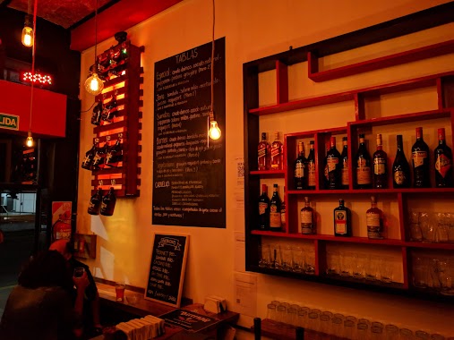
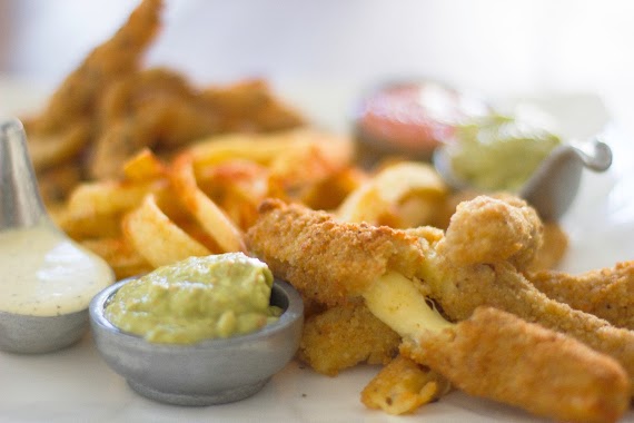
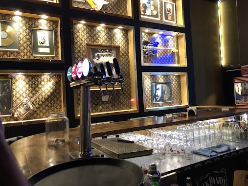
Bar nearby El Popular
Coronavirus disease (COVID-19) Situation
confirmed cases
10128845
deaths
130841
Argentina
Bar nearby El Popular
El Popular
3800, Avenida Federico Lacroze, C1427, Comuna 15, Buenos Aires, AR Argentina
contacts phone
:
+54
Latitude:
-34.583265
, Longitude:
-58.452488
larger map & directions
read more
nearest Bar
21 m
BAR EL POPULAR-CHACARITA
Avenida Federico Lacroze 3800
Bar
read more
159 m
Rita Restaurante
Olleros 3891
Bar
read more
162 m
Bar Palacio (Museo Fotográfico Simik)
Avenida Federico Lacroze 3901
Bar
read more
259 m
Pedretti Bar
Avenida Forest 728
Bar
read more
265 m
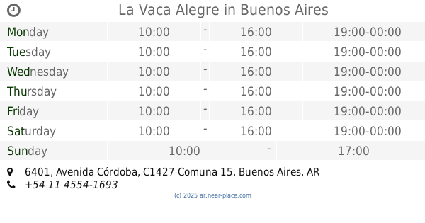
La Vaca Alegre
Avenida Córdoba 6401
Bar
read more
356 m
BORNEO BAR
Álvarez Thomas 635
Bar
read more
430 m
Braun
Olleros 4142
Bar
read more
461 m
Pizza Restó Bar Buni's
Estación Federico Lacroze, Avenida Federico Lacroze 4190
Bar
read more
657 m
Lekeitio Vasco Oriental
Santos Dumont 4056
Bar
read more
694 m
Mattina
Avenida Álvarez Thomas 22, Palermo Hollywood
Bar
read more
697 m
Mattina Bar
Avenida Álvarez Thomas 22
Bar
read more
725 m
Los Andes (Tango)
Avenida Dorrego 1578
Bar
read more
773 m
Minimal Bar
Avenida Córdoba 5981
Bar
read more
793 m
Balder Beer - Cervecería Artesanal
Arévalo 1392
Bar
read more
815 m
Los dos Hermanos
Arévalo 1395
Bar
read more
825 m
El Galpón
Avenida Coronel Niceto Vega 5976
Bar
read more
866 m
Barcelona Asturias
Avenida Córdoba 5895
Bar
read more
872 m
Kronopios
Avenida Elcano 3640
Bar
read more
918 m
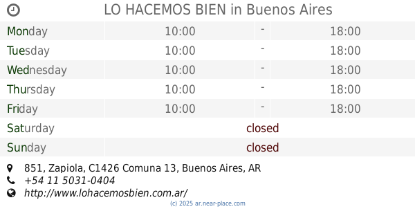
LO HACEMOS BIEN
C1426ATQ, Zapiola 851
Bar
read more
939 m
Genoma Bar
Gorriti 6534
Bar
read more
981 m
PL Deli Café & Take Away
Gorriti 6046
Bar
read more
1.022 km
Roppongi Bar
Avenida Elcano 3487
Bar
read more
1.077 km
La Beba (Tango)
Avenida Álvarez Thomas 1449
Bar
read more
1.104 km
El Codo
Juan Ramirez de Velasco 1400, Buenos Aires
Bar
read more
1.143 km
Jack White Bar
Virrey Avilés 3383
Bar
read more
📑
all categories
Accounting
Administrative area level 1
Administrative area level 2
Airport
Amusement park
Aquarium
Art gallery
Atm
Bakery
Bank
Bar
Beauty salon
Bicycle store
Book store
Bowling alley
Bus station
Cafe
Campground
Car dealer
Car rental
Car repair
Car wash
Casino
Cemetery
Church
City hall
Clothing store
Colloquial area
Convenience store
Country
Courthouse
Dentist
Department store
Doctor
Electrician
Electronics store
Embassy
Establishment
Finance
Fire station
Florist
Food
Funeral home
Furniture store
Gas station
General contractor
Grocery or supermarket
Gym
Hair care
Hardware store
Health
Hindu Temple
Home goods store
Hospital
Insurance agency
Intersection
Jewelry store
Laundry
Lawyer
Library
Light rail station
Liquor store
Local government office
Locality
Locksmith
Lodging
Meal delivery
Meal takeaway
Mosque
Movie rental
Movie theater
Moving company
Museum
Natural feature
Neighborhood
Night club
Painter
Park
Parking
Pet store
Pharmacy
Physiotherapist
Place of worship
Plumber
Point of interest
Police
Political
Post office
Premise
Real estate agency
Restaurant
Roofing contractor
Route
Rv park, camping
School
Shoe store
Shopping mall
Spa
Stadium
Storage
Store
Subpremise
Subway station
Supermarket
Synagogue
Taxi stand
Train station
Transit station
Travel agency
University
Veterinary care
Zoo
sublocality level 1
sublocality level 3
↑