Bar nearby La Kantina De Los San (De Alianza Jesús María)
Argentina
Bar nearby La Kantina De Los San (De Alianza Jesús María)
La Kantina De Los San (De Alianza Jesús María)
Calle Tucumán, 5220, Jesus María, Colón, AR Argentina
contacts phone
:
+54
Latitude:
-30.9722801
, Longitude:
-64.09333
larger map & directions
read more
nearest Bar
239 m
Blue Magic
Calle Córdoba 20, Jesus María
Bar
read more
420 m
EL MAS ALLA BAR
tucuman y 9 de julio, Jesus María
Bar
read more
472 m
Mala Pinta, Birreria
Castulo Peña 220, Jesus María
Bar
read more
502 m
LO MAS PANCHO
Calle Tucumán 269, Jesus María
Bar
read more
507 m
Bar España
España 116, Jesus María
Bar
read more
582 m
La Rueda Restobar
Calle España 116, Jesus María
Bar
read more
598 m
Puerto Maria
Córdoba 326, Jesus María
Bar
read more
680 m
Bar Rincon Nuestro
Calle Colón 81, Jesus María
Bar
read more
720 m
Cristhobal
Calle Tucumán 413, Jesus María
Bar
read more
781 m
Kariba - CraftBeer & Coffee
Jesus María
Bar
read more
793 m
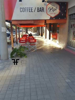
Lo de Pipi Cofee / Bar
Calle J Kennedy 193, Jesus María
Bar
read more
793 m
Lado B Cofee / Bar
Calle J Kennedy 193, Jesus María
Bar
read more
800 m
chester queen
Castulo Peña 518, Jesus María
Bar
read more
803 m
El Creyente Bar
Calle J Kennedy, Jesus María
Bar
read more
803 m
4 Elementos Bar
Calle Tucumán 500, Jesus María
Bar
read more
824 m
Kariba - Craft Beer & Coffee
Calle Tucumán 499, 5220, Jesus María
Bar
read more
839 m
Bar Comedor San Cayetano
513, Belgrano, Jesus María
Bar
read more
839 m
Isidro bar
Sarmiento & Belgrano, Jesus María
Bar
read more
890 m
Terminal JM
Avenida Laprida
Bar
read more
890 m
A'lares
Castulo Peña 522, Jesus María
Bar
read more
924 m
Lado B Drinkstore
Salta, Jesus María
Bar
read more
962 m
Bar la Vieja Terminal
Calle Tucumán 640, Jesus María
Bar
read more
1.033 km
Victorino Resto Bar
Julio Argentino Roca 99, Jesus María
Bar
read more
1.035 km
Bar & Beer
Calle Córdoba 696, Jesus María
Bar
read more
1.142 km
DON PEPE BAR RESTAURANT
Calle J Alberdi, Jesus María
Bar
read more
📑
all categories
Accounting
Administrative area level 1
Administrative area level 2
Airport
Amusement park
Aquarium
Art gallery
Atm
Bakery
Bank
Bar
Beauty salon
Bicycle store
Book store
Bowling alley
Bus station
Cafe
Campground
Car dealer
Car rental
Car repair
Car wash
Casino
Cemetery
Church
City hall
Clothing store
Colloquial area
Convenience store
Country
Courthouse
Dentist
Department store
Doctor
Electrician
Electronics store
Embassy
Establishment
Finance
Fire station
Florist
Food
Funeral home
Furniture store
Gas station
General contractor
Grocery or supermarket
Gym
Hair care
Hardware store
Health
Hindu Temple
Home goods store
Hospital
Insurance agency
Intersection
Jewelry store
Laundry
Lawyer
Library
Light rail station
Liquor store
Local government office
Locality
Locksmith
Lodging
Meal delivery
Meal takeaway
Mosque
Movie rental
Movie theater
Moving company
Museum
Natural feature
Neighborhood
Night club
Painter
Park
Parking
Pet store
Pharmacy
Physiotherapist
Place of worship
Plumber
Point of interest
Police
Political
Post office
Premise
Real estate agency
Restaurant
Roofing contractor
Route
Rv park, camping
School
Shoe store
Shopping mall
Spa
Stadium
Storage
Store
Subpremise
Subway station
Supermarket
Synagogue
Taxi stand
Train station
Transit station
Travel agency
University
Veterinary care
Zoo
sublocality level 1
sublocality level 3
↑