Bar nearby Wine Station
Coronavirus disease (COVID-19) Situation
confirmed cases
10128845
deaths
130841
Argentina
Bar nearby Wine Station
Wine Station
ANR, Crámer 800, Buenos Aires Argentina
contacts phone
:
+54
Latitude:
-34.5732803
, Longitude:
-58.4482004
read more
nearest Bar
46 m
Ruda Bar
Crámer 824
Bar
read more
275 m
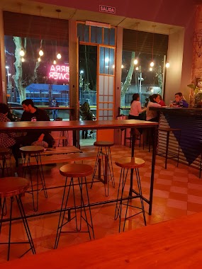
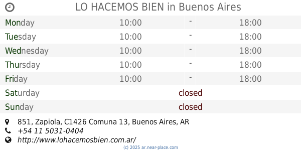
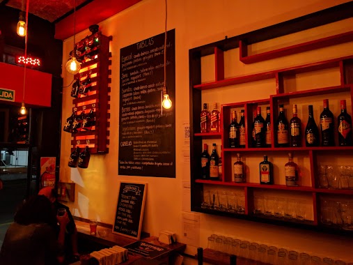
LO HACEMOS BIEN
C1426ATQ, Zapiola 851
Bar
read more
384 m
Milapizzería
Ciudad de La Paz 1080
Bar
read more
396 m
Restó - Bar Alexander
Zabala 2825
Bar
read more
505 m
Soraya
Avenida Cabildo 739
Bar
read more
512 m
Loreto Garden Bar
Virrey Loreto 2912
Bar
read more
561 m
Santillo
Avenida Cabildo 548
Bar
read more
592 m
42 NYC
ATZ, Zapiola 1220
Bar
read more
679 m
Social Club Buena Birra - Colegiales
Zapiola 1353
Bar
read more
815 m
Café Bar Antonio
Avenida Cabildo 264
Bar
read more
822 m
BORNEO BAR
Álvarez Thomas 635
Bar
read more
852 m
La Loggia Cervecería Artesanal
Avenida Federico Lacroze 2114
Bar
read more
901 m
Vinoteca Quetec
Avenida Cabildo 196
Bar
read more
921 m
Restaurante Ayelen Diet
Zapata 101
Bar
read more
953 m
De Barricas
C1414CLP, Avenida Dorrego 2092
Bar
read more
999 m
El Dorrego
Nicaragua 6086
Bar
read more
1.001 km
Nanni Segundo Ciclo
C1426DFD, Concepción Arenal 2420
Bar
read more
1.007 km
Genoma Bar
Gorriti 6534
Bar
read more
1.019 km
La Isla Resto Bar
Nicaragua 6078
Bar
read more
1.074 km
PL Deli Café & Take Away
Gorriti 6046
Bar
read more
1.126 km
Bar du Marché
Nicaragua 6002
Bar
read more
1.128 km
Aldo's Restoran Vinoteca Palermo
Arévalo 2032
Bar
read more
1.131 km
BPE
El Salvador 5983, Buenos Aires
Bar
read more
1.224 km
Trova Wine Bar
Dr. Emilio Ravignani 1710
Bar
read more
1.255 km
Little Lou - Brunch & Restó
Soldado de la Independencia 1154
Bar
read more
📑
all categories
Accounting
Administrative area level 1
Administrative area level 2
Airport
Amusement park
Aquarium
Art gallery
Atm
Bakery
Bank
Bar
Beauty salon
Bicycle store
Book store
Bowling alley
Bus station
Cafe
Campground
Car dealer
Car rental
Car repair
Car wash
Casino
Cemetery
Church
City hall
Clothing store
Colloquial area
Convenience store
Country
Courthouse
Dentist
Department store
Doctor
Electrician
Electronics store
Embassy
Establishment
Finance
Fire station
Florist
Food
Funeral home
Furniture store
Gas station
General contractor
Grocery or supermarket
Gym
Hair care
Hardware store
Health
Hindu Temple
Home goods store
Hospital
Insurance agency
Intersection
Jewelry store
Laundry
Lawyer
Library
Light rail station
Liquor store
Local government office
Locality
Locksmith
Lodging
Meal delivery
Meal takeaway
Mosque
Movie rental
Movie theater
Moving company
Museum
Natural feature
Neighborhood
Night club
Painter
Park
Parking
Pet store
Pharmacy
Physiotherapist
Place of worship
Plumber
Point of interest
Police
Political
Post office
Premise
Real estate agency
Restaurant
Roofing contractor
Route
Rv park, camping
School
Shoe store
Shopping mall
Spa
Stadium
Storage
Store
Subpremise
Subway station
Supermarket
Synagogue
Taxi stand
Train station
Transit station
Travel agency
University
Veterinary care
Zoo
sublocality level 1
sublocality level 3
↑