Bus station nearby Av. Santa Ana 2777
Coronavirus disease (COVID-19) Situation
confirmed cases
10128845
deaths
130841
Argentina
Bus station nearby Av. Santa Ana 2777
Av. Santa Ana 2777
Córdoba, Argentina
contacts phone
:
+54
Latitude:
-31.4143614
, Longitude:
-64.2218444
larger map & directions
read more
nearest Bus station
274 m
Av. Santa Ana 2566
Argentina
Bus station
read more
388 m
Maestro Vidal 594
Argentina
Bus station
read more
408 m
Av. Santa Ana 2477
Argentina
Bus station
read more
448 m
Maestro Vidal 770
Argentina
Bus station
read more
613 m
Av. Santa Ana 3288
Argentina
Bus station
read more
639 m
Pueyrredon 2650
Argentina
Bus station
read more
647 m
Leon Pinelo 1100
Argentina
Bus station
read more
673 m
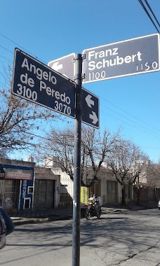
Angelo De Peredo 2944
Argentina
Bus station
read more
680 m
Peredo 3100
Argentina
Bus station
read more
693 m
Maestro Vidal 1050
Argentina
Bus station
read more
701 m
Av. Duarte Quiros 2615
Argentina
Bus station
read more
717 m
Angelo Peredo 2925
Argentina
Bus station
read more
734 m
Av. Duarte Quiros 2921
Argentina
Bus station
read more
754 m
Av. Santa Ana 2139
Argentina
Bus station
read more
817 m
Julian Aguirre 2750
Argentina
Bus station
read more
820 m
Av. Duarte Quiros 3056
Argentina
Bus station
read more
856 m
Av. Santa Ana 3550
Argentina
Bus station
read more
899 m
Luis De Azpeitia 3425
Argentina
Bus station
read more
951 m
Ceballos 2750
Argentina
Bus station
read more
1.023 km
Luis De Azpeitia 3576
Argentina
Bus station
read more
1.067 km
Av. Pueyrredon 1930
Argentina
Bus station
read more
1.153 km
Duarte Quiroz 3513
Argentina
Bus station
read more
1.174 km
Duarte Quiroz 3566
Argentina
Bus station
read more
1.22 km
Av. Don Bosco 3795
Argentina
Bus station
read more
1.313 km
Sol De Mayo 1120
Argentina
Bus station
read more
📑
all categories
Accounting
Administrative area level 1
Administrative area level 2
Airport
Amusement park
Aquarium
Art gallery
Atm
Bakery
Bank
Bar
Beauty salon
Bicycle store
Book store
Bowling alley
Bus station
Cafe
Campground
Car dealer
Car rental
Car repair
Car wash
Casino
Cemetery
Church
City hall
Clothing store
Colloquial area
Convenience store
Country
Courthouse
Dentist
Department store
Doctor
Electrician
Electronics store
Embassy
Establishment
Finance
Fire station
Florist
Food
Funeral home
Furniture store
Gas station
General contractor
Grocery or supermarket
Gym
Hair care
Hardware store
Health
Hindu Temple
Home goods store
Hospital
Insurance agency
Intersection
Jewelry store
Laundry
Lawyer
Library
Light rail station
Liquor store
Local government office
Locality
Locksmith
Lodging
Meal delivery
Meal takeaway
Mosque
Movie rental
Movie theater
Moving company
Museum
Natural feature
Neighborhood
Night club
Painter
Park
Parking
Pet store
Pharmacy
Physiotherapist
Place of worship
Plumber
Point of interest
Police
Political
Post office
Premise
Real estate agency
Restaurant
Roofing contractor
Route
Rv park, camping
School
Shoe store
Shopping mall
Spa
Stadium
Storage
Store
Subpremise
Subway station
Supermarket
Synagogue
Taxi stand
Train station
Transit station
Travel agency
University
Veterinary care
Zoo
sublocality level 1
sublocality level 3
↑