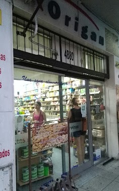
Bus station nearby Avenida Congreso 4606
Coronavirus disease (COVID-19) Situation
confirmed cases
10128845
deaths
130841
Argentina
Bus station nearby Avenida Congreso 4606
Avenida Congreso 4606
Autonomen Stadt Buenos Aires, Argentinien
contacts phone
:
+54
Latitude:
-34.5669853
, Longitude:
-58.4847893
larger map & directions
read more
nearest Bus station
420 m
Tomás A. Le Bretón 4202-4252
Argentina
Bus station
read more
483 m
Nahuel Huapi 4165-4199
Argentina
Bus station
read more
520 m
Mariano Acha 3385
Argentina
Bus station
read more
554 m
Lugones 2536
Argentina
Bus station
read more
585 m
Quesada 5191
Argentina
Bus station
read more
640 m
Avenida Álvarez Thomas 3041
Argentina
Bus station
read more
650 m
Donado 3420
Argentina
Bus station
read more
746 m
Núñez 5032
Argentina
Bus station
read more
751 m
Avenida Triunvirato 4820
Argentina
Bus station
read more
839 m
Bucarelli 2801-2899
Argentina
Bus station
read more
876 m
Mariano Acha 2271
Argentina
Bus station
read more
879 m
Galvan 3581
Argentina
Bus station
read more
879 m
Avenida Olazábal 4218
Argentina
Bus station
read more
886 m
Avenida Monroe 3929-3999
Argentina
Bus station
read more
895 m
Cullen 5297
Argentina
Bus station
read more
912 m
Avenida Crisólogo Larralde 4979
Argentina
Bus station
read more
971 m
Avenida Triunvirato 4489
Argentina
Bus station
read more
974 m
Avenida Álvarez Thomas 2771
Argentina
Bus station
read more
974 m
Avenida Olazábal 4002-4100
Argentina
Bus station
read more
1.064 km
Avenida Congreso 5485
Argentina
Bus station
read more
1.086 km
Manuel Ugarte 3638
Argentina
Bus station
read more
1.147 km
Doctor Pedro Ignacio Rivera 5514
Argentina
Bus station
read more
1.204 km
Roque Pérez 3102-3140
Argentina
Bus station
read more
1.226 km
Mariano Acha 1981
Argentina
Bus station
read more
1.338 km
Avenida Doctor Ricardo Balbín 3001-3091
Argentina
Bus station
read more
📑
all categories
Accounting
Administrative area level 1
Administrative area level 2
Airport
Amusement park
Aquarium
Art gallery
Atm
Bakery
Bank
Bar
Beauty salon
Bicycle store
Book store
Bowling alley
Bus station
Cafe
Campground
Car dealer
Car rental
Car repair
Car wash
Casino
Cemetery
Church
City hall
Clothing store
Colloquial area
Convenience store
Country
Courthouse
Dentist
Department store
Doctor
Electrician
Electronics store
Embassy
Establishment
Finance
Fire station
Florist
Food
Funeral home
Furniture store
Gas station
General contractor
Grocery or supermarket
Gym
Hair care
Hardware store
Health
Hindu Temple
Home goods store
Hospital
Insurance agency
Intersection
Jewelry store
Laundry
Lawyer
Library
Light rail station
Liquor store
Local government office
Locality
Locksmith
Lodging
Meal delivery
Meal takeaway
Mosque
Movie rental
Movie theater
Moving company
Museum
Natural feature
Neighborhood
Night club
Painter
Park
Parking
Pet store
Pharmacy
Physiotherapist
Place of worship
Plumber
Point of interest
Police
Political
Post office
Premise
Real estate agency
Restaurant
Roofing contractor
Route
Rv park, camping
School
Shoe store
Shopping mall
Spa
Stadium
Storage
Store
Subpremise
Subway station
Supermarket
Synagogue
Taxi stand
Train station
Transit station
Travel agency
University
Veterinary care
Zoo
sublocality level 1
sublocality level 3
↑