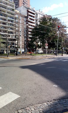
Bus station nearby Avenida General las Heras 2152
Argentina
Bus station nearby Avenida General las Heras 2152
Avenida General las Heras 2152
Buenos Aires, Argentina
contacts phone
:
+54
Latitude:
-34.5891611
, Longitude:
-58.3951825
larger map & directions
read more
nearest Bus station
221 m
Avenida General las Heras 2252-2300
Argentina
Bus station
read more
252 m
Avenida Pueyrredón 2277
Argentina
Bus station
read more
458 m
Avenida General las Heras 2439
Argentina
Bus station
read more
476 m
Avenida Callao 1399
Argentina
Bus station
read more
510 m
Juncal 2210
Argentina
Bus station
read more
546 m
Avenida General las Heras 2502-2600
Argentina
Bus station
read more
561 m
Avenida del Libertador 1459-1499
Argentina
Bus station
read more
562 m
Avenida Pueyrredón 2579-2599
Argentina
Bus station
read more
594 m
Avenida General las Heras 2545
Argentina
Bus station
read more
722 m
Juncal 1481
Argentina
Bus station
read more
770 m
Avenida del Libertador 1165-1199
Argentina
Bus station
read more
806 m
Avenida Santa Fe 1687
Argentina
Bus station
read more
877 m
Avenida Santa Fe 1622
Argentina
Bus station
read more
911 m
Avenida del Libertador 1901-1999
Argentina
Bus station
read more
933 m
Juncal 1317
Argentina
Bus station
read more
941 m
Avenida General las Heras 2902-2978
Argentina
Bus station
read more
951 m
Avenida Presidente Figueroa Alcorta 2811-2999
Argentina
Bus station
read more
1.058 km
Billinghurst 2279
Argentina
Bus station
read more
1.06 km
Ecuador 1302-1324
Argentina
Bus station
read more
1.08 km
Avenida General las Heras 3013-3099
Argentina
Bus station
read more
1.113 km
Avenida Santa Fe 1320
Argentina
Bus station
read more
1.123 km
Paraguay 2332
Argentina
Bus station
read more
1.142 km
Ecuador 1254
Argentina
Bus station
read more
1.145 km
Avenida Ortiz de Ocampo 2601-2699
Argentina
Bus station
read more
1.327 km
Av. Pueyrredón
Argentina
Bus station
read more
📑
all categories
Accounting
Administrative area level 1
Administrative area level 2
Airport
Amusement park
Aquarium
Art gallery
Atm
Bakery
Bank
Bar
Beauty salon
Bicycle store
Book store
Bowling alley
Bus station
Cafe
Campground
Car dealer
Car rental
Car repair
Car wash
Casino
Cemetery
Church
City hall
Clothing store
Colloquial area
Convenience store
Country
Courthouse
Dentist
Department store
Doctor
Electrician
Electronics store
Embassy
Establishment
Finance
Fire station
Florist
Food
Funeral home
Furniture store
Gas station
General contractor
Grocery or supermarket
Gym
Hair care
Hardware store
Health
Hindu Temple
Home goods store
Hospital
Insurance agency
Intersection
Jewelry store
Laundry
Lawyer
Library
Light rail station
Liquor store
Local government office
Locality
Locksmith
Lodging
Meal delivery
Meal takeaway
Mosque
Movie rental
Movie theater
Moving company
Museum
Natural feature
Neighborhood
Night club
Painter
Park
Parking
Pet store
Pharmacy
Physiotherapist
Place of worship
Plumber
Point of interest
Police
Political
Post office
Premise
Real estate agency
Restaurant
Roofing contractor
Route
Rv park, camping
School
Shoe store
Shopping mall
Spa
Stadium
Storage
Store
Subpremise
Subway station
Supermarket
Synagogue
Taxi stand
Train station
Transit station
Travel agency
University
Veterinary care
Zoo
sublocality level 1
sublocality level 3
↑