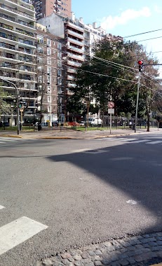
Bus station nearby Azcuénaga 834
Coronavirus disease (COVID-19) Situation
confirmed cases
10128845
deaths
130841
Argentina
Bus station nearby Azcuénaga 834
Azcuénaga 834
C1115 CABA, Argentina
contacts phone
:
+54
Latitude:
-34.5991487
, Longitude:
-58.4010485
larger map & directions
read more
nearest Bus station
42 m
Avenida Córdoba 2431
Argentina
Bus station
read more
199 m
Presidente José Evaristo Uriburu 860
Argentina
Bus station
read more
264 m
Viamonte 2518
Argentina
Bus station
read more
307 m
Paraguay 2102-2200
Argentina
Bus station
read more
343 m
Junín 802-900
Argentina
Bus station
read more
382 m
Av. Pueyrredón
Argentina
Bus station
read more
439 m
Avenida Pueyrredón 706
Argentina
Bus station
read more
454 m
Paraguay 2002-2026
Argentina
Bus station
read more
531 m
Ecuador 1302-1324
Argentina
Bus station
read more
532 m
Lavalle 2177
Argentina
Bus station
read more
621 m
Tucumán 1901-1991
Argentina
Bus station
read more
630 m
Avenida Córdoba 1837-1899
Argentina
Bus station
read more
687 m
Junín 410
Argentina
Bus station
read more
701 m
Avenida Corrientes 2102-2200
Argentina
Bus station
read more
765 m
Juncal 2210
Argentina
Bus station
read more
865 m
Viamonte 1730
Argentina
Bus station
read more
919 m
Avenida Pueyrredón 336
Argentina
Bus station
read more
923 m
Charcas 2935-2999
Argentina
Bus station
read more
952 m
Avenida Santa Fe 1687
Argentina
Bus station
read more
983 m
Paso 167-199
Argentina
Bus station
read more
1.004 km
General Lucio Norberto Mansilla 3083
Argentina
Bus station
read more
1.023 km
Avenida Callao 1399
Argentina
Bus station
read more
1.045 km
Avenida Corrientes 3202-3266
Argentina
Bus station
read more
1.061 km
Avenida Santa Fe 1622
Argentina
Bus station
read more
1.255 km
Billinghurst 1601-1699
Argentina
Bus station
read more
📑
all categories
Accounting
Administrative area level 1
Administrative area level 2
Airport
Amusement park
Aquarium
Art gallery
Atm
Bakery
Bank
Bar
Beauty salon
Bicycle store
Book store
Bowling alley
Bus station
Cafe
Campground
Car dealer
Car rental
Car repair
Car wash
Casino
Cemetery
Church
City hall
Clothing store
Colloquial area
Convenience store
Country
Courthouse
Dentist
Department store
Doctor
Electrician
Electronics store
Embassy
Establishment
Finance
Fire station
Florist
Food
Funeral home
Furniture store
Gas station
General contractor
Grocery or supermarket
Gym
Hair care
Hardware store
Health
Hindu Temple
Home goods store
Hospital
Insurance agency
Intersection
Jewelry store
Laundry
Lawyer
Library
Light rail station
Liquor store
Local government office
Locality
Locksmith
Lodging
Meal delivery
Meal takeaway
Mosque
Movie rental
Movie theater
Moving company
Museum
Natural feature
Neighborhood
Night club
Painter
Park
Parking
Pet store
Pharmacy
Physiotherapist
Place of worship
Plumber
Point of interest
Police
Political
Post office
Premise
Real estate agency
Restaurant
Roofing contractor
Route
Rv park, camping
School
Shoe store
Shopping mall
Spa
Stadium
Storage
Store
Subpremise
Subway station
Supermarket
Synagogue
Taxi stand
Train station
Transit station
Travel agency
University
Veterinary care
Zoo
sublocality level 1
sublocality level 3
↑