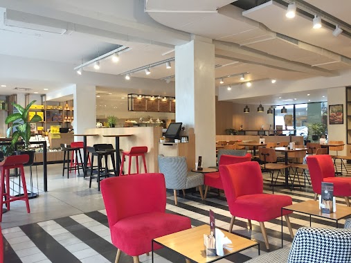
Cafe nearby Boccatina
Argentina
Cafe nearby Boccatina
Boccatina
1601, Juana Manso, 1699, Comuna 1, AR Argentina
contacts phone
:
+54 57870444
website:
www.boccatina.com.ar
Latitude:
-34.6166468
, Longitude:
-58.3621348
larger map & directions
read more
nearest Cafe
49 m
Blue Cafe
Juana Manso 1626
Cafe
read more
322 m
casa gus
Lola Mora 457
Cafe
read more
411 m
Havanna
Aimé Painé 1271-1399
Cafe
read more
445 m
Cafe Martinez
Avenida Alicia Moreau de Justo 1400
Cafe
read more
587 m
I Fresh Market
Olga Cossettini 1175
Cafe
read more
589 m
Central Market
Olga Cossettini 1190
Cafe
read more
619 m
OL'DAYS
Olga Cossettini 1182
Cafe
read more
621 m
Havanna
Olga Cossettini 1165
Cafe
read more
659 m
Parada Colectivo
C1063ACG, Avenida Paseo Colón 667
Cafe
read more
667 m
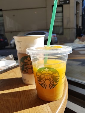
Starbucks
Juana Manso 1107
Cafe
read more
793 m
El Sueño Panaderia Bar
C1063ACL, Avenida Paseo Colón 1197
Cafe
read more
793 m
The Dream Bakery Bar
C1063ACL, Avenida Paseo Colón 1197
Cafe
read more
871 m
Alice's Tea House
Carlos Calvo 372
Cafe
read more
881 m
Café Martínez
Balcarce 420
Cafe
read more
885 m
Galería de la Inmaculada Concepción
Defensa 845
Cafe
read more
900 m
Terrazas - Cafe
Defensa 899
Cafe
read more
926 m
Florencia Casa de Té y Café
Avenida Paseo Colón 1331, Buenos Aires
Cafe
read more
962 m
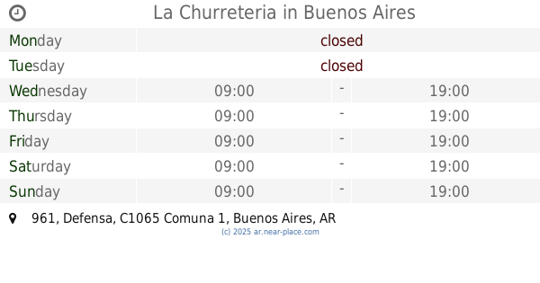
La Churreteria
Defensa 961
Cafe
read more
982 m
Chantal. Café des Délices
Carlos Calvo 455, Mercado de San Telmo PB, Local 22
Cafe
read more
997 m
El Caribe Cafe - Bar
Defensa 419
Cafe
read more
1.008 km
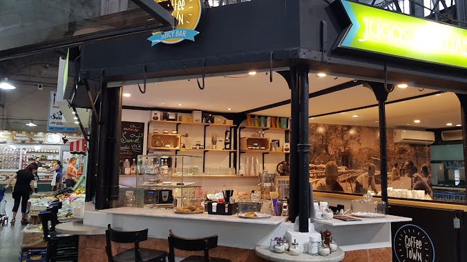
Coffee Town
Bolívar 976
Cafe
read more
1.034 km
Lumio Café
Carlos Calvo 498
Cafe
read more
1.057 km
Starbucks
Adolfo Alsina 300, Buenos Aires
Cafe
read more
1.08 km
Coffeematic Maq de Café
Defensa 1287
Cafe
read more
1.302 km
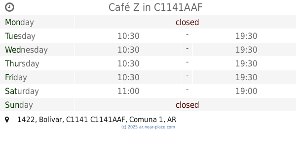
Café Z
Bolívar 1422, C1141AAF
Cafe
read more
📑
all categories
Accounting
Administrative area level 1
Administrative area level 2
Airport
Amusement park
Aquarium
Art gallery
Atm
Bakery
Bank
Bar
Beauty salon
Bicycle store
Book store
Bowling alley
Bus station
Cafe
Campground
Car dealer
Car rental
Car repair
Car wash
Casino
Cemetery
Church
City hall
Clothing store
Colloquial area
Convenience store
Country
Courthouse
Dentist
Department store
Doctor
Electrician
Electronics store
Embassy
Establishment
Finance
Fire station
Florist
Food
Funeral home
Furniture store
Gas station
General contractor
Grocery or supermarket
Gym
Hair care
Hardware store
Health
Hindu Temple
Home goods store
Hospital
Insurance agency
Intersection
Jewelry store
Laundry
Lawyer
Library
Light rail station
Liquor store
Local government office
Locality
Locksmith
Lodging
Meal delivery
Meal takeaway
Mosque
Movie rental
Movie theater
Moving company
Museum
Natural feature
Neighborhood
Night club
Painter
Park
Parking
Pet store
Pharmacy
Physiotherapist
Place of worship
Plumber
Point of interest
Police
Political
Post office
Premise
Real estate agency
Restaurant
Roofing contractor
Route
Rv park, camping
School
Shoe store
Shopping mall
Spa
Stadium
Storage
Store
Subpremise
Subway station
Supermarket
Synagogue
Taxi stand
Train station
Transit station
Travel agency
University
Veterinary care
Zoo
sublocality level 1
sublocality level 3
↑