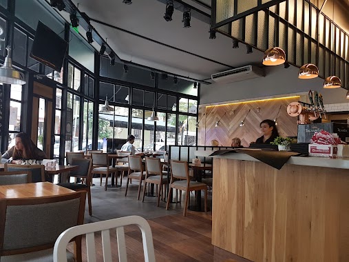
Cafe nearby Cafetería Spacio 1
Coronavirus disease (COVID-19) Situation
confirmed cases
10128845
deaths
130841
Argentina
Cafe nearby Cafetería Spacio 1
Cafetería Spacio 1
5747, Avenida del Libertador, C1428, Comuna 13, Buenos Aires, AR Argentina
contacts phone
:
+54 11 4344-6000
Latitude:
-34.5592229
, Longitude:
-58.44543
larger map & directions
read more
nearest Cafe
203 m
Cônte Café
C1426ENA, José Hernández 1395
Cafe
read more
374 m
Churrería Herrera
Juramento 1698
Cafe
read more
550 m
Amo mi Matcha
Mendoza 1702
Cafe
read more
576 m
Havanna UB
Zabala 1851
Cafe
read more
600 m
Milo Coffee & Deli
C1428DGS, Olazábal 1458
Cafe
read more
626 m
Starbucks
Avenida del Libertador 6220
Cafe
read more
628 m
Café Martínez
Olazábal 1700-1602, C1428DGU
Cafe
read more
776 m
Crème Chic - Helados -
3 de Febrero 2296
Cafe
read more
857 m
PIT DELI
Soldado de la Independencia 1154
Cafe
read more
1.001 km
Café del Golf
Avenida Ernesto Tornquist
Cafe
read more
1.003 km
Furchi Artesanal
Avenida Cabildo 1508
Cafe
read more
1.004 km
Café Van Gogh
Avenida Cabildo 1500, CABA
Cafe
read more
1.005 km
Chungo Helados, Café y Delicatessen
buenos Aires Esquina, Franklin D. Roosevelt
Cafe
read more
1.067 km
Starbucks
C1428AAP, Avenida Cabildo 2020
Cafe
read more
1.071 km
Starbucks
Avenida Cabildo 2020
Cafe
read more
1.077 km
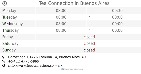
Tea Connection
1610, CTD, Gorostiaga
Cafe
read more
1.13 km
Caffe Nascosto
Ciudad de La Paz 1883
Cafe
read more
1.139 km
Good Coffe
Ciudad de La Paz 1898
Cafe
read more
1.141 km
Mc Café
C1426BOH, Avenida Luis María Campos 931-999
Cafe
read more
1.147 km
Chungo
Virrey del Pino 2500
Cafe
read more
1.15 km
Luna del Sur
Virrey Arredondo 2497
Cafe
read more
1.183 km
Almacén de Pizzas
Avenida del Libertador 6700
Cafe
read more
1.193 km
Crisol Núñez
1602, Avenida Congreso
Cafe
read more
1.219 km
Domenico Coffee & Brunch
Arce 901, Loc. 201
Cafe
read more
1.33 km
Tilo Cafe Y Restaurant
Soldado de la Independencia 790, C1426BTV
Cafe
read more
📑
all categories
Accounting
Administrative area level 1
Administrative area level 2
Airport
Amusement park
Aquarium
Art gallery
Atm
Bakery
Bank
Bar
Beauty salon
Bicycle store
Book store
Bowling alley
Bus station
Cafe
Campground
Car dealer
Car rental
Car repair
Car wash
Casino
Cemetery
Church
City hall
Clothing store
Colloquial area
Convenience store
Country
Courthouse
Dentist
Department store
Doctor
Electrician
Electronics store
Embassy
Establishment
Finance
Fire station
Florist
Food
Funeral home
Furniture store
Gas station
General contractor
Grocery or supermarket
Gym
Hair care
Hardware store
Health
Hindu Temple
Home goods store
Hospital
Insurance agency
Intersection
Jewelry store
Laundry
Lawyer
Library
Light rail station
Liquor store
Local government office
Locality
Locksmith
Lodging
Meal delivery
Meal takeaway
Mosque
Movie rental
Movie theater
Moving company
Museum
Natural feature
Neighborhood
Night club
Painter
Park
Parking
Pet store
Pharmacy
Physiotherapist
Place of worship
Plumber
Point of interest
Police
Political
Post office
Premise
Real estate agency
Restaurant
Roofing contractor
Route
Rv park, camping
School
Shoe store
Shopping mall
Spa
Stadium
Storage
Store
Subpremise
Subway station
Supermarket
Synagogue
Taxi stand
Train station
Transit station
Travel agency
University
Veterinary care
Zoo
sublocality level 1
sublocality level 3
↑