Cafe nearby Sarasvati
Argentina
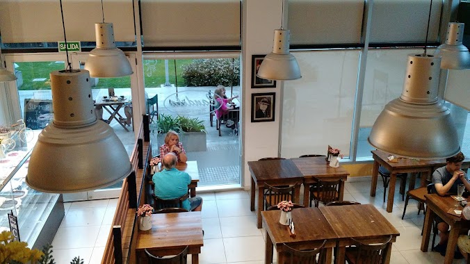
Cafe nearby Sarasvati
Sarasvati
2446, Holmberg, C1430, Comuna 12, Buenos Aires, AR Argentina
contacts phone
:
+54
Latitude:
-34.5691473
, Longitude:
-58.4769057
larger map & directions
read more
nearest Cafe
54 m
Repostería Candela
C1430DWA, Holmberg 2410
Cafe
read more
214 m
Palmi Gelato & Caffe
Avenida Monroe 4399
Cafe
read more
214 m
Monte Olimpo
Avenida Monroe 4399
Cafe
read more
423 m
Bonafide
Avenida Monroe 4599
Cafe
read more
445 m
Don Olazabal Café
Avenida Olazábal 4466
Cafe
read more
555 m
Cigaló Specialty Coffee
Holmberg 2004
Cafe
read more
671 m
La Marina
4691 Olazabal C1431CGC, CGC
Cafe
read more
683 m
Vía Varese
Avenida Monroe 2586
Cafe
read more
841 m
Macus
Mendoza 4900
Cafe
read more
866 m
Slava Tea Room
2100 Ángel Pacheco
Cafe
read more
927 m
O-291 Sweet Place
C1431BTJ, Nahuel Huapi 4918
Cafe
read more
970 m
Cake & Coffee
Pedro Ignacio Rivera 4992
Cafe
read more
989 m
Havanna
5044, CAP, Avenida Monroe
Cafe
read more
996 m
Usina Cafetera
Avenida Triunvirato 4307
Cafe
read more
1.063 km
Café de La U
Avenida Triunvirato 4801
Cafe
read more
1.086 km
La Nueva Esmeralda
Avenida Monroe 3205
Cafe
read more
1.123 km
Dobos
Avenida Monroe 5180
Cafe
read more
1.155 km
Chungo Ice Cream, Coffee and Delicatessen
Olazábal 5092
Cafe
read more
1.155 km
Chungo
Avenida Olazábal 5092
Cafe
read more
1.169 km
Estacion Urquiza kiosco
Avenida Monroe 5187
Cafe
read more
1.196 km
Placeres PORTEÑOS
Avenida Monroe 5246
Cafe
read more
1.197 km
Frahel Helado y Café
Avenida Monroe 5246
Cafe
read more
1.197 km
Trappola
Avenida Monroe 5246
Cafe
read more
1.278 km
La Aurora Panadería Cafetería
Avenida de los Incas 3910
Cafe
read more
1.357 km
Modena Heladeria & Cafeteria
Olazábal 5239
Cafe
read more
📑
all categories
Accounting
Administrative area level 1
Administrative area level 2
Airport
Amusement park
Aquarium
Art gallery
Atm
Bakery
Bank
Bar
Beauty salon
Bicycle store
Book store
Bowling alley
Bus station
Cafe
Campground
Car dealer
Car rental
Car repair
Car wash
Casino
Cemetery
Church
City hall
Clothing store
Colloquial area
Convenience store
Country
Courthouse
Dentist
Department store
Doctor
Electrician
Electronics store
Embassy
Establishment
Finance
Fire station
Florist
Food
Funeral home
Furniture store
Gas station
General contractor
Grocery or supermarket
Gym
Hair care
Hardware store
Health
Hindu Temple
Home goods store
Hospital
Insurance agency
Intersection
Jewelry store
Laundry
Lawyer
Library
Light rail station
Liquor store
Local government office
Locality
Locksmith
Lodging
Meal delivery
Meal takeaway
Mosque
Movie rental
Movie theater
Moving company
Museum
Natural feature
Neighborhood
Night club
Painter
Park
Parking
Pet store
Pharmacy
Physiotherapist
Place of worship
Plumber
Point of interest
Police
Political
Post office
Premise
Real estate agency
Restaurant
Roofing contractor
Route
Rv park, camping
School
Shoe store
Shopping mall
Spa
Stadium
Storage
Store
Subpremise
Subway station
Supermarket
Synagogue
Taxi stand
Train station
Transit station
Travel agency
University
Veterinary care
Zoo
sublocality level 1
sublocality level 3
↑