Cemetery nearby Cementerio De La Chacarita
Argentina
Cemetery nearby Cementerio De La Chacarita
Cementerio De La Chacarita
Avenida Corrientes, C1193, Comuna 3, Buenos Aires, AR Argentina
contacts phone
:
+54
Latitude:
-34.60403
, Longitude:
-58.4108635
larger map & directions
read more
nearest Cemetery
300 m
Ahora Empresa Monserrat
Cemetery
read more
2.045 km
Grupo Jardín del Pilar
Avenida Santa Fe 3591
Cemetery
read more
2.349 km
Pantheon of Eva Perón
2099 C1128ACE, Vicente López 2001
Cemetery
read more
2.386 km
Bartolomé Mitre
Cemetery
read more
2.41 km
Mausoleo Familia Leloir
Cemetery
read more
2.412 km
Panteón Federico Leloir
Recoleta
Cemetery
read more
2.425 km
Panteón Familia Noble
Buenos Aires
Cemetery
read more
2.435 km
Cementerio de la Recoleta
Junín 1760
Cemetery
read more
2.456 km
Cripta Carlos Pellegrini
Cemetery
read more
2.505 km
Mausleo Juan Bautista Alberdi
Cemetery
read more
2.513 km
Bóveda con los restos del Ing. Luis A. Huergo (1837-1913).
Roque Sáenz Peña, Esperanza
Cemetery
read more
2.867 km
Giallo S.R.L. - Pizarras Samaca
Suipacha 472
Cemetery
read more
2.988 km
Piedra Purpura Sa
Avenida Callao 2094
Cemetery
read more
3.035 km
Sala Velatoria y Cocheria AMIA Loyola
Loyola 1139
Cemetery
read more
4.057 km
Nueva Luz
Agaces 101
Cemetery
read more
4.525 km
Augusto Lobo Vandor
Cemetery
read more
4.526 km
Tumba Alfredo Le Pera
Cemetery
read more
4.564 km
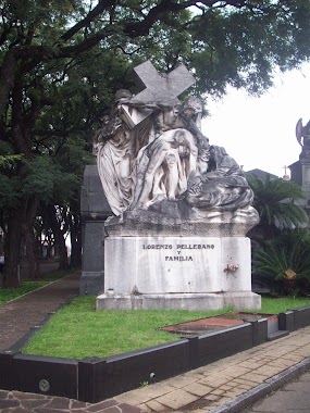
Cripta Lorenzo Pellerano
Cemetery
read more
4.592 km
Chola Chacarita
C1416CQE, Avenida Warnes 1749
Cemetery
read more
4.638 km
Panteón Familia Roverano
Cemetery
read more
4.716 km
Tumba De Alfonsina Storni
Unnamed Road
Cemetery
read more
4.886 km
Cementerio Igna
Cemetery
read more
5.217 km
Deutscher Friedhof
Avenida Elcano 4352-4634
Cemetery
read more
5.219 km
Cementerio Alemán
Avenida Elcano 4530
Cemetery
read more
6.324 km
Panteón Naval
Cemetery
read more
📑
all categories
Accounting
Administrative area level 1
Administrative area level 2
Airport
Amusement park
Aquarium
Art gallery
Atm
Bakery
Bank
Bar
Beauty salon
Bicycle store
Book store
Bowling alley
Bus station
Cafe
Campground
Car dealer
Car rental
Car repair
Car wash
Casino
Cemetery
Church
City hall
Clothing store
Colloquial area
Convenience store
Country
Courthouse
Dentist
Department store
Doctor
Electrician
Electronics store
Embassy
Establishment
Finance
Fire station
Florist
Food
Funeral home
Furniture store
Gas station
General contractor
Grocery or supermarket
Gym
Hair care
Hardware store
Health
Hindu Temple
Home goods store
Hospital
Insurance agency
Intersection
Jewelry store
Laundry
Lawyer
Library
Light rail station
Liquor store
Local government office
Locality
Locksmith
Lodging
Meal delivery
Meal takeaway
Mosque
Movie rental
Movie theater
Moving company
Museum
Natural feature
Neighborhood
Night club
Painter
Park
Parking
Pet store
Pharmacy
Physiotherapist
Place of worship
Plumber
Point of interest
Police
Political
Post office
Premise
Real estate agency
Restaurant
Roofing contractor
Route
Rv park, camping
School
Shoe store
Shopping mall
Spa
Stadium
Storage
Store
Subpremise
Subway station
Supermarket
Synagogue
Taxi stand
Train station
Transit station
Travel agency
University
Veterinary care
Zoo
sublocality level 1
sublocality level 3
↑