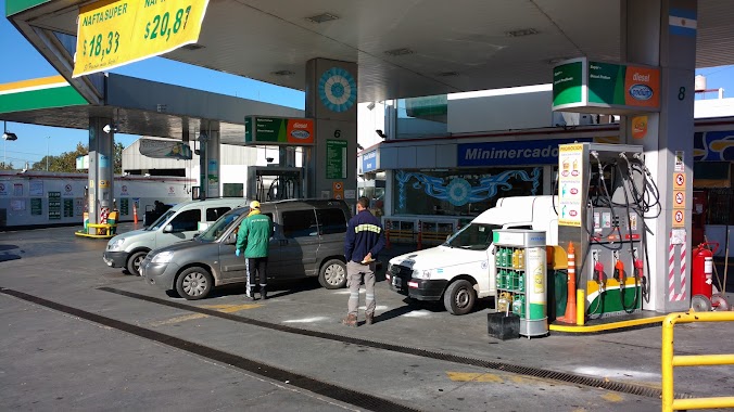
Gas station nearby Petrobras
Argentina
Gas station nearby Petrobras
Petrobras
1729, Avenida Lacarra, C1407, Comuna 9, Buenos Aires, AR Argentina
contacts phone
:
+54 11 4636-1355
Latitude:
-34.6511533
, Longitude:
-58.4677696
larger map & directions
read more
nearest Gas station
559 m
Axion Energy
Avenida Eva Perón 4350
Gas station
read more
571 m
Lin 7
Medina 1750
Gas station
read more
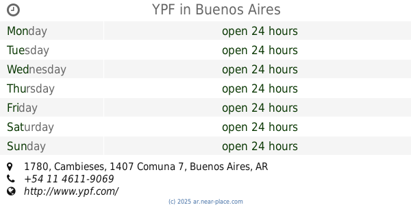
604 m
YPF
Cambieses 1780, Ciudad Autónoma Buenos Aires
Gas station
read more
703 m
Lubricentro Top Race
C1407HUI, Avenida Eva Perón 4475
Gas station
read more
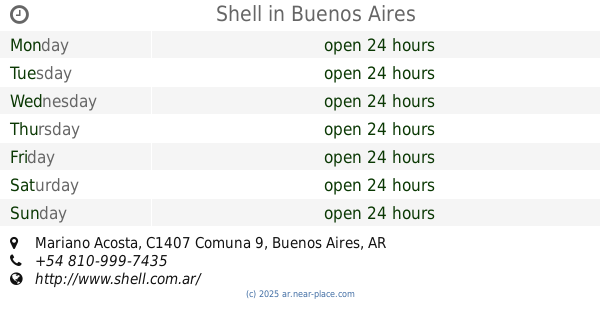
855 m
Shell
1196, KBX, Mariano Acosta
Gas station
read more
856 m
Shell
Mariano Acosta 1195
Gas station
read more
883 m
YPF
Cambieses 1780, Buenos Aires
Gas station
read more
1.038 km
YPF
Primera Junta 3263, Munro
Gas station
read more
1.04 km
Shelll
Mariano Acosta y, castañares
Gas station
read more
1.193 km
Hersol Combustibles SA
Pergamino 750
Gas station
read more
1.225 km
YPF
Avenida Eva Perón 4899, Buenos Aires
Gas station
read more
1.262 km
Caprio Fabio Augusto
C1406HNE, Avenida Eva Perón 2955
Gas station
read more
1.318 km
YPF Service Station
Avenida Olivera 1136
Gas station
read more
1.543 km
Calitri Jose
Avenida Escalada 2951
Gas station
read more
1.56 km
YPF
Avenida Escalada 2951
Gas station
read more
1.56 km
YPF
2951, FHO, Avenida Escalada
Gas station
read more
1.693 km
Ypf (Dual)
Avenida Olivera 631
Gas station
read more
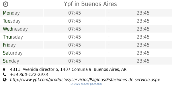
1.696 km
Ypf
Avenida directorio 4311
Gas station
read more
1.813 km
Rohmbe S.A. GNC
Avenida Eva Perón 2330
Gas station
read more
1.825 km
Gnc Gde
Avenida Eva Perón 2335
Gas station
read more
1.828 km
Gde
Gas station
read more
1.873 km
YPF
Avenida Directorio 2578
Gas station
read more
1.901 km
YPF
Avenida Varela 418
Gas station
read more
1.911 km
YPF
Avenida Directorio 2578, Buenos Aires
Gas station
read more
2.079 km
GNC
5134,, Dellepiane Sur 5102
Gas station
read more
📑
all categories
Accounting
Administrative area level 1
Administrative area level 2
Airport
Amusement park
Aquarium
Art gallery
Atm
Bakery
Bank
Bar
Beauty salon
Bicycle store
Book store
Bowling alley
Bus station
Cafe
Campground
Car dealer
Car rental
Car repair
Car wash
Casino
Cemetery
Church
City hall
Clothing store
Colloquial area
Convenience store
Country
Courthouse
Dentist
Department store
Doctor
Electrician
Electronics store
Embassy
Establishment
Finance
Fire station
Florist
Food
Funeral home
Furniture store
Gas station
General contractor
Grocery or supermarket
Gym
Hair care
Hardware store
Health
Hindu Temple
Home goods store
Hospital
Insurance agency
Intersection
Jewelry store
Laundry
Lawyer
Library
Light rail station
Liquor store
Local government office
Locality
Locksmith
Lodging
Meal delivery
Meal takeaway
Mosque
Movie rental
Movie theater
Moving company
Museum
Natural feature
Neighborhood
Night club
Painter
Park
Parking
Pet store
Pharmacy
Physiotherapist
Place of worship
Plumber
Point of interest
Police
Political
Post office
Premise
Real estate agency
Restaurant
Roofing contractor
Route
Rv park, camping
School
Shoe store
Shopping mall
Spa
Stadium
Storage
Store
Subpremise
Subway station
Supermarket
Synagogue
Taxi stand
Train station
Transit station
Travel agency
University
Veterinary care
Zoo
sublocality level 1
sublocality level 3
↑