Gym nearby María Cananiz
Coronavirus disease (COVID-19) Situation
confirmed cases
10128845
deaths
130841
Argentina
Gym nearby María Cananiz
María Cananiz
Buenos Aires, CABA, Argentina
contacts phone
:
+54
website:
www.mariacananiz.com
Latitude:
-34.5426579
, Longitude:
-58.4620756
larger map & directions
read more
nearest Gym
107 m
Megatlon Defensores de Belgrano
Avenida del Libertador 7995, C1429BMM
Gym
read more
133 m
Megatlon
Avenida Comodoro Martín Rivadavia 1570
Gym
read more
137 m
Fy Espacio de Bienestar
Avenida Comodoro Martín Rivadavia 1692
Gym
read more
137 m
FY
Avenida Comodoro Martín Rivadavia 1692
Gym
read more
177 m
Benicio
11 de Septiembre 3635
Gym
read more
269 m
Club Ciudad
Avenida del Libertador 5701
Gym
read more
329 m
Juventud de Nunez | Sport Club
11 de Septiembre 3600
Gym
read more
329 m
Club Social y Deportivo Juventud de Núñez
11 de Septiembre 3600
Gym
read more
339 m
CrossFit Tuluka Nuñez
Avenida del Libertador 8176
Gym
read more
399 m
MUNI - Estacionamiento
C1429BSC, Avenida Miguel B. Sánchez 1013-1477
Gym
read more
403 m
Athletia
Avenida Miguel B. Sánchez 1049, C1429BSC
Gym
read more
604 m
Club Ciudad Bs. As.
1500, C1429BSP, Avenida Miguel B. Sánchez 1014
Gym
read more
631 m
Figurella Núñez
Manuela Pedraza 1773
Gym
read more
633 m
Amanazca Yoga
Grecia 3394
Gym
read more
713 m
Instituto obras
C1429BRD, Padre Canavery 7557
Gym
read more
910 m
Cabildo Latino
Avenida Cabildo 4248
Gym
read more
910 m
Gimnasio Cabildo Latino
Avenida Cabildo 4248
Gym
read more
922 m
Move (Yoga Center)
Vuelta de Obligado 3326
Gym
read more
934 m
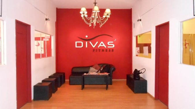
Divas' Fitness
Avenida Cabildo 3561
Gym
read more
944 m
Boulevard Vilela
Avenida San Isidro Labrador 4195
Gym
read more
1.034 km
Clases de Yoga Nuñez - Tradicion Krisnamacharya KHYF
3 de Febrero 2919
Gym
read more
1.039 km
75686
Avenida García del Río 2584
Gym
read more
1.058 km
Trust Futbol
Avenida Cabildo 3432
Gym
read more
1.07 km
Yoga
Pedro Agote 1419, C1428CKC
Gym
read more
1.158 km
Surf fit
B1638CWI, Zufriategui 1251, Vicente López
Gym
read more
📑
all categories
Accounting
Administrative area level 1
Administrative area level 2
Airport
Amusement park
Aquarium
Art gallery
Atm
Bakery
Bank
Bar
Beauty salon
Bicycle store
Book store
Bowling alley
Bus station
Cafe
Campground
Car dealer
Car rental
Car repair
Car wash
Casino
Cemetery
Church
City hall
Clothing store
Colloquial area
Convenience store
Country
Courthouse
Dentist
Department store
Doctor
Electrician
Electronics store
Embassy
Establishment
Finance
Fire station
Florist
Food
Funeral home
Furniture store
Gas station
General contractor
Grocery or supermarket
Gym
Hair care
Hardware store
Health
Hindu Temple
Home goods store
Hospital
Insurance agency
Intersection
Jewelry store
Laundry
Lawyer
Library
Light rail station
Liquor store
Local government office
Locality
Locksmith
Lodging
Meal delivery
Meal takeaway
Mosque
Movie rental
Movie theater
Moving company
Museum
Natural feature
Neighborhood
Night club
Painter
Park
Parking
Pet store
Pharmacy
Physiotherapist
Place of worship
Plumber
Point of interest
Police
Political
Post office
Premise
Real estate agency
Restaurant
Roofing contractor
Route
Rv park, camping
School
Shoe store
Shopping mall
Spa
Stadium
Storage
Store
Subpremise
Subway station
Supermarket
Synagogue
Taxi stand
Train station
Transit station
Travel agency
University
Veterinary care
Zoo
sublocality level 1
sublocality level 3
↑