Lodging nearby Hotel Cosmo
Coronavirus disease (COVID-19) Situation
confirmed cases
10128845
deaths
130841
Argentina
Lodging nearby Hotel Cosmo
Hotel Cosmo
1811, Lima, C1138, Comuna 1, Buenos Aires, AR Argentina
contacts phone
:
+54
Latitude:
-34.6291035
, Longitude:
-58.3814527
larger map & directions
read more
nearest Lodging
295 m
Kiosco Sandra
Pavón 1219
Lodging
read more
357 m
Viella
San José 1770
Lodging
read more
420 m
Sides Palace Hotel
Pavón 1285
Lodging
read more
538 m
Versalles Palace Hotel
Doctor Enrique Finochietto 864
Lodging
read more
551 m
Hotel Familiar Kenono
Pavón 1435
Lodging
read more
593 m
HOTEL Wilson
Presidente Luis Sáenz Peña 1508
Lodging
read more
601 m
El Santo (Hotel Intersur - San Telmo)
Avenida Brasil 780
Lodging
read more
601 m
Hotel Intersur San Telmo
Avenida Brasil 780
Lodging
read more
643 m
Hotel la Estrella
Virrey Cevallos 1616
Lodging
read more
670 m
Ilda Hotel
Doctor Ramón Carrillo 310
Lodging
read more
709 m
Dazzler Flats San Telmo
Avenida Juan de Garay 737
Lodging
read more
828 m
San Vicente
Avenida San Juan 1329
Lodging
read more
843 m
Studio Apartment UADE
1157, Salta #9*72, Buenos Aires
Lodging
read more
855 m
Albergue Transitorio Acuario
Avenida Brasil 1777
Lodging
read more
866 m
Departamento Turistico San Telmo
Doctor Enrique Finochietto 480, Buenos Aires
Lodging
read more
913 m
Romina
Avenida Caseros 1943
Lodging
read more
934 m
Gran Prince
Salta 1094
Lodging
read more
946 m
HOTEL CAIRO
Combate de los Pozos 2186
Lodging
read more
949 m
1890 Hotel Boutique
Salta 1074, Altamira
Lodging
read more
997 m
San Telmo House
Bolívar 1356, Ciudad Autonoma de buenos AIres
Lodging
read more
1.01 km
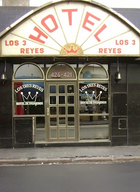
Hotel Los Tres Reyes
Avenida Brasil 425
Lodging
read more
1.013 km
Estilo y Confort en San Telmo
Piedras 1088
Lodging
read more
1.02 km
Círculo del Personal Superior Serv. Penitenciario F.
Santiago del Estero 1036
Lodging
read more
1.114 km
Hotel Boutique Tiana
Humberto 1º 629
Lodging
read more
1.233 km
HOTEL FAMILIAR DEL SUR
Humberto 1º 1737
Lodging
read more
📑
all categories
Accounting
Administrative area level 1
Administrative area level 2
Airport
Amusement park
Aquarium
Art gallery
Atm
Bakery
Bank
Bar
Beauty salon
Bicycle store
Book store
Bowling alley
Bus station
Cafe
Campground
Car dealer
Car rental
Car repair
Car wash
Casino
Cemetery
Church
City hall
Clothing store
Colloquial area
Convenience store
Country
Courthouse
Dentist
Department store
Doctor
Electrician
Electronics store
Embassy
Establishment
Finance
Fire station
Florist
Food
Funeral home
Furniture store
Gas station
General contractor
Grocery or supermarket
Gym
Hair care
Hardware store
Health
Hindu Temple
Home goods store
Hospital
Insurance agency
Intersection
Jewelry store
Laundry
Lawyer
Library
Light rail station
Liquor store
Local government office
Locality
Locksmith
Lodging
Meal delivery
Meal takeaway
Mosque
Movie rental
Movie theater
Moving company
Museum
Natural feature
Neighborhood
Night club
Painter
Park
Parking
Pet store
Pharmacy
Physiotherapist
Place of worship
Plumber
Point of interest
Police
Political
Post office
Premise
Real estate agency
Restaurant
Roofing contractor
Route
Rv park, camping
School
Shoe store
Shopping mall
Spa
Stadium
Storage
Store
Subpremise
Subway station
Supermarket
Synagogue
Taxi stand
Train station
Transit station
Travel agency
University
Veterinary care
Zoo
sublocality level 1
sublocality level 3
↑