Park nearby Plaza Cnel. Ramón L. Falcón
Coronavirus disease (COVID-19) Situation
confirmed cases
10128845
deaths
130841
Argentina
Park nearby Plaza Cnel. Ramón L. Falcón
Plaza Cnel. Ramón L. Falcón
Coronel Ramón Lorenzo Falcón, Comuna 10, Buenos Aires, AR Argentina
contacts phone
:
+54
Latitude:
-34.6357039
, Longitude:
-58.48226
larger map & directions
read more
nearest Park
322 m
Gnc Service
8658,, Avenida Rivadavia 8642
Park
read more
656 m
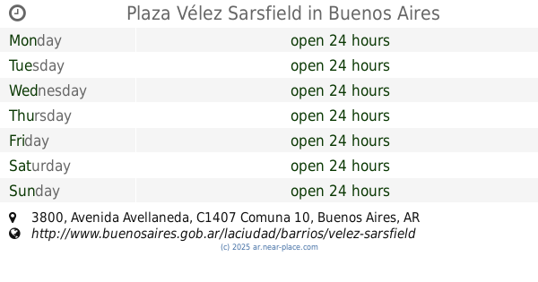
Plaza Vélez Sarsfield
Avenida Avellaneda 3800
Park
read more
740 m
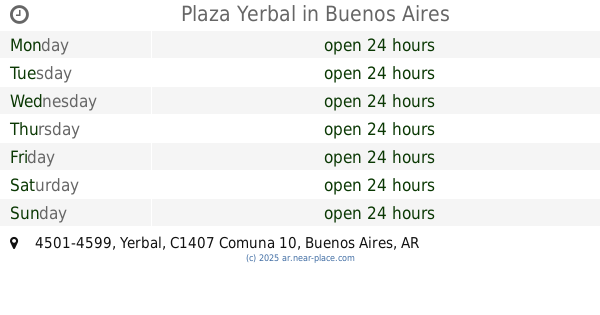
Plaza Yerbal
C1407EAY, Yerbal 4501-4599
Park
read more
838 m
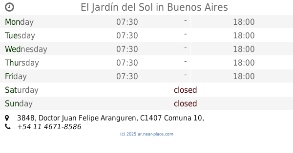
El Jardín del Sol
Doctor Juan Felipe Aranguren 3848
Park
read more
838 m
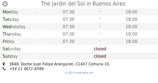
The Jardin del Sol
Doctor Juan Felipe Aranguren 3848
Park
read more
924 m
León Fontova
Medina 102-120
Park
read more
942 m
Vivero Parque Avellaneda
Avenida Directorio 4250
Park
read more
1.022 km
Vicente Bellini
Avenida Rivadavia 9175-9179
Park
read more
1.073 km
Parque Avellaneda
Av Directorio
Park
read more
1.088 km
Carlos Gardel
Park
read more
1.089 km
Plaza
Gualeguaychú 800-752
Park
read more
1.107 km
Paseo de Juegos La Victoria
C1407FIV, Avenida Gaona 4602
Park
read more
1.188 km
Expreso Alegria Tren Parque Avellaneda
Acceso privado dentro del Parque Camino para personal del Peaje Avellaneda. 202
Park
read more
1.341 km
Floresta Club
C1407JQY, Avenida Lacarra 1257
Park
read more
1.351 km
Parque
Park
read more
1.379 km
Plaza Hugo Ricardo Corradi
Park
read more
1.462 km
Parque Sarmiento
Parque Sarmiento Chiclana, San Nicolás de Los Arroyos
Park
read more
1.679 km
Cantero Central Francisco Bilbao
C1406EVA, Pillado 711
Park
read more
1.695 km
Prof. Ernesto Nelson
Villa Luro
Park
read more
1.887 km
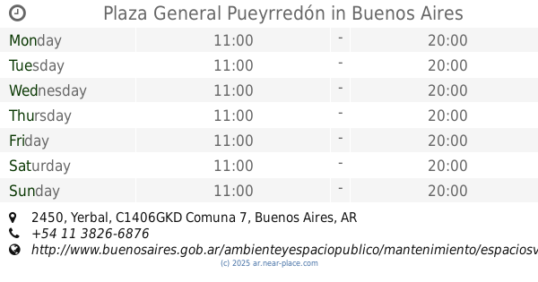
Plaza General Pueyrredón
Yerbal 2450
Park
read more
1.93 km
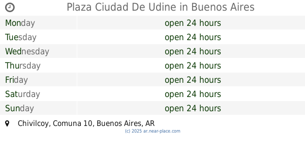
Plaza Ciudad De Udine
Chivilcoy
Park
read more
1.949 km
Boulevard Juan Bautista Justo
C1407FBU, Avenida Juan Bautista Justo 8232
Park
read more
2.06 km
Plaza Jorge Di Pascuale
Park
read more
2.06 km
Plaza Jorge Di Pasquale
Park
read more
2.198 km
Jacinto Oddone
Avenida Derqui 3901-3939
Park
read more
📑
all categories
Accounting
Administrative area level 1
Administrative area level 2
Airport
Amusement park
Aquarium
Art gallery
Atm
Bakery
Bank
Bar
Beauty salon
Bicycle store
Book store
Bowling alley
Bus station
Cafe
Campground
Car dealer
Car rental
Car repair
Car wash
Casino
Cemetery
Church
City hall
Clothing store
Colloquial area
Convenience store
Country
Courthouse
Dentist
Department store
Doctor
Electrician
Electronics store
Embassy
Establishment
Finance
Fire station
Florist
Food
Funeral home
Furniture store
Gas station
General contractor
Grocery or supermarket
Gym
Hair care
Hardware store
Health
Hindu Temple
Home goods store
Hospital
Insurance agency
Intersection
Jewelry store
Laundry
Lawyer
Library
Light rail station
Liquor store
Local government office
Locality
Locksmith
Lodging
Meal delivery
Meal takeaway
Mosque
Movie rental
Movie theater
Moving company
Museum
Natural feature
Neighborhood
Night club
Painter
Park
Parking
Pet store
Pharmacy
Physiotherapist
Place of worship
Plumber
Point of interest
Police
Political
Post office
Premise
Real estate agency
Restaurant
Roofing contractor
Route
Rv park, camping
School
Shoe store
Shopping mall
Spa
Stadium
Storage
Store
Subpremise
Subway station
Supermarket
Synagogue
Taxi stand
Train station
Transit station
Travel agency
University
Veterinary care
Zoo
sublocality level 1
sublocality level 3
↑