Park nearby Plaza Provincia de Buenos Aires
Argentina
Park nearby Plaza Provincia de Buenos Aires
Plaza Provincia de Buenos Aires
Autopista Presidente Arturo Frondizi 2015 Argentinien
contacts phone
:
+54
Latitude:
-34.6282548
, Longitude:
-58.3785179
read more
nearest Park
168 m
Plaza Casa Cuna
Doctor Enrique Finochietto 901-969
Park
read more
360 m
Plaza de la Constitución
Avenida Juan de Garay 1105-1157
Park
read more
389 m
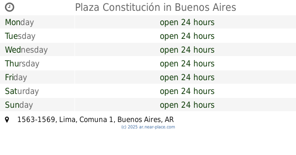
Plaza Constitución
Lima 1563-1569
Park
read more
415 m
M. A. de Paz y Figueroa
Park
read more
602 m
Plaza Gumersindo González
Park
read more
680 m
Plazoleta Juan Carlos Castagnino
599, C1153ABD, Avenida Juan de Garay 501
Park
read more
681 m
Plaza Rosario Vera Peñaloza
Park
read more
721 m
Vera Peñaloza Plazoleta
Chacabuco 1208
Park
read more
721 m
Plazoleta Vera Peñaloza
Chacabuco 1208
Park
read more
746 m
Cecilia Grierson Plazoleta
Avenida San Juan 679
Park
read more
746 m
Plazoleta Cecilia Grierson
Avenida San Juan 679
Park
read more
764 m
Feria Parque Lezama
C1165ABC, Avenida Martín García 341-365
Park
read more
789 m
Plaza Poeta Ricardo E. Lleras
Herrera 402-556
Park
read more
795 m
Poeta Ricardo E. Lleras
Park
read more
798 m
Lugar con mesas y sillas
Park
read more
841 m
Parque Lezama
Avenida Brasil
Park
read more
881 m
Plazoleta
C1147AAQ, Avenida San Juan 502
Park
read more
969 m
Spain Park
Park
read more
1.06 km
Plaza Dorrego
Park
read more
1.06 km
Plaza Dorrego
C1103 Buenos Aires, Argentina
Park
read more
1.081 km
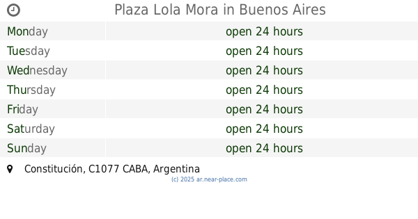
Plaza Lola Mora
Park
read more
1.136 km
Memory Walk
Avenida Paseo Colón
Park
read more
1.142 km
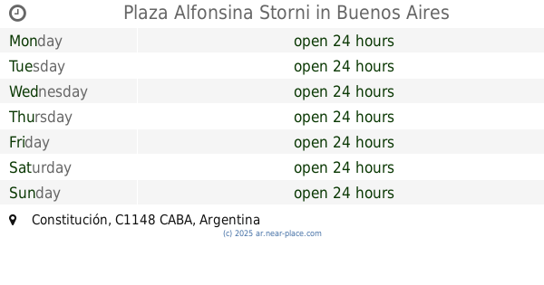
Plaza Alfonsina Storni
Constitución
Park
read more
1.142 km
Plaza Jaime Yankelevich
C1287ACC, Pinzón 1301-1395
Park
read more
1.159 km
Patio Porteño Barracas
Pinzón 1293, C1287ACA
Park
read more
📑
all categories
Accounting
Administrative area level 1
Administrative area level 2
Airport
Amusement park
Aquarium
Art gallery
Atm
Bakery
Bank
Bar
Beauty salon
Bicycle store
Book store
Bowling alley
Bus station
Cafe
Campground
Car dealer
Car rental
Car repair
Car wash
Casino
Cemetery
Church
City hall
Clothing store
Colloquial area
Convenience store
Country
Courthouse
Dentist
Department store
Doctor
Electrician
Electronics store
Embassy
Establishment
Finance
Fire station
Florist
Food
Funeral home
Furniture store
Gas station
General contractor
Grocery or supermarket
Gym
Hair care
Hardware store
Health
Hindu Temple
Home goods store
Hospital
Insurance agency
Intersection
Jewelry store
Laundry
Lawyer
Library
Light rail station
Liquor store
Local government office
Locality
Locksmith
Lodging
Meal delivery
Meal takeaway
Mosque
Movie rental
Movie theater
Moving company
Museum
Natural feature
Neighborhood
Night club
Painter
Park
Parking
Pet store
Pharmacy
Physiotherapist
Place of worship
Plumber
Point of interest
Police
Political
Post office
Premise
Real estate agency
Restaurant
Roofing contractor
Route
Rv park, camping
School
Shoe store
Shopping mall
Spa
Stadium
Storage
Store
Subpremise
Subway station
Supermarket
Synagogue
Taxi stand
Train station
Transit station
Travel agency
University
Veterinary care
Zoo
sublocality level 1
sublocality level 3
↑