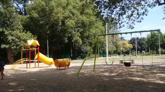
Park nearby Quinta Mañas
Argentina
Park nearby Quinta Mañas
Quinta Mañas
7250, Galileo Galilei, Trujui, Moreno, AR Argentina
contacts phone
:
+54
Latitude:
-34.5983234
, Longitude:
-58.7349498
larger map & directions
read more
nearest Park
260 m
Quinta Los Robles
Trujui
Park
Lodging
Point of interest
Establishment
read more
324 m
Campamento
B1736IHN, Néstor Kirchner 2778, Trujui
Park
read more
800 m
Mebla
7399, B1736CTQ, Maipú 7309, Trujui
Park
read more
810 m
Mebla
Maipú 7309, Trujui
Park
read more
933 m
Plaza Mariló
Trujui
Park
read more
1.151 km
Plaza Four Heroes of Malvinas
Bella Vista
Park
read more
1.553 km
Plaza San Jorge
Potosí, Trujui
Park
read more
1.575 km
Club Los Indios
Ignacio Altamirano, Bella Vista
Park
read more
1.614 km
Plaza Facundo Quiroga
Bella Vista
Park
read more
1.717 km
La quinta - la luz chica
598 B1661EGB, Rafael 500, Bella Vista
Park
read more
1.738 km
Plaza Trujui
Trujui
Park
read more
1.738 km
Trujui Park
Albatros 7385, Trujui
Park
read more
2.258 km
parque malvinas argentinas
Martín Fierro 5150, Udaondo
Park
read more
2.321 km
Parque Malvinas Argentina
2199, B1715FUA, Andrés Chazarreta 2099, Udaondo
Park
read more
2.371 km
Parque Santa Maria
Autopista Camino del Buen Ayre, Udaondo
Park
read more
2.413 km
Parque Malvinas Argentinas, Ceamse
B1715FUH, Andrés Chazarreta 2400-2498, Udaondo
Park
read more
2.413 km
Malvinas Argentinas, Ceamse Park
B1715FUH, Andrés Chazarreta 2400-2498, Udaondo
Park
read more
2.875 km
Club de Golf
Bella Vista
Park
read more
2.914 km
Camping Walter Velez Ex Jugadores
1622, B1743MDR, Dalmacio Sánchez 1586, Trujui
Park
read more
3.293 km
Veinticinco Talas
1300-1202, B1661DYZ, Ingeniero Carlos Chapeaurouge, Bella Vista
Park
read more
3.577 km
PLAZA VILLA NUEVA
Trujui
Park
read more
4.175 km
Los Plátanos Cabañas & Suites
Padre Varvello 4429, Moreno
Campground
Park
Lodging
Point of interest
Establishment
read more
4.248 km
Predio AP.L.
Julián Balbín 4025, Udaondo
Park
read more
4.412 km
Centro familiar EVITA STPCHYA
3300, B1663NNL, Belgrano 3002, San Miguel
Park
read more
4.868 km
Parque Leloir
Del Cielito 1800-1898, Udaondo
Park
read more
📑
all categories
Accounting
Administrative area level 1
Administrative area level 2
Airport
Amusement park
Aquarium
Art gallery
Atm
Bakery
Bank
Bar
Beauty salon
Bicycle store
Book store
Bowling alley
Bus station
Cafe
Campground
Car dealer
Car rental
Car repair
Car wash
Casino
Cemetery
Church
City hall
Clothing store
Colloquial area
Convenience store
Country
Courthouse
Dentist
Department store
Doctor
Electrician
Electronics store
Embassy
Establishment
Finance
Fire station
Florist
Food
Funeral home
Furniture store
Gas station
General contractor
Grocery or supermarket
Gym
Hair care
Hardware store
Health
Hindu Temple
Home goods store
Hospital
Insurance agency
Intersection
Jewelry store
Laundry
Lawyer
Library
Light rail station
Liquor store
Local government office
Locality
Locksmith
Lodging
Meal delivery
Meal takeaway
Mosque
Movie rental
Movie theater
Moving company
Museum
Natural feature
Neighborhood
Night club
Painter
Park
Parking
Pet store
Pharmacy
Physiotherapist
Place of worship
Plumber
Point of interest
Police
Political
Post office
Premise
Real estate agency
Restaurant
Roofing contractor
Route
Rv park, camping
School
Shoe store
Shopping mall
Spa
Stadium
Storage
Store
Subpremise
Subway station
Supermarket
Synagogue
Taxi stand
Train station
Transit station
Travel agency
University
Veterinary care
Zoo
sublocality level 1
sublocality level 3
↑