Pharmacy nearby Farma Track
Coronavirus disease (COVID-19) Situation
confirmed cases
10128845
deaths
130841
Argentina
Pharmacy nearby Farma Track
Farma Track
3513, Santos Dumont, Comuna 15, Buenos Aires, AR Argentina
contacts phone
:
+54 11 5290-6000
website:
www.farmatrack.com.ar
Latitude:
-34.5834553
, Longitude:
-58.4478804
larger map & directions
read more
nearest Pharmacy
84 m
SM Farma Express
Supermercado Vea, Avenida Córdoba 6150
Pharmacy
read more
204 m
Farmacity
Avenida Álvarez Thomas 284, Ciudad Autonoma de Buenos Aires
Pharmacy
read more
220 m
Pami Farmacia Homeopatia
Avenida Álvarez Thomas 302
Pharmacy
read more
224 m
Farmacia Rawson
Avenida Álvarez Thomas 302
Pharmacy
read more
409 m
Nueva Salud
Avenida Federico Lacroze 3776
Pharmacy
read more
476 m
Farmacity
Roseti 704
Pharmacy
read more
509 m
Farmacia Real
Avenida Federico Lacroze 3322
Pharmacy
read more
511 m
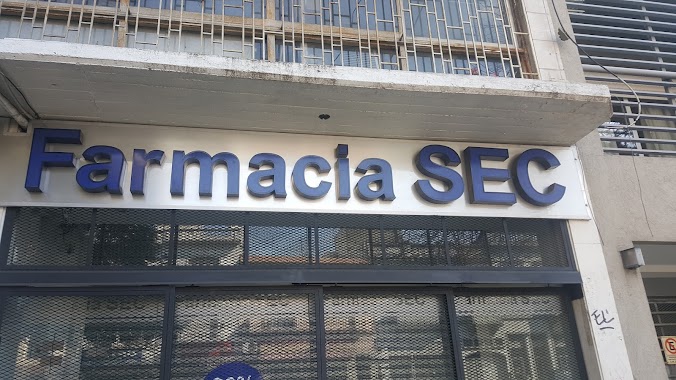
SEC
Avenida Federico Lacroze 3883
Pharmacy
read more
519 m
Real
Avenida Federico Lacroze 3310
Pharmacy
read more
528 m
Farmacia Silvy
Avenida Federico Lacroze 3938
Pharmacy
read more
564 m
Gran Ignacio
Avenida Federico Lacroze 3230
Pharmacy
read more
665 m
Panacea Lacroze
Avenida Federico Lacroze 4126
Pharmacy
read more
701 m
Service Pharma S.A.
México 2501
Pharmacy
read more
724 m
Farmacias Dr. Ahorro
Avenida Corrientes 6847
Pharmacy
read more
744 m
Lamaité
Conde 815
Pharmacy
read more
758 m
Alberdi y Saladillo Mataderos
Fraga 900
Pharmacy
read more
764 m
Farmacia Faraday
Estación Federico Lacroze, Avenida Federico Lacroze 4125
Pharmacy
read more
772 m
Farmacia Solidaria
Avenida Federico Lacroze 4181
Pharmacy
read more
781 m
Farmacia Álvarez Thomas
Avenida Álvarez Thomas 900
Pharmacy
read more
784 m
Farmacia del Conde
Palpa 3203
Pharmacy
read more
827 m
De los Santos Juan
Bonpland 1507
Pharmacy
read more
838 m
Farmacia Galicia
Bonpland 1507
Pharmacy
read more
947 m
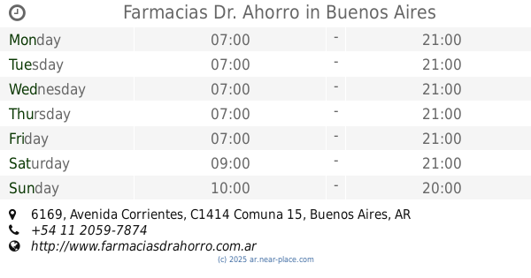
Farmacias Dr. Ahorro
Avenida Corrientes 6169
Pharmacy
read more
1.071 km
Farmacia Amiga
Avenida Álvarez Thomas 1175
Pharmacy
read more
1.27 km
Josue
Conde 1290
Pharmacy
read more
📑
all categories
Accounting
Administrative area level 1
Administrative area level 2
Airport
Amusement park
Aquarium
Art gallery
Atm
Bakery
Bank
Bar
Beauty salon
Bicycle store
Book store
Bowling alley
Bus station
Cafe
Campground
Car dealer
Car rental
Car repair
Car wash
Casino
Cemetery
Church
City hall
Clothing store
Colloquial area
Convenience store
Country
Courthouse
Dentist
Department store
Doctor
Electrician
Electronics store
Embassy
Establishment
Finance
Fire station
Florist
Food
Funeral home
Furniture store
Gas station
General contractor
Grocery or supermarket
Gym
Hair care
Hardware store
Health
Hindu Temple
Home goods store
Hospital
Insurance agency
Intersection
Jewelry store
Laundry
Lawyer
Library
Light rail station
Liquor store
Local government office
Locality
Locksmith
Lodging
Meal delivery
Meal takeaway
Mosque
Movie rental
Movie theater
Moving company
Museum
Natural feature
Neighborhood
Night club
Painter
Park
Parking
Pet store
Pharmacy
Physiotherapist
Place of worship
Plumber
Point of interest
Police
Political
Post office
Premise
Real estate agency
Restaurant
Roofing contractor
Route
Rv park, camping
School
Shoe store
Shopping mall
Spa
Stadium
Storage
Store
Subpremise
Subway station
Supermarket
Synagogue
Taxi stand
Train station
Transit station
Travel agency
University
Veterinary care
Zoo
sublocality level 1
sublocality level 3
↑