Restaurant nearby Restaurante Siero
Coronavirus disease (COVID-19) Situation
confirmed cases
10128845
deaths
130841
Argentina
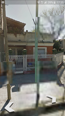
Restaurant nearby Restaurante Siero
Restaurante Siero
2163, Chile, C1227, Comuna 3, Buenos Aires, AR Argentina
contacts phone
:
+54
Latitude:
-34.6172295
, Longitude:
-58.3970413
larger map & directions
read more
nearest Restaurant
304 m
La Brochette
ABJ, Venezuela 2002
Restaurant
read more
401 m
Panch8
Avenida Independencia
Restaurant
read more
406 m
Parrilla lo de juan
Carlos Calvo 2100
Restaurant
read more
481 m
Parrilla Mingo
Argentina
Restaurant
read more
684 m
El Rinconcito de San Juan
Avenida San Juan 2094
Restaurant
read more
774 m
Kentucky
Avenida San Juan 1811
Restaurant
read more
790 m
La Galleguita
Solís 308
Restaurant
read more
798 m
Galileo
Venezuela 2788
Restaurant
read more
824 m
Canton
Combate de los Pozos 120
Restaurant
read more
841 m
Atenea
Avenida Rivadavia 2300
Restaurant
read more
851 m
UGI´S
Avenida Rivadavia 2178
Restaurant
read more
876 m
Fábrica de Pizzas Nuevos Dueños
9, ABA, Junín
Restaurant
read more
878 m
Nuestra Ilusión
Acceso A San Juan 1720
Restaurant
read more
906 m
Fábrica de Pizzas
C1232AAW, Avenida San Juan 2724, Buenos Aires
Restaurant
read more
915 m
Parrilla Dean Funes
Argentina
Restaurant
read more
918 m
Bar En 11Economi
Adolfo Alsina 2800-2702, C1090AAT
Restaurant
read more
927 m
Vos y Yo
Moreno 1599
Restaurant
read more
950 m
Restaurante Chino Xiao Xiao Tang Cai Guan
Avenida Jujuy 136
Restaurant
read more
956 m
la santina
km 151, Ruta 9
Restaurant
read more
975 m
La parrilla de la esquina
Carlos Calvo 2900, C1230AAV
Restaurant
read more
992 m
Febo Express
Avenida Rivadavia 2602
Restaurant
read more
1.005 km
Restaurant Don Chicho
Avenida Jujuy 140
Restaurant
read more
1.023 km
Martín G Feldman
La Rioja 795
Restaurant
read more
1.064 km
El Trigal
Avenida Rivadavia 1715
Restaurant
read more
1.137 km
Ugi's
Argentina
Restaurant
read more
📑
all categories
Accounting
Administrative area level 1
Administrative area level 2
Airport
Amusement park
Aquarium
Art gallery
Atm
Bakery
Bank
Bar
Beauty salon
Bicycle store
Book store
Bowling alley
Bus station
Cafe
Campground
Car dealer
Car rental
Car repair
Car wash
Casino
Cemetery
Church
City hall
Clothing store
Colloquial area
Convenience store
Country
Courthouse
Dentist
Department store
Doctor
Electrician
Electronics store
Embassy
Establishment
Finance
Fire station
Florist
Food
Funeral home
Furniture store
Gas station
General contractor
Grocery or supermarket
Gym
Hair care
Hardware store
Health
Hindu Temple
Home goods store
Hospital
Insurance agency
Intersection
Jewelry store
Laundry
Lawyer
Library
Light rail station
Liquor store
Local government office
Locality
Locksmith
Lodging
Meal delivery
Meal takeaway
Mosque
Movie rental
Movie theater
Moving company
Museum
Natural feature
Neighborhood
Night club
Painter
Park
Parking
Pet store
Pharmacy
Physiotherapist
Place of worship
Plumber
Point of interest
Police
Political
Post office
Premise
Real estate agency
Restaurant
Roofing contractor
Route
Rv park, camping
School
Shoe store
Shopping mall
Spa
Stadium
Storage
Store
Subpremise
Subway station
Supermarket
Synagogue
Taxi stand
Train station
Transit station
Travel agency
University
Veterinary care
Zoo
sublocality level 1
sublocality level 3
↑