School nearby Cancha
Argentina
School nearby Cancha
Cancha
escuela, Salta, Argentina
contacts phone
:
+54
Latitude:
-24.8158653
, Longitude:
-65.4616169
larger map & directions
read more
nearest School
School No. 4848 Nuestra Señora de Atocha
Unnamed Road,, Salta
School
read more
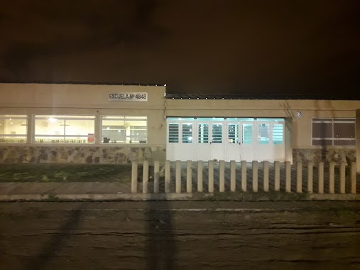
Escuela N°4848 Nuestra Señora de Atocha
Unnamed Road,, Salta
School
read more
95 m
School No. 4848 OUR LADY OF ATOCHA
Bº ATOCHA II, LA LONJA, ATOCHA, Salta
School
read more
95 m
ESCUELA Nº 4848 NUESTRA SEÑORA DE ATOCHA
Bº ATOCHA II, LA LONJA, ATOCHA, Salta
School
read more
221 m
La Lonja
Pasaje 12, Salta
School
read more
429 m
Salita de pre jardin Girasol
Salta
School
read more
1.126 km
ANIDAR
Salta
School
read more
1.27 km
Escuela 4304 Ntra. Sra del Carmen - La Cienaga
Avenida Luna, Salta
School
read more
1.448 km
Comedor Niño Jesus
Las Gaviotas, Salta
School
read more
1.531 km
School El Carmen
Salta
School
read more
1.606 km
Escuela Evaristo Pi�on Arias
El C�ndor 3155, Salta, SALTA
School
read more
1.673 km
centro de la primera infancia los salteñitos
El Pavo Real 1756, Salta
School
read more
1.706 km
Casa de Retiros La Divina Misericordia
Salta
School
read more
1.708 km
Esc. de Ed. Esp. N°8217 Ayúdame a Crecer
Ruta Provincial 99, Salta
School
read more
1.749 km
Colegio De Atocha
Salta
School
read more
1.754 km
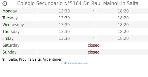
Colegio Secundario N°5164 Dr. Raul Mainoli
Salta
School
read more
1.757 km
Merendero De La Cienaga Rafael Arcangel
Rio Bermejo, Salta
School
read more
1.834 km
Escuela Mercedes Lavin
Monseñor Pérez, Salta
School
read more
1.876 km
Maria De Las Merceces Lavin
Salta
School
read more
2.026 km
PRE JARDIN RINCONCITO FELIZ
SANTA ELENA N° 2764, Salta
School
read more
2.049 km
Escuelita
Itiyuro, Salta
School
read more
2.267 km
Instituto Provincia De Salta
Santa Cecilia, Salta
School
read more
2.651 km
Escuela Ntra. Sra. de la Asuncion
Salta
School
read more
3.649 km
Mi Refugio
Gral. J. J. de Urquiza 2596. Salta. Capital c/p 4400
School
read more
3.782 km
Escuela N° 4002 Mariano Cabezon
Salta
School
read more
📑
all categories
Accounting
Administrative area level 1
Administrative area level 2
Airport
Amusement park
Aquarium
Art gallery
Atm
Bakery
Bank
Bar
Beauty salon
Bicycle store
Book store
Bowling alley
Bus station
Cafe
Campground
Car dealer
Car rental
Car repair
Car wash
Casino
Cemetery
Church
City hall
Clothing store
Colloquial area
Convenience store
Country
Courthouse
Dentist
Department store
Doctor
Electrician
Electronics store
Embassy
Establishment
Finance
Fire station
Florist
Food
Funeral home
Furniture store
Gas station
General contractor
Grocery or supermarket
Gym
Hair care
Hardware store
Health
Hindu Temple
Home goods store
Hospital
Insurance agency
Intersection
Jewelry store
Laundry
Lawyer
Library
Light rail station
Liquor store
Local government office
Locality
Locksmith
Lodging
Meal delivery
Meal takeaway
Mosque
Movie rental
Movie theater
Moving company
Museum
Natural feature
Neighborhood
Night club
Painter
Park
Parking
Pet store
Pharmacy
Physiotherapist
Place of worship
Plumber
Point of interest
Police
Political
Post office
Premise
Real estate agency
Restaurant
Roofing contractor
Route
Rv park, camping
School
Shoe store
Shopping mall
Spa
Stadium
Storage
Store
Subpremise
Subway station
Supermarket
Synagogue
Taxi stand
Train station
Transit station
Travel agency
University
Veterinary care
Zoo
sublocality level 1
sublocality level 3
↑