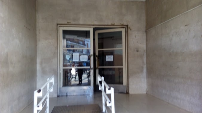
School nearby Escuela Nº 26 DE 5
Argentina
School nearby Escuela Nº 26 DE 5
Escuela Nº 26 DE 5
682, San Antonio, C1276, Comuna 4, Buenos Aires, AR Argentina
contacts phone
:
+54
website:
pri20de05.blogspot.com.ar
Latitude:
-34.6498893
, Longitude:
-58.3777835
larger map & directions
read more
nearest School
146 m
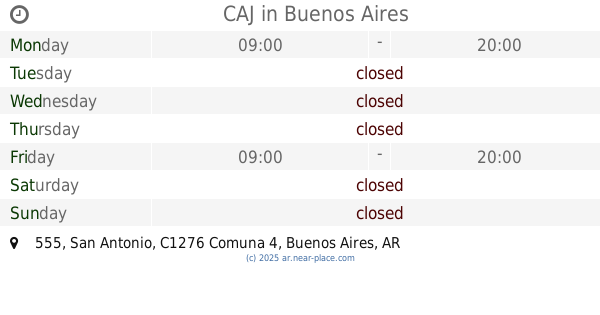
CAJ
San Antonio 555
School
read more
197 m
Escuela EP Nro 6
V., Vieytes 1549
School
read more
254 m
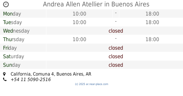
Andrea Allen Atellier
California, Buenos Aires
School
read more
261 m
centro de apoyo escolar
California 2325
School
read more
313 m
Pulgarcito Jardín Maternal
Argentina
School
read more
355 m
Asociación Fraga
California 1925
School
read more
378 m
Escuela Tecnica libertad
School
read more
390 m
Colegio Buen Consejo (Sede varones)
C1277ADM, Río Cuarto 2560
School
read more
440 m
Alu
C1275AGT, Vieytes 1710
School
read more
491 m
COLEGIO SANTA TERESA
Avenida Montes de Oca 1822
School
read more
590 m
Esc. Primaria Común Nº 13 Fray Mamerto Esquiú
Salom 332
School
read more
598 m
estudio
C1293ABA, Algarrobo 1041
School
read more
599 m
Apoyo Escolar
Santa Elena 465
School
read more
601 m
Cafydma
C1293ABA, Algarrobo 1041
School
read more
626 m
cmd lab
School
read more
637 m
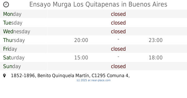
Ensayo Murga Los Quitapenas
Benito Quinquela Martín 1852-1896
School
read more
712 m
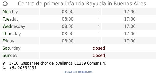
Centro de primera infancia Rayuela
Gaspar Melchor de Jovellanos 1710
School
read more
838 m
Trade School Joaquin V. González Issue 01
School
read more
845 m
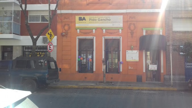
Pido Gancho
C1296ACC, Coronel Salvadores 1443
School
read more
845 m
escuels
General Gregorio Aráoz de Lamadrid 1710
School
read more
944 m
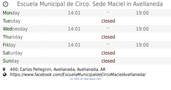
Escuela Municipal de Circo. Sede Maciel
Carlos Pellegrini 400, Avellaneda
School
read more
1.037 km
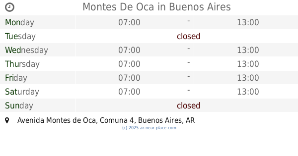
Montes De Oca
Avenida Montes de Oca, Buenos Aires
School
read more
1.051 km
CBC
Avenida Montes de Oca 1142
School
read more
1.055 km
Űň!\/€ř
Avenida Montes de Oca 1142
School
read more
1.106 km
Baldomero Fernandez Moreno 2673C1406 CABA
Olavarría 2766
School
read more
📑
all categories
Accounting
Administrative area level 1
Administrative area level 2
Airport
Amusement park
Aquarium
Art gallery
Atm
Bakery
Bank
Bar
Beauty salon
Bicycle store
Book store
Bowling alley
Bus station
Cafe
Campground
Car dealer
Car rental
Car repair
Car wash
Casino
Cemetery
Church
City hall
Clothing store
Colloquial area
Convenience store
Country
Courthouse
Dentist
Department store
Doctor
Electrician
Electronics store
Embassy
Establishment
Finance
Fire station
Florist
Food
Funeral home
Furniture store
Gas station
General contractor
Grocery or supermarket
Gym
Hair care
Hardware store
Health
Hindu Temple
Home goods store
Hospital
Insurance agency
Intersection
Jewelry store
Laundry
Lawyer
Library
Light rail station
Liquor store
Local government office
Locality
Locksmith
Lodging
Meal delivery
Meal takeaway
Mosque
Movie rental
Movie theater
Moving company
Museum
Natural feature
Neighborhood
Night club
Painter
Park
Parking
Pet store
Pharmacy
Physiotherapist
Place of worship
Plumber
Point of interest
Police
Political
Post office
Premise
Real estate agency
Restaurant
Roofing contractor
Route
Rv park, camping
School
Shoe store
Shopping mall
Spa
Stadium
Storage
Store
Subpremise
Subway station
Supermarket
Synagogue
Taxi stand
Train station
Transit station
Travel agency
University
Veterinary care
Zoo
sublocality level 1
sublocality level 3
↑