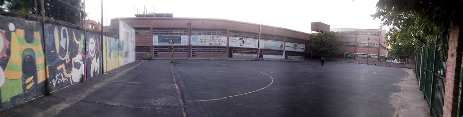
School nearby Escuela4 De 19
Argentina
School nearby Escuela4 De 19
Escuela4 De 19
1850, Avenida Riestra, C1437, Comuna 7, Buenos Aires, AR Argentina
contacts phone
:
+54
Latitude:
-34.6465036
, Longitude:
-58.4355413
larger map & directions
read more
nearest School
3 m
Escuela Primaria N° 4 de 19 Ricardo Güiraldes
Avenida Riestra 1850
School
read more
56 m
Escuela Primaria Comun Número 04
School
read more
234 m
C.p.i La Hormiguita Viajera
Presidente Camilo Torres y Tenorio 2302-2500
School
read more
288 m
Instituto San Judas Tadeo
Somellera 1720
School
read more
295 m
Escuela Primaria Comun Número 11 Ignacio Fermin Rodríguez
School
read more
304 m
Centro de Jubilados Los Galancitos
School
read more
306 m
E.E.M 3 DE 19
C1437ANK, Agustín de Vedia 2519
School
read more
312 m
Colegio General Juan Jose Torrez Cochabamba
Presidente Camilo Torres y Tenorio 2246
School
read more
388 m
Cens Número 68
School
read more
501 m
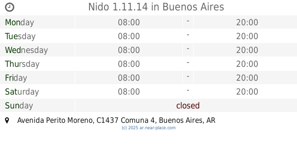
Nido 1.11.14
Avenida Perito Moreno
School
read more
532 m
Jardin Nro.1 D.e. 19
Alfonsina Storni 2152
School
read more
606 m
centro accion familiar 3
&, Alfonsina Storni, Malvinas Argentinas
School
read more
643 m
escuela palacios
Victor Martínez 1953
School
read more
663 m
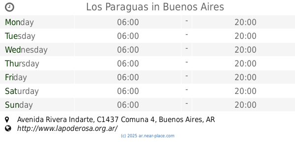
Los Paraguas
Avenida Rivera Indarte
School
read more
680 m
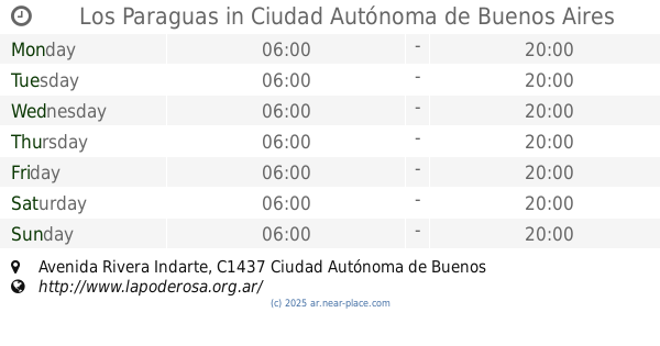
Los Paraguas
Avenida Rivera Indarte, Ciudad Autónoma de Buenos Aires
School
read more
727 m
Pico 2689
La Capital
School
read more
751 m
Escuela Miguel Hernandez
Argentina
School
read more
795 m
ESBA
C1406CEI, Victor Martínez 1739
School
read more
824 m
Escuela 13 De 19
Itaqui 2050
School
read more
842 m
Escuela 15 De 8
Saraza 1539
School
read more
855 m
Asociacion Cooperadora F Julio Picarell Esc 15 D E
Saraza 1353
School
read more
898 m
Centro De Formación ProfecionL
N°1427 la, Calle 5
School
read more
1.028 km
CPPFA
C1437HJH, Avenida Riestra 3077-3097
School
read more
1.072 km
Escuela Primaria Común N°23 DE 19° JC
C1437HBT,, Coronel Martiniano Chilavert 2690
School
read more
1.195 km
Campito Mariamista
Ana María Janer 2865
School
read more
📑
all categories
Accounting
Administrative area level 1
Administrative area level 2
Airport
Amusement park
Aquarium
Art gallery
Atm
Bakery
Bank
Bar
Beauty salon
Bicycle store
Book store
Bowling alley
Bus station
Cafe
Campground
Car dealer
Car rental
Car repair
Car wash
Casino
Cemetery
Church
City hall
Clothing store
Colloquial area
Convenience store
Country
Courthouse
Dentist
Department store
Doctor
Electrician
Electronics store
Embassy
Establishment
Finance
Fire station
Florist
Food
Funeral home
Furniture store
Gas station
General contractor
Grocery or supermarket
Gym
Hair care
Hardware store
Health
Hindu Temple
Home goods store
Hospital
Insurance agency
Intersection
Jewelry store
Laundry
Lawyer
Library
Light rail station
Liquor store
Local government office
Locality
Locksmith
Lodging
Meal delivery
Meal takeaway
Mosque
Movie rental
Movie theater
Moving company
Museum
Natural feature
Neighborhood
Night club
Painter
Park
Parking
Pet store
Pharmacy
Physiotherapist
Place of worship
Plumber
Point of interest
Police
Political
Post office
Premise
Real estate agency
Restaurant
Roofing contractor
Route
Rv park, camping
School
Shoe store
Shopping mall
Spa
Stadium
Storage
Store
Subpremise
Subway station
Supermarket
Synagogue
Taxi stand
Train station
Transit station
Travel agency
University
Veterinary care
Zoo
sublocality level 1
sublocality level 3
↑