School nearby ESPACIO - Logistica y Distribucion
Coronavirus disease (COVID-19) Situation
confirmed cases
10128845
deaths
130841
Argentina
School nearby ESPACIO - Logistica y Distribucion
ESPACIO - Logistica y Distribucion
2258, Avenida San Juan Bautista de la Salle, C1407, Comuna 9, Buenos Aires, AR Argentina
contacts phone
:
+54
Latitude:
-34.6548516
, Longitude:
-58.4739098
larger map & directions
read more
nearest School
356 m
School No. 5 D.E. 13
Zinny 1641
School
read more
365 m
VidaMusik
C1407HWN, Zuviría 3960
School
read more
398 m
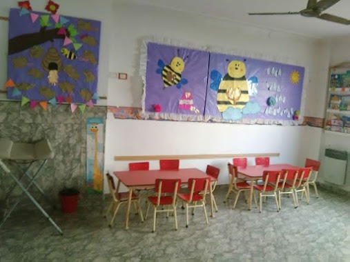
Centro De Primera Infancia Semillitas De Esperanza
Dellepiane Norte 3955, Buenos Aires
School
read more
420 m
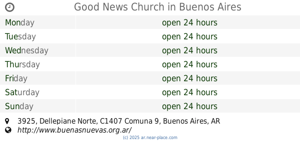
Good News Church
Dellepiane Norte 3925
School
read more
449 m
Escuela Común Primaria
Homero 2169
School
read more
450 m
Escuela Tailandia
C1439FLC, Homero 2169
School
read more
508 m
JIN C Escuela 8
Saravia 2358
School
read more
508 m
Jin C Escuela 18
Saravia 2358
School
read more
580 m
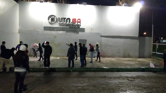
UTN
Mozart
School
read more
580 m
UTN
Mozart & Santander
School
read more
629 m
UTN Pabellón Informática
Avenida Santiago de Compostela 4052-4200
School
read more
691 m
Apoyo Escolar
Dellepiane Sur 4280
School
read more
822 m
Policia De La Ciudad
School
read more
831 m
Fiet intituto
Avenida Eva Perón 5170
School
read more
838 m
Uai
Autopista Perito Moreno
School
read more
856 m
Escuela de Comercio Número 06 América
School
read more
863 m
Instituto Parroquial Madre De Dios
C1439AWH, Crisóstomo Álvarez 4680
School
read more
911 m
Utn
4299, C1439AOA, Saraza 4201
School
read more
912 m
Egresódromo UTN.BA
Mozart 2300
School
read more
916 m
Jardin Maternal Dulce De Leche Srl
Homero 1535
School
read more
963 m
Manuel M. Láinez
Avenida Escalada, 2890
School
read more
969 m
Escuela Normal Superior N. 3
Saraza 4241
School
read more
976 m
G&L School of English
C1439BAI, Doctor Horacio Casco 4855
School
read more
1.095 km
Escuela Infantil Pequitas
Fecundidad 3634
School
read more
1.143 km
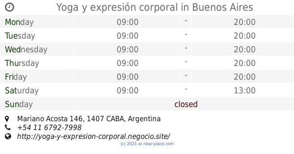
Yoga y expresión corporal
Mariano Acosta 146
School
read more
📑
all categories
Accounting
Administrative area level 1
Administrative area level 2
Airport
Amusement park
Aquarium
Art gallery
Atm
Bakery
Bank
Bar
Beauty salon
Bicycle store
Book store
Bowling alley
Bus station
Cafe
Campground
Car dealer
Car rental
Car repair
Car wash
Casino
Cemetery
Church
City hall
Clothing store
Colloquial area
Convenience store
Country
Courthouse
Dentist
Department store
Doctor
Electrician
Electronics store
Embassy
Establishment
Finance
Fire station
Florist
Food
Funeral home
Furniture store
Gas station
General contractor
Grocery or supermarket
Gym
Hair care
Hardware store
Health
Hindu Temple
Home goods store
Hospital
Insurance agency
Intersection
Jewelry store
Laundry
Lawyer
Library
Light rail station
Liquor store
Local government office
Locality
Locksmith
Lodging
Meal delivery
Meal takeaway
Mosque
Movie rental
Movie theater
Moving company
Museum
Natural feature
Neighborhood
Night club
Painter
Park
Parking
Pet store
Pharmacy
Physiotherapist
Place of worship
Plumber
Point of interest
Police
Political
Post office
Premise
Real estate agency
Restaurant
Roofing contractor
Route
Rv park, camping
School
Shoe store
Shopping mall
Spa
Stadium
Storage
Store
Subpremise
Subway station
Supermarket
Synagogue
Taxi stand
Train station
Transit station
Travel agency
University
Veterinary care
Zoo
sublocality level 1
sublocality level 3
↑