School nearby Imagen
Argentina
School nearby Imagen
Imagen
622, Avenida del Libertador, C1001, Comuna 1, Buenos Aires, AR Argentina
contacts phone
:
+54
Latitude:
-34.5887282
, Longitude:
-58.3822796
larger map & directions
read more
nearest School
456 m
Supervision D E 1
C1014ACA, Avenida Presidente Manuel Quintana 35
School
read more
463 m
Distrito Escolar N° 1
Avenida Presidente Manuel Quintana 55, Buenos Aires
School
read more
463 m
RoMa Bridge Academy
Avenida Presidente Manuel Quintana 161
School
read more
540 m
IAE Sede Centro
1250, Cerrito
School
read more
580 m
Colegio
Libertad 1260, C1012AAZ
School
read more
617 m
BAMA Arenales
C1010AAZ, Cerrito 1202-1222
School
read more
711 m
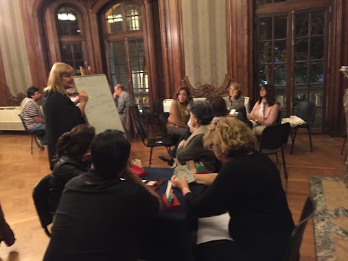
Martu Teatro
Vicente López 1661
School
read more
713 m
La Rosa
Avenida Presidente Manuel Quintana 500
School
read more
735 m
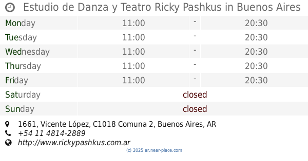
Estudio de Danza y Teatro Ricky Pashkus
Vicente López 1661
School
read more
743 m
Office du tourisme
Avenida Santa Fe 883
School
read more
745 m
Claudina Thevenet Foundation
Uruguay 1237
School
read more
755 m
AMA
C1059ABS, Avenida Santa Fe 1171
School
read more
765 m
CAF 6 Bichito De Luz
School
read more
872 m
Lo Jack
Avenida Estado de Israel 4200
School
read more
948 m
Colegio Del Pilar
Vicente López 1969
School
read more
951 m
Institute Nuestra Señora del Pilar
Vicente López 1969
School
read more
989 m
Facultad de Derecho
C1127AAN, Avenida General Las Heras 1832
School
read more
1.004 km
Fairy Tale
Juncal 1640
School
read more
1.029 km
FlorAler MakeUp
C1007ABL, Esmeralda 920
School
read more
1.046 km
con ciencia experimentos
C1061AAS, Arenales 1659
School
read more
1.071 km
ORAL IELTS
Paraguay 755
School
read more
1.074 km
escuela de nauticaa
Avenida Antártida Argentina 1535
School
read more
1.216 km
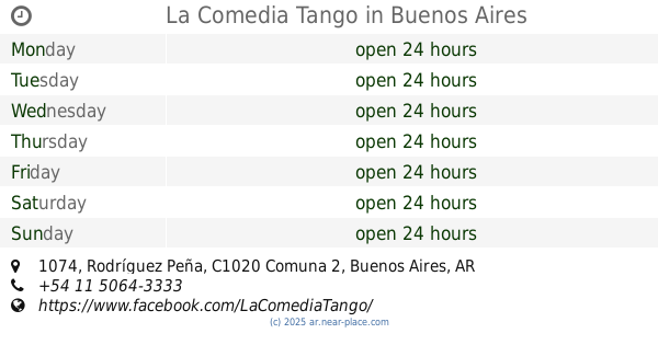
La Comedia Tango
C1020ADV, Rodríguez Peña 1074
School
read more
1.255 km
AbiertoalArte Magui Roccatagliata
Rodríguez Peña 1054
School
read more
1.255 km
ICRS Instituto De Cultura Religiosa Superior
Rodríguez Peña 1054
School
read more
📑
all categories
Accounting
Administrative area level 1
Administrative area level 2
Airport
Amusement park
Aquarium
Art gallery
Atm
Bakery
Bank
Bar
Beauty salon
Bicycle store
Book store
Bowling alley
Bus station
Cafe
Campground
Car dealer
Car rental
Car repair
Car wash
Casino
Cemetery
Church
City hall
Clothing store
Colloquial area
Convenience store
Country
Courthouse
Dentist
Department store
Doctor
Electrician
Electronics store
Embassy
Establishment
Finance
Fire station
Florist
Food
Funeral home
Furniture store
Gas station
General contractor
Grocery or supermarket
Gym
Hair care
Hardware store
Health
Hindu Temple
Home goods store
Hospital
Insurance agency
Intersection
Jewelry store
Laundry
Lawyer
Library
Light rail station
Liquor store
Local government office
Locality
Locksmith
Lodging
Meal delivery
Meal takeaway
Mosque
Movie rental
Movie theater
Moving company
Museum
Natural feature
Neighborhood
Night club
Painter
Park
Parking
Pet store
Pharmacy
Physiotherapist
Place of worship
Plumber
Point of interest
Police
Political
Post office
Premise
Real estate agency
Restaurant
Roofing contractor
Route
Rv park, camping
School
Shoe store
Shopping mall
Spa
Stadium
Storage
Store
Subpremise
Subway station
Supermarket
Synagogue
Taxi stand
Train station
Transit station
Travel agency
University
Veterinary care
Zoo
sublocality level 1
sublocality level 3
↑