Bakery nearby JESICA
Argentina
Bakery nearby JESICA
JESICA
244, Campichuelo, C1405, Comuna 6, Buenos Aires, AR Argentina
contacts phone
:
+54 11 4903-9800
Latitude:
-34.6141476
, Longitude:
-58.4341627
larger map & directions
read more
nearest Bakery
140 m
Caprice
Campichuelo 375
Bakery
read more
275 m
El Puente
Juan B. Ambrosetti 149
Bakery
read more
320 m
Panadería San Telmo
Avenida Acoyte 285
Bakery
read more
359 m
Cocelia
Avenida Acoyte 449
Bakery
read more
388 m
Roel
Avenida Avellaneda 99
Bakery
read more
400 m
Panadería y confiteria fatima
Avenida Avellaneda 526
Bakery
read more
424 m
Los Patissiers
Bogotá 5
Bakery
read more
524 m
Aló! Panadería Boutique
Avenida Acoyte 621
Bakery
read more
565 m
Mil Grullas Pastelería
Bakery
read more
565 m
Thousand Cranes Pastry
Bakery
read more
682 m
Lurdes
Senillosa 242
Bakery
read more
694 m
La Nueva Fragola
Avenida Díaz Vélez 4505
Bakery
read more
696 m
Panadería RCL
Muñiz 278
Bakery
read more
846 m
Las Medialunas del Abuelo
San José de Calasanz 154
Bakery
read more
863 m
Panadería Mari
José Mármol 380
Bakery
read more
893 m
Tutto Pane
Rojas 123
Bakery
read more
907 m
Confitería El Greco
Avenida Rivadavia 5353, Buenos Aires
Bakery
read more
908 m
Confitería El Greco
Rivadavia 5353
Cafe
Bakery
Store
Restaurant
Food
Point of interest
Establishment
read more
927 m
Panadería San Marcos
Guayaquil 712
Bakery
read more
984 m
PETIT BOUQUET
Franklin 666
Bakery
read more
985 m
TortasGeniales
Teniente General Juan Domingo Perón 4456
Bakery
read more
1.05 km
El modelo
Franklin 756
Bakery
read more
1.106 km
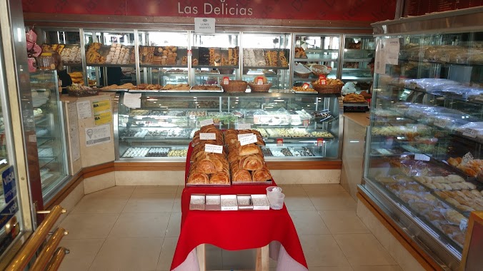
Las Delicias
Avenida La Plata 620
Bakery
read more
1.11 km
Panadería La Milagrosa
Avenida del Barco Centenera 257
Bakery
read more
1.257 km
Panadería las delicias
Bakery
read more
📑
all categories
Accounting
Administrative area level 1
Administrative area level 2
Airport
Amusement park
Aquarium
Art gallery
Atm
Bakery
Bank
Bar
Beauty salon
Bicycle store
Book store
Bowling alley
Bus station
Cafe
Campground
Car dealer
Car rental
Car repair
Car wash
Casino
Cemetery
Church
City hall
Clothing store
Colloquial area
Convenience store
Country
Courthouse
Dentist
Department store
Doctor
Electrician
Electronics store
Embassy
Establishment
Finance
Fire station
Florist
Food
Funeral home
Furniture store
Gas station
General contractor
Grocery or supermarket
Gym
Hair care
Hardware store
Health
Hindu Temple
Home goods store
Hospital
Insurance agency
Intersection
Jewelry store
Laundry
Lawyer
Library
Light rail station
Liquor store
Local government office
Locality
Locksmith
Lodging
Meal delivery
Meal takeaway
Mosque
Movie rental
Movie theater
Moving company
Museum
Natural feature
Neighborhood
Night club
Painter
Park
Parking
Pet store
Pharmacy
Physiotherapist
Place of worship
Plumber
Point of interest
Police
Political
Post office
Premise
Real estate agency
Restaurant
Roofing contractor
Route
Rv park, camping
School
Shoe store
Shopping mall
Spa
Stadium
Storage
Store
Subpremise
Subway station
Supermarket
Synagogue
Taxi stand
Train station
Transit station
Travel agency
University
Veterinary care
Zoo
sublocality level 1
sublocality level 3
↑