Bakery nearby La Aldea
Argentina
Bakery nearby La Aldea
La Aldea
2795, Nazarre, 1417, Cuudad autonoma de buenos aires, Comuna 11, AR Argentina
contacts phone
:
+54 11 4504-1420
Latitude:
-34.5991041
, Longitude:
-58.4896765
larger map & directions
read more
nearest Bakery
164 m
Casa de Empanadas & Pizzas DEL POPOLO
Condarco 3212
Bakery
read more
386 m
El caserito
General José Gervasio Artigas 3076
Bakery
read more
556 m
El Sabor Del Pan
Tinogasta 3178
Bakery
read more
576 m
La Victoria
Cuenca 3090
Bakery
read more
643 m
Maga's house
Marcos Sastre 3101
Bakery
read more
643 m
La Casa de Maga
Marcos Sastre 3101
Bakery
read more
650 m
MATEO
Nogoyá 3221
Bakery
read more
655 m
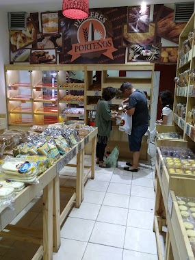
Placeres Porteños
C1417AAK, Cuenca 2735
Bakery
read more
662 m
Fabrica de Tortas y Sanguches Flambo
Santo Tomé 2798
Bakery
read more
680 m
EL PRINCIPE
Argerich 2728
Bakery
read more
690 m
La Nueva Muguet
Nazarre 3285
Bakery
read more
704 m
Panadería La Yoli
Santo Tomé 2601
Bakery
read more
718 m
Fca. de Sandwiches EL COLONIAL
Nogoyá 3269
Bakery
read more
753 m
San Miguel
Nogoyá 3280
Bakery
read more
755 m
La Nueva Santa Paula
Avenida Nazca 2633
Bakery
read more
766 m
LAS MEDIALUNAS DEL ABUELO
Cuenca 3478
Bakery
read more
786 m
La Nonna
Arregui 2875
Bakery
read more
871 m
El Molino Panadería y Confitería
Cuenca 2514
Bakery
read more
880 m
San José
Avenida Nazca 3773
Bakery
read more
902 m
El Atlántico
General José Gervasio Artigas 3667
Bakery
read more
962 m
Panaderia Los Nietos
General José Gervasio Artigas 1553
Bakery
read more
972 m
La Nueva Santa Paula
Bolivia 2526
Bakery
read more
1.082 km
Fiambrería La Amistad Panadería
Adolfo P. Carranza 2800
Bakery
read more
1.092 km
Bambi
Avenida Nazca 2398
Bakery
read more
1.185 km
Panadería Buenos Aires
Avenida Nazca 4067
Bakery
read more
📑
all categories
Accounting
Administrative area level 1
Administrative area level 2
Airport
Amusement park
Aquarium
Art gallery
Atm
Bakery
Bank
Bar
Beauty salon
Bicycle store
Book store
Bowling alley
Bus station
Cafe
Campground
Car dealer
Car rental
Car repair
Car wash
Casino
Cemetery
Church
City hall
Clothing store
Colloquial area
Convenience store
Country
Courthouse
Dentist
Department store
Doctor
Electrician
Electronics store
Embassy
Establishment
Finance
Fire station
Florist
Food
Funeral home
Furniture store
Gas station
General contractor
Grocery or supermarket
Gym
Hair care
Hardware store
Health
Hindu Temple
Home goods store
Hospital
Insurance agency
Intersection
Jewelry store
Laundry
Lawyer
Library
Light rail station
Liquor store
Local government office
Locality
Locksmith
Lodging
Meal delivery
Meal takeaway
Mosque
Movie rental
Movie theater
Moving company
Museum
Natural feature
Neighborhood
Night club
Painter
Park
Parking
Pet store
Pharmacy
Physiotherapist
Place of worship
Plumber
Point of interest
Police
Political
Post office
Premise
Real estate agency
Restaurant
Roofing contractor
Route
Rv park, camping
School
Shoe store
Shopping mall
Spa
Stadium
Storage
Store
Subpremise
Subway station
Supermarket
Synagogue
Taxi stand
Train station
Transit station
Travel agency
University
Veterinary care
Zoo
sublocality level 1
sublocality level 3
↑