Bakery nearby La Panadería
Argentina
Bakery nearby La Panadería
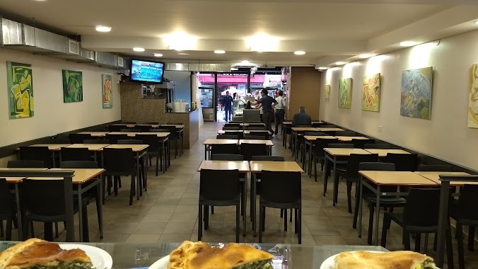
La Panadería
835, Lavalle, C1047, Comuna 1, Buenos Aires, AR Argentina
contacts phone
:
+54
Latitude:
-34.6023
, Longitude:
-58.378612
larger map & directions
read more
nearest Bakery
51 m
El Cañón
Esmeralda 524
Bakery
read more
86 m
CONFITERÍA Lepetymer
Suilpacha 485
Bakery
read more
86 m
Panadería Lamarque
Lavalle 899
Bakery
read more
282 m
Medialunadas
Viamonte 728
Bakery
read more
317 m
Productos Panificados Batan S A
Calle 1 Entre 6 Y 8, Bat�n, Buenos Aires
Bakery
read more
447 m
SCARLETT BOUTIQUE - CENTRO
C1006AAG, Maipú 825
Bakery
read more
461 m
Date El Gusto
Suipacha 860, Microcentro
Bakery
read more
542 m
GRANDFATHER medialunas
Bartolomé Mitre 695
Bakery
read more
651 m
Alimentari
Sarmiento 372
Bakery
read more
658 m
Bakery & Confectionery Felipe & Mignon
Suipacha 6
Bakery
read more
666 m
Gamas
Marcelo Torcuato de Alvear 955/7
Bakery
read more
676 m
Buenos Aires Bakery
Maipú 2
Bakery
read more
686 m
Pell Street Kiosco & Foood
Carlos Pellegrini 1011
Bakery
read more
691 m
La Piedad
Florida 31
Bakery
read more
732 m
Cafe Comega
Avenida Corrientes 224
Bakery
read more
743 m
Bombonería A los Holandeses
Avenida de Mayo 826
Bakery
read more
826 m
Maria Antonieta
Uruguay 250
Bakery
read more
957 m
Panadería Saludable
Avenida Córdoba 1511
Bakery
read more
958 m
Doña Andreza
Uruguay 87
Bakery
read more
982 m
Del Socorro
Suipacha 1240
Bakery
read more
1.114 km
Pucará Panadería
San José 114
Bakery
read more
1.148 km
Isidoro Café
San José 145
Bakery
read more
1.181 km
Del Grano, Café & Bakery
Montevideo 80
Bakery
read more
1.197 km
Panadería Las Morenas
Balcarce 262
Bakery
read more
1.278 km
Confitería Giucris
Adolfo Alsina 1501
Bakery
read more
📑
all categories
Accounting
Administrative area level 1
Administrative area level 2
Airport
Amusement park
Aquarium
Art gallery
Atm
Bakery
Bank
Bar
Beauty salon
Bicycle store
Book store
Bowling alley
Bus station
Cafe
Campground
Car dealer
Car rental
Car repair
Car wash
Casino
Cemetery
Church
City hall
Clothing store
Colloquial area
Convenience store
Country
Courthouse
Dentist
Department store
Doctor
Electrician
Electronics store
Embassy
Establishment
Finance
Fire station
Florist
Food
Funeral home
Furniture store
Gas station
General contractor
Grocery or supermarket
Gym
Hair care
Hardware store
Health
Hindu Temple
Home goods store
Hospital
Insurance agency
Intersection
Jewelry store
Laundry
Lawyer
Library
Light rail station
Liquor store
Local government office
Locality
Locksmith
Lodging
Meal delivery
Meal takeaway
Mosque
Movie rental
Movie theater
Moving company
Museum
Natural feature
Neighborhood
Night club
Painter
Park
Parking
Pet store
Pharmacy
Physiotherapist
Place of worship
Plumber
Point of interest
Police
Political
Post office
Premise
Real estate agency
Restaurant
Roofing contractor
Route
Rv park, camping
School
Shoe store
Shopping mall
Spa
Stadium
Storage
Store
Subpremise
Subway station
Supermarket
Synagogue
Taxi stand
Train station
Transit station
Travel agency
University
Veterinary care
Zoo
sublocality level 1
sublocality level 3
↑