Bakery nearby Obrador de Panes & Galletas
Argentina
Bakery nearby Obrador de Panes & Galletas
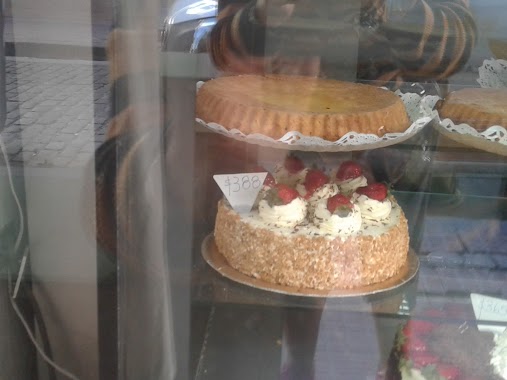
Obrador de Panes & Galletas
524, Chile, C1098, Comuna 1, Buenos Aires, AR Argentina
contacts phone
:
+54
website:
www.facebook.com
Latitude:
-34.6160762
, Longitude:
-58.3734556
larger map & directions
read more
nearest Bakery
57 m
Haus Mond Sa
Bolívar 728
Bakery
read more
180 m
Santa María
Defensa 668
Bakery
read more
219 m
Tortas and Cakes.
C1065AAI, Defensa 535-599
Bakery
read more
256 m
M Pastelería
Defensa 529
Bakery
read more
267 m
La Victoria
Avenida Independencia 702
Bakery
read more
270 m
Croissants Honey
Defensa 863
Bakery
read more
355 m
Rotiseria y Panaderia La Tranquera
Chile 799 C1098AAO
Bakery
read more
504 m
Cosas Ricas
Perú 1081
Bakery
read more
504 m
C.R. Cosas Ricas
Perú 1081
Bakery
read more
588 m
San Telmo style
Perú 259
Bakery
read more
642 m
Panadería Las Morenas
Balcarce 262
Bakery
read more
649 m
Bragado
Avenida San Juan 419
Bakery
read more
788 m
Don Armando
Avenida San Juan 200, C1147AAN
Bakery
read more
865 m
panaderia los soba garcha
Avenida San Juan 952
Bakery
read more
900 m
Bombonería A los Holandeses
Avenida de Mayo 826
Bakery
read more
914 m
Anahid
Avenida Hipólito Yrigoyen 901
Bakery
read more
926 m
Buenos Aires Bakery
Maipú 2
Bakery
read more
940 m
El Buen Almacén
Carlos Calvo 1187
Bakery
read more
941 m
La Perla de San Telmo
Piedras 1336
Bakery
read more
943 m
La Piedad
Florida 31
Bakery
read more
983 m
Panadería y Confitería Santa Ángela
Defensa 1455
Bakery
read more
984 m
Noval Rodriguez Victor
Salta 389
Bakery
read more
984 m
La Masse
Salta 389
Bakery
read more
1.026 km
Panadería La Nueva Belgrano
Avenida Belgrano 1270, C1093AAN
Bakery
read more
1.028 km
Bakery & Confectionery Felipe & Mignon
Suipacha 6
Bakery
read more
📑
all categories
Accounting
Administrative area level 1
Administrative area level 2
Airport
Amusement park
Aquarium
Art gallery
Atm
Bakery
Bank
Bar
Beauty salon
Bicycle store
Book store
Bowling alley
Bus station
Cafe
Campground
Car dealer
Car rental
Car repair
Car wash
Casino
Cemetery
Church
City hall
Clothing store
Colloquial area
Convenience store
Country
Courthouse
Dentist
Department store
Doctor
Electrician
Electronics store
Embassy
Establishment
Finance
Fire station
Florist
Food
Funeral home
Furniture store
Gas station
General contractor
Grocery or supermarket
Gym
Hair care
Hardware store
Health
Hindu Temple
Home goods store
Hospital
Insurance agency
Intersection
Jewelry store
Laundry
Lawyer
Library
Light rail station
Liquor store
Local government office
Locality
Locksmith
Lodging
Meal delivery
Meal takeaway
Mosque
Movie rental
Movie theater
Moving company
Museum
Natural feature
Neighborhood
Night club
Painter
Park
Parking
Pet store
Pharmacy
Physiotherapist
Place of worship
Plumber
Point of interest
Police
Political
Post office
Premise
Real estate agency
Restaurant
Roofing contractor
Route
Rv park, camping
School
Shoe store
Shopping mall
Spa
Stadium
Storage
Store
Subpremise
Subway station
Supermarket
Synagogue
Taxi stand
Train station
Transit station
Travel agency
University
Veterinary care
Zoo
sublocality level 1
sublocality level 3
↑