Bakery nearby Panaderia Rolon
Argentina
Bakery nearby Panaderia Rolon
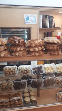
Panaderia Rolon
Alberti 1718 Argentina
contacts phone
:
+54
Latitude:
-34.6299382
, Longitude:
-58.399457
read more
nearest Bakery
133 m
Daniela Pasteleria
1°6°, C1249AAK, Matheu 1771
Bakery
read more
148 m
Panaderia Gran Matheu
Matheu 1621, C1249AAI
Bakery
read more
173 m
Panadería y Confitería Malvinas Argentinas
Avenida Brasil 2399
Bakery
read more
269 m
Panaderia Rolon
Alberti 1718, C1247AAL 1754AAB
Bakery
read more
532 m
Panadería, confitería y rotisería, Los Abuelos
Rondeau 2599
Bakery
read more
585 m
Los Abuelos II
Rondeau 2700
Bakery
read more
589 m
Panadería Tito
Avenida Caseros 2669
Bakery
read more
658 m
Casimiro
Avenida Caseros 2551
Bakery
read more
759 m
Panadería "La Argentina 2"
Avenida Juan de Garay 1859
Bakery
read more
768 m
PANADERÍA ARTESANAL -PAN CALIENTE-
La Rioja 1937
Bakery
read more
788 m
La Nueva Entre Rios Panaderia Confiteria
Avenida Entre Ríos 1913
Bakery
read more
805 m
Panadería Cambalache
Avenida Entre Ríos 1601
Bakery
read more
823 m
Panaderia Constutucion
Constitución 1900, Buenos Aires
Bakery
read more
854 m
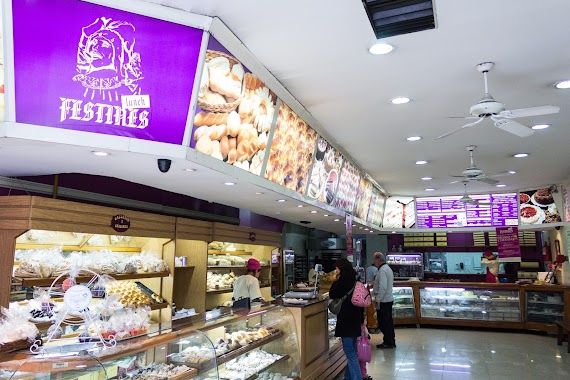
Festines Lunch
La Rioja 2084
Bakery
read more
865 m
Gustos
Avenida San Juan 2102
Bakery
read more
878 m
Las Medialunas del Abuelo
La Rioja 2091
Bakery
read more
905 m
Panadería La Vienesa
C1231ACD, Humberto 1º 2800
Bakery
read more
929 m
GaLiLeo
La Rioja 2135
Bakery
read more
984 m
LA ARGENTINA
Doctor Enrique Finochietto 2029
Bakery
read more
1.029 km
Laborde Rodolfo P
Carlos Calvo 2772
Bakery
read more
1.077 km
La Princesa
Avenida San Juan 3136
Bakery
read more
1.13 km
Le Mirage
Carlos Calvo 3002
Bakery
read more
1.192 km
Confitería y Sandwichería La Unión
Avenida Entre Ríos 1098
Bakery
read more
1.196 km
La Flor Guaraní
Avenida Entre Ríos 1067
Bakery
read more
1.351 km
Estela Maris
Uriburu (C11) 547, Villa Zagala
Bakery
read more
📑
all categories
Accounting
Administrative area level 1
Administrative area level 2
Airport
Amusement park
Aquarium
Art gallery
Atm
Bakery
Bank
Bar
Beauty salon
Bicycle store
Book store
Bowling alley
Bus station
Cafe
Campground
Car dealer
Car rental
Car repair
Car wash
Casino
Cemetery
Church
City hall
Clothing store
Colloquial area
Convenience store
Country
Courthouse
Dentist
Department store
Doctor
Electrician
Electronics store
Embassy
Establishment
Finance
Fire station
Florist
Food
Funeral home
Furniture store
Gas station
General contractor
Grocery or supermarket
Gym
Hair care
Hardware store
Health
Hindu Temple
Home goods store
Hospital
Insurance agency
Intersection
Jewelry store
Laundry
Lawyer
Library
Light rail station
Liquor store
Local government office
Locality
Locksmith
Lodging
Meal delivery
Meal takeaway
Mosque
Movie rental
Movie theater
Moving company
Museum
Natural feature
Neighborhood
Night club
Painter
Park
Parking
Pet store
Pharmacy
Physiotherapist
Place of worship
Plumber
Point of interest
Police
Political
Post office
Premise
Real estate agency
Restaurant
Roofing contractor
Route
Rv park, camping
School
Shoe store
Shopping mall
Spa
Stadium
Storage
Store
Subpremise
Subway station
Supermarket
Synagogue
Taxi stand
Train station
Transit station
Travel agency
University
Veterinary care
Zoo
sublocality level 1
sublocality level 3
↑