Bank nearby Como Llegar
Argentina
Bank nearby Como Llegar
Como Llegar
Gorriti, C1176, Comuna 14, Buenos Aires, AR Argentina
contacts phone
:
+54
Latitude:
-34.5955295
, Longitude:
-58.4167552
larger map & directions
read more
nearest Bank
299 m
Santander Río
Avenida Córdoba 3419
Bank
read more
486 m
Banco Galicia
Avenida Córdoba 3227
Bank
read more
486 m
Banco Galicia - Sucursal Palermo Sud
AAG, Avenida Córdoba 3227, Buenos Aires
Bank
read more
727 m
Banco Supervielle
C1425BMX, Charcas 3602
Bank
read more
902 m
Casa de Josevi
C1186ACH, San Luis 3074
Bank
read more
922 m
Citibank
Avenida Santa Fe 3160
Bank
read more
924 m
Santander Río
Avenida Santa Fe 3168
Bank
read more
940 m
Banco Santander Sucursal Av. Coronel Diax
Avenida Santa Fe 3168
Bank
read more
949 m
Banco Supervielle
Av. Santa Fe 2974
Bank
read more
955 m
Caja de Seguros Sa
Pringles 1165
Bank
read more
959 m
Santander Río
Avenida Santa Fe 3077
Bank
read more
966 m
HSBC Bank Argentina S.A.
Avenida Santa Fe 3117
Bank
read more
973 m
ICBC
Palermo, Av. Santa Fe 3316 Alto Palermo, BGV, Buenos Aires
Bank
read more
977 m
Banco Itaú
Avenida Santa Fe 3315
Bank
read more
1.02 km
Santander Río
Avenida Corrientes 4136, Buenos Aires
Bank
read more
1.03 km
Santander Río Superclub
Arenales 3376 C1425BER
Bank
read more
1.035 km
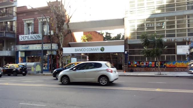
Banco Comafi
Avenida Santa Fe 2764
Bank
read more
1.041 km
Pago Fácil
Avenida Corrientes 3301
Bank
read more
1.041 km
Banco Credicoop
C1414DON, Avenida Raúl Scalabrini Ortíz 1364
Bank
read more
1.053 km
centro de canje BCO RIO
C1425BER, Arenales 3360
Bank
read more
1.118 km
Banco de la Nación Argentina
Avenida Corrientes 4279
Bank
read more
1.153 km
Banco Galicia - Sucursal Abasto
Av. Corrientes 3148, Once
Bank
read more
1.227 km
Corrientes Y Jean Jaures
3099, C1193AAC, Avenida Corrientes 3019
Bank
read more
1.256 km
Siempre pense que había un banco acá
Billinghurst, Juncal &
Bank
read more
1.315 km
Western Union
Costa Rica 4729, C1414BSK
Bank
read more
📑
all categories
Accounting
Administrative area level 1
Administrative area level 2
Airport
Amusement park
Aquarium
Art gallery
Atm
Bakery
Bank
Bar
Beauty salon
Bicycle store
Book store
Bowling alley
Bus station
Cafe
Campground
Car dealer
Car rental
Car repair
Car wash
Casino
Cemetery
Church
City hall
Clothing store
Colloquial area
Convenience store
Country
Courthouse
Dentist
Department store
Doctor
Electrician
Electronics store
Embassy
Establishment
Finance
Fire station
Florist
Food
Funeral home
Furniture store
Gas station
General contractor
Grocery or supermarket
Gym
Hair care
Hardware store
Health
Hindu Temple
Home goods store
Hospital
Insurance agency
Intersection
Jewelry store
Laundry
Lawyer
Library
Light rail station
Liquor store
Local government office
Locality
Locksmith
Lodging
Meal delivery
Meal takeaway
Mosque
Movie rental
Movie theater
Moving company
Museum
Natural feature
Neighborhood
Night club
Painter
Park
Parking
Pet store
Pharmacy
Physiotherapist
Place of worship
Plumber
Point of interest
Police
Political
Post office
Premise
Real estate agency
Restaurant
Roofing contractor
Route
Rv park, camping
School
Shoe store
Shopping mall
Spa
Stadium
Storage
Store
Subpremise
Subway station
Supermarket
Synagogue
Taxi stand
Train station
Transit station
Travel agency
University
Veterinary care
Zoo
sublocality level 1
sublocality level 3
↑