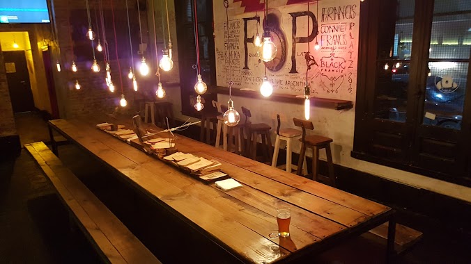
Bar nearby Barley
Argentina
Bar nearby Barley
Barley
3028, Bermúdez, C1417, Comuna 11, Buenos Aires, AR Argentina
contacts phone
:
+54
Latitude:
-34.6127509
, Longitude:
-58.5183847
larger map & directions
read more
nearest Bar
62 m
The Black's - Picadas y Cervezas Envasadas
Simbrón 4925, C1417EWC
Bar
read more
93 m
Pentos Cervecería Artesanal
Bermúdez 3100
Bar
read more
93 m
Pintos
Bermúdez 3100 C1417BWX
Bar
read more
93 m
Pentos Craft Beer
Bermúdez 3100
Bar
read more
113 m
Henry Craft Beer
EZA, José Pedro Varela 4999, Buenos Aires
Bar
read more
208 m
Benoy Café (Bar)
José Pedro Varela 4866
Bar
read more
244 m
Imperial
Bermúdez 3196
Bar
read more
290 m
Wine Art Devoto
C1417EYW, José Pedro Varela 4777
Bar
read more
408 m
Garden bar
Avenida Francisco Beiró 4706
Bar
read more
447 m
Lavadero De Murata
y, Avenida Francisco Beiró
Bar
read more
576 m
Pinto Una Pinta Devoto
Avenida Lope de Vega 2628, C1417COX
Bar
read more
592 m
Papucho.com
Coronel Ramón Lista 5328
Bar
read more
620 m
Lope De Vega Y Beiro
Avenida Lope de Vega 3096
Bar
read more
680 m
Tiempo de Sabores Sucursal Villa Real
Avenida Francisco Beiró 5325
Bar
read more
743 m
REPLICA Cerveceria
&, Virgilio, Avenida Francisco Beiró, Buenos Aires
Bar
read more
802 m
Cervecería Una Mas
Avenida Francisco Beiró 5447
Bar
read more
841 m
UBATUBA Bar - Parrilla
Melincué 5429
Bar
read more
942 m
Bar Vigo
Asunción 5313
Bar
read more
945 m
Días y Flores
Tinogasta 4430
Bar
read more
1.007 km
Cafe de García (Hugo García)
Sanabria 3302
Bar
read more
1.121 km
Nuevo Villa Real RESTAURANTE
Avenida Francisco Beiró 5702
Bar
read more
1.185 km
Corleone Cervecería Artesanal
Avenida Francisco Beiró 5757
Bar
read more
1.519 km
Delon Terraza Resto y Bar
Chivilcoy 3896
Bar
read more
1.575 km
Saturno Delivery Bar
Joaquín V. González 3198, C1417AQV
Bar
read more
2.633 km
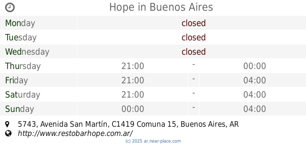
Hope
Avenida San Martín 5743
Bar
read more
📑
all categories
Accounting
Administrative area level 1
Administrative area level 2
Airport
Amusement park
Aquarium
Art gallery
Atm
Bakery
Bank
Bar
Beauty salon
Bicycle store
Book store
Bowling alley
Bus station
Cafe
Campground
Car dealer
Car rental
Car repair
Car wash
Casino
Cemetery
Church
City hall
Clothing store
Colloquial area
Convenience store
Country
Courthouse
Dentist
Department store
Doctor
Electrician
Electronics store
Embassy
Establishment
Finance
Fire station
Florist
Food
Funeral home
Furniture store
Gas station
General contractor
Grocery or supermarket
Gym
Hair care
Hardware store
Health
Hindu Temple
Home goods store
Hospital
Insurance agency
Intersection
Jewelry store
Laundry
Lawyer
Library
Light rail station
Liquor store
Local government office
Locality
Locksmith
Lodging
Meal delivery
Meal takeaway
Mosque
Movie rental
Movie theater
Moving company
Museum
Natural feature
Neighborhood
Night club
Painter
Park
Parking
Pet store
Pharmacy
Physiotherapist
Place of worship
Plumber
Point of interest
Police
Political
Post office
Premise
Real estate agency
Restaurant
Roofing contractor
Route
Rv park, camping
School
Shoe store
Shopping mall
Spa
Stadium
Storage
Store
Subpremise
Subway station
Supermarket
Synagogue
Taxi stand
Train station
Transit station
Travel agency
University
Veterinary care
Zoo
sublocality level 1
sublocality level 3
↑