Bar nearby Café Bar Antonio
Argentina
Bar nearby Café Bar Antonio
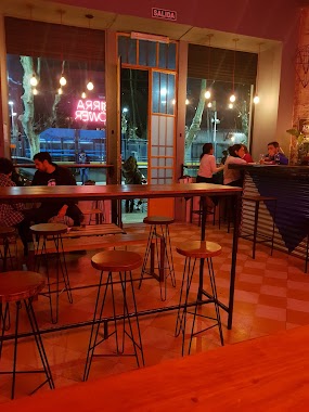
Café Bar Antonio
264, Avenida Cabildo, C1426, Comuna 14, Buenos Aires, AR Argentina
contacts phone
:
+54
Latitude:
-34.5730708
, Longitude:
-58.4393006
larger map & directions
read more
nearest Bar
107 m
Vinoteca Quetec
Avenida Cabildo 196
Bar
read more
249 m
Restaurante Ayelen Diet
Zapata 101
Bar
read more
412 m
La Tacita
Avenida Dorrego 2525
Bar
read more
522 m
El Dorrego
Nicaragua 6086
Bar
read more
547 m
Soraya
Avenida Cabildo 739
Bar
read more
584 m
Aldo's Restoran Vinoteca Palermo
Arévalo 2032
Bar
read more
617 m
De Barricas
C1414CLP, Avenida Dorrego 2092
Bar
read more
621 m
Bar du Marché
Nicaragua 6002
Bar
read more
651 m
Maldita Malta
Avenida Santa Fe 5208
Bar
read more
693 m
La Loggia Cervecería Artesanal
Avenida Federico Lacroze 2114
Bar
read more
713 m
Jerome Cerveza Artesanal
Avenida General Indalecio Chenaut 1878
Bar
read more
747 m
DISTRITO Beer Garden
C1426BRG, Báez 315
Bar
read more
774 m
Berlina Las Cañitas
Arévalo 2925
Bar
read more
796 m
BPE
El Salvador 5983, Buenos Aires
Bar
read more
815 m
Long Bar BsAs
Ángel Justiniano Carranza 2101-2199, C1425FXA
Bar
read more
852 m
Guaresnei
Nicaragua 5802, Palermo
Bar
read more
852 m
Ruda Bar
Crámer 824
Bar
read more
861 m
Coppolla’s
Arce 243
Bar
read more
868 m
Cervecería 1989
Ángel Justiniano Carranza 1989
Bar
read more
945 m
Trova Wine Bar
Dr. Emilio Ravignani 1710
Bar
read more
948 m
Pinta Madre
Nicaragua 5711
Bar
read more
966 m
PL Deli Café & Take Away
Gorriti 6046
Bar
read more
1.022 km
ATHLETIC CLUB PALERMO
Fitz Roy 2238
Bar
read more
1.089 km
El Muro Brewpub
2021, CIE, Fitz Roy, Buenos Aires
Bar
read more
1.185 km
BarQ - Quartier
Humboldt 2125
Bar
read more
📑
all categories
Accounting
Administrative area level 1
Administrative area level 2
Airport
Amusement park
Aquarium
Art gallery
Atm
Bakery
Bank
Bar
Beauty salon
Bicycle store
Book store
Bowling alley
Bus station
Cafe
Campground
Car dealer
Car rental
Car repair
Car wash
Casino
Cemetery
Church
City hall
Clothing store
Colloquial area
Convenience store
Country
Courthouse
Dentist
Department store
Doctor
Electrician
Electronics store
Embassy
Establishment
Finance
Fire station
Florist
Food
Funeral home
Furniture store
Gas station
General contractor
Grocery or supermarket
Gym
Hair care
Hardware store
Health
Hindu Temple
Home goods store
Hospital
Insurance agency
Intersection
Jewelry store
Laundry
Lawyer
Library
Light rail station
Liquor store
Local government office
Locality
Locksmith
Lodging
Meal delivery
Meal takeaway
Mosque
Movie rental
Movie theater
Moving company
Museum
Natural feature
Neighborhood
Night club
Painter
Park
Parking
Pet store
Pharmacy
Physiotherapist
Place of worship
Plumber
Point of interest
Police
Political
Post office
Premise
Real estate agency
Restaurant
Roofing contractor
Route
Rv park, camping
School
Shoe store
Shopping mall
Spa
Stadium
Storage
Store
Subpremise
Subway station
Supermarket
Synagogue
Taxi stand
Train station
Transit station
Travel agency
University
Veterinary care
Zoo
sublocality level 1
sublocality level 3
↑