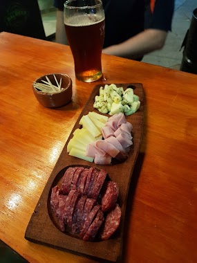
Bar nearby Cervecería Pando
Argentina
Bar nearby Cervecería Pando
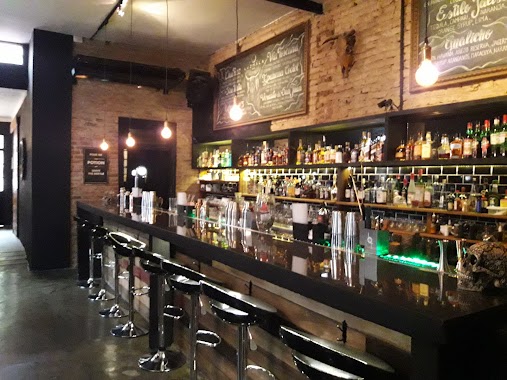
Cervecería Pando
3257-3275, Avenida Congreso, C1428, Comuna 12, Buenos Aires, AR Argentinien
contacts phone
:
+54
Latitude:
-34.5597638
, Longitude:
-58.4709261
larger map & directions
read more
nearest Bar
125 m
Pardo Home Brew Beer
Avenida Congreso 3330
Bar
read more
132 m
La sede
C1428CZR, Capitán General Ramón Freire 2802
Bar
read more
317 m
Boedo
Capitán General Ramón Freire 3151
Bar
read more
376 m
Meeting Point
Superí 2609, Coghlan
Bar
read more
395 m
Wunderbar
Avenida Crámer 2830
Bar
read more
413 m
Bar Despedida Gabi
Avenida Crámer 2887
Bar
read more
558 m
Radiobar
Manuel Ugarte 2789
Bar
read more
573 m
El Supremo De La Milanesa
Avenida Monroe 2917
Bar
read more
579 m
Pizza Parrilla Por Metro
Avenida Monroe 2917
Bar
read more
592 m
Roosevelt
Franklin D. Roosevelt 2811
Bar
read more
671 m
BALBEER
Avenida Doctor Ricardo Balbín 2368
Bar
read more
859 m
Holzen Hops
Iberá 2424
Bar
read more
865 m
THE NEW TIME
Avenida Monroe 2574
Bar
read more
899 m
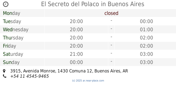
El Secreto del Polaco
Avenida Monroe 3915
Bar
read more
933 m
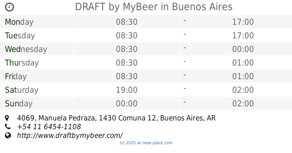
DRAFT by MyBeer
Manuela Pedraza 4069
Bar
read more
953 m
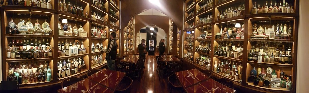
Whisky Malt Argentina
C1430BLQ, Avenida Monroe 3982, Buenos Aires
Bar
read more
956 m
Hangover Beer Station
Amenábar 2363, Buenos Aires
Bar
read more
965 m
Bar
Avenida Cabildo 2600
Bar
read more
968 m
Kiosco
Avenida Cabildo 3378
Bar
read more
985 m
Cerveceria los Beltran
Jaramillo 3278, C1429CSB
Bar
read more
1.009 km
Plaza del Carmen
Av Cabildo 2500
Bar
read more
1.009 km
del Carmen Plaza
Avenida Cabildo 2500
Bar
read more
1.088 km
Bar Plus Ultra
Echeverría 3155
Bar
read more
1.099 km
Holmbar Bar
Holmberg 2637
Bar
read more
1.226 km
Luzmala Bar
Arcos 2950
Bar
read more
📑
all categories
Accounting
Administrative area level 1
Administrative area level 2
Airport
Amusement park
Aquarium
Art gallery
Atm
Bakery
Bank
Bar
Beauty salon
Bicycle store
Book store
Bowling alley
Bus station
Cafe
Campground
Car dealer
Car rental
Car repair
Car wash
Casino
Cemetery
Church
City hall
Clothing store
Colloquial area
Convenience store
Country
Courthouse
Dentist
Department store
Doctor
Electrician
Electronics store
Embassy
Establishment
Finance
Fire station
Florist
Food
Funeral home
Furniture store
Gas station
General contractor
Grocery or supermarket
Gym
Hair care
Hardware store
Health
Hindu Temple
Home goods store
Hospital
Insurance agency
Intersection
Jewelry store
Laundry
Lawyer
Library
Light rail station
Liquor store
Local government office
Locality
Locksmith
Lodging
Meal delivery
Meal takeaway
Mosque
Movie rental
Movie theater
Moving company
Museum
Natural feature
Neighborhood
Night club
Painter
Park
Parking
Pet store
Pharmacy
Physiotherapist
Place of worship
Plumber
Point of interest
Police
Political
Post office
Premise
Real estate agency
Restaurant
Roofing contractor
Route
Rv park, camping
School
Shoe store
Shopping mall
Spa
Stadium
Storage
Store
Subpremise
Subway station
Supermarket
Synagogue
Taxi stand
Train station
Transit station
Travel agency
University
Veterinary care
Zoo
sublocality level 1
sublocality level 3
↑