Bar nearby Figueroa Cervecería
Argentina
Bar nearby Figueroa Cervecería
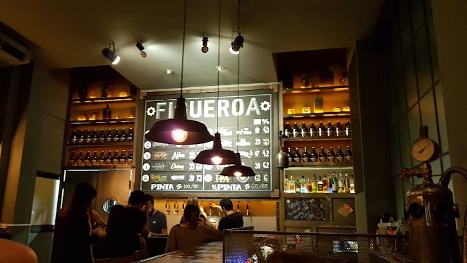
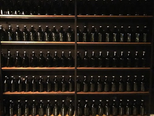
Figueroa Cervecería
2929, French, C1425, Comuna 2, Buenos Aires, AR Argentyna
contacts phone
:
+54 48074976
website:
www.facebook.com
Latitude:
-34.5876562
, Longitude:
-58.4043793
larger map & directions
read more
nearest Bar
43 m
Anglos - Beer & Food
Pasaje Bollini 2134
Bar
read more
298 m
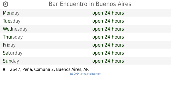
Bar Encuentro
Peña 2647
Bar
read more
484 m
Prisal
Beruti 3336
Bar
read more
486 m
Códigos de Barra
Paseo del Sol, Beruti 3336
Bar
read more
528 m
Piacere
Avenida General Las Heras 2889
Bar
read more
536 m
Refugio Patagonia
Arenales 2707
Bar
read more
553 m
La Barra
Juncal 2383, Buenos Aires
Bar
read more
632 m
Biere
Bulnes 2587
Bar
read more
649 m
Kentucky
Avenida Santa Fe
Bar
read more
649 m
Casona María María
Güemes 3112
Bar
read more
736 m
Bar de Carnes - Brasas & Pintas
Peña 2287
Bar
read more
742 m
Perro Verde
Anasagasti 2004
Bar
read more
799 m
Rufina Sushi Bar Speakeasy
Vicente López 2257, Buenos Aires
Bar
read more
801 m
Oviedo Bar
Avenida Pueyrredón 1384
Bar
read more
831 m
Bombar
Azcuénaga 1222
Bar
read more
851 m
Estación Tacuara
Aráoz 2785
Bar
read more
859 m
Silver Pub
Vicente López 2176
Bar
read more
861 m
Entre Amigos
General Lucio Norberto Mansilla 2899
Bar
read more
887 m
Saint Patrick Irish Pub
Pres. José Evaristo Uriburu 1710 / 1714, Recoleta
Bar
read more
915 m
Paralelo Bar
Julián Álvarez 2492
Bar
read more
934 m
Estación Sur
Presidente José Evaristo Uriburu 1210
Bar
read more
937 m
Gotama Restó Bar
República Dominicana 3386
Bar
read more
1.001 km
La Victoria Café bar
Sánchez de Bustamante 1402, Recoleta
Bar
read more
1.01 km
Flopy
Paraguay 3088
Bar
read more
1.295 km
Oasis Bar
Avenida Callao 1176
Bar
read more
📑
all categories
Accounting
Administrative area level 1
Administrative area level 2
Airport
Amusement park
Aquarium
Art gallery
Atm
Bakery
Bank
Bar
Beauty salon
Bicycle store
Book store
Bowling alley
Bus station
Cafe
Campground
Car dealer
Car rental
Car repair
Car wash
Casino
Cemetery
Church
City hall
Clothing store
Colloquial area
Convenience store
Country
Courthouse
Dentist
Department store
Doctor
Electrician
Electronics store
Embassy
Establishment
Finance
Fire station
Florist
Food
Funeral home
Furniture store
Gas station
General contractor
Grocery or supermarket
Gym
Hair care
Hardware store
Health
Hindu Temple
Home goods store
Hospital
Insurance agency
Intersection
Jewelry store
Laundry
Lawyer
Library
Light rail station
Liquor store
Local government office
Locality
Locksmith
Lodging
Meal delivery
Meal takeaway
Mosque
Movie rental
Movie theater
Moving company
Museum
Natural feature
Neighborhood
Night club
Painter
Park
Parking
Pet store
Pharmacy
Physiotherapist
Place of worship
Plumber
Point of interest
Police
Political
Post office
Premise
Real estate agency
Restaurant
Roofing contractor
Route
Rv park, camping
School
Shoe store
Shopping mall
Spa
Stadium
Storage
Store
Subpremise
Subway station
Supermarket
Synagogue
Taxi stand
Train station
Transit station
Travel agency
University
Veterinary care
Zoo
sublocality level 1
sublocality level 3
↑