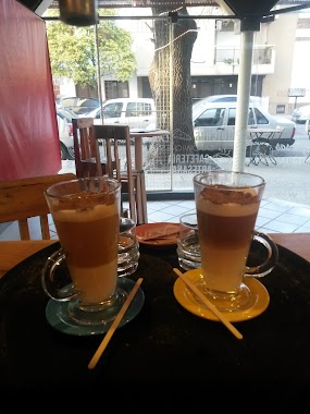
Bar nearby Hurry Up
Argentina
Bar nearby Hurry Up
Hurry Up
895, Calle 56, B1900, La Plata, La Plata, AR Argentina
contacts phone
:
+54
Latitude:
-34.9225641
, Longitude:
-57.9507199
larger map & directions
read more
nearest Bar
175 m
The Brothers House
Calle 11, La Plata
Bar
read more
320 m
Theater - Bar La Plata
Calle 58 770, La Plata
Bar
read more
356 m
Pinta Rock
Calle 56 722, La Plata
Bar
read more
450 m
Bar De Agrupacion Politica KOKINA La Plata
Calle 10 1200, La Plata
Bar
read more
455 m
Hummingbird Art and Culture
Calle 10 1305, La Plata
Bar
read more
455 m
Colibrí Arte y Cultura
Calle 10 1305, La Plata
Bar
read more
562 m
Chicha Cervezas Artesanales
Diagonal 74 1702, La Plata
Bar
read more
572 m
Almendra Bar
Calle 8 1208, La Plata
Bar
read more
577 m
Ogham
Calle 10 & Calle 50, La Plata
Bar
read more
582 m
FRIDA La Plata
B1900DPL, Calle 11 859, La Plata
Bar
read more
637 m
Pachanga
Calle 54 632, La Plata
Bar
read more
641 m
Lupita
B1900AQE, Calle 49 775, La Plata
Bar
read more
692 m
Antares La Plata Diagonal
Calle 74, La Plata
Bar
read more
699 m
Hendrix
Diagonal 74 1900, La Plata
Bar
read more
715 m
Sampietro Roberto
Avenida 7 1094, La Plata
Bar
read more
777 m
Twins
Av 7 1278, Casco Urbano, La Plata
Bar
read more
787 m
Refugio Patagonia
Av. 7 & Calle 59, La Plata
Bar
read more
827 m
FUTER Cervecería
Calle 47 797, La Plata
Bar
read more
881 m
Ennio Tierra de Vinos
Calle 47 973, La Plata
Bar
read more
895 m
El Círculo Craft Beers
53 esq 6 num 544, La Plata
Bar
read more
902 m
Amberes Cervezas Artesanales
Calle 63 827, La Plata
Bar
read more
948 m
Estación Growler
B1904CLB, Avenida 7 1400, La Plata
Bar
read more
996 m
Vino Rojo / Red Wine
Av. 13 672, Casco Urbano, La Plata
Bar
read more
1.026 km
Cinco Sabios
Avenida 13 1540, La Plata
Bar
read more
1.059 km
Cerveceria Gambrinus
Calle 45 777, La Plata
Bar
read more
📑
all categories
Accounting
Administrative area level 1
Administrative area level 2
Airport
Amusement park
Aquarium
Art gallery
Atm
Bakery
Bank
Bar
Beauty salon
Bicycle store
Book store
Bowling alley
Bus station
Cafe
Campground
Car dealer
Car rental
Car repair
Car wash
Casino
Cemetery
Church
City hall
Clothing store
Colloquial area
Convenience store
Country
Courthouse
Dentist
Department store
Doctor
Electrician
Electronics store
Embassy
Establishment
Finance
Fire station
Florist
Food
Funeral home
Furniture store
Gas station
General contractor
Grocery or supermarket
Gym
Hair care
Hardware store
Health
Hindu Temple
Home goods store
Hospital
Insurance agency
Intersection
Jewelry store
Laundry
Lawyer
Library
Light rail station
Liquor store
Local government office
Locality
Locksmith
Lodging
Meal delivery
Meal takeaway
Mosque
Movie rental
Movie theater
Moving company
Museum
Natural feature
Neighborhood
Night club
Painter
Park
Parking
Pet store
Pharmacy
Physiotherapist
Place of worship
Plumber
Point of interest
Police
Political
Post office
Premise
Real estate agency
Restaurant
Roofing contractor
Route
Rv park, camping
School
Shoe store
Shopping mall
Spa
Stadium
Storage
Store
Subpremise
Subway station
Supermarket
Synagogue
Taxi stand
Train station
Transit station
Travel agency
University
Veterinary care
Zoo
sublocality level 1
sublocality level 3
↑