Bar nearby La Oreja Brew Garden
Argentina
Bar nearby La Oreja Brew Garden
La Oreja Brew Garden
60, Ruta, Junín, Junín, AR Argentina
contacts phone
:
+54 261 611-1555
website:
www.facebook.com
Latitude:
-33.1152506
, Longitude:
-68.5438462
larger map & directions
read more
nearest Bar
122 m
La Oreja
Junín
Bar
read more
2.426 km
Karliucho SA
Ximenita 69 Barriales, Junín
Bar
read more
4.556 km
Peluquería Agustín Miranda
ruta 61Rodriguez, Peña, Mendoza
Bar
read more
6.122 km
citon bailable
Necochea 706, San Martín
Bar
read more
6.292 km
Huar Cerveza Artesanal
Unnamed Road, San Martín
Bar
read more
6.359 km
Hungry Café Bar
Sarmiento 298, Junín
Bar
read more
6.398 km
POPULUS BAR DE AMIGO
Avenida Mitre 446, Junín
Bar
read more
6.538 km
POSITANO
Junín
Bar
read more
7.112 km
El Madero Resto-bar
M5570HJH, Cuesta del Madero 57, San Martín
Bar
read more
7.185 km
EL Pichon Grill & Bar
25 de mayo y velez sarfield, San Martín
Bar
read more
7.212 km
PODIUM coffee&bar
Bailen 52, San Martín
Bar
read more
7.357 km
Cafe Viser
M5570ARA Almirante Brown 112, ARA
Bar
read more
7.607 km
CONVOY Beer Park
Calle Sarmiento s/n ( entre calle Viamonte y Balcarce, San Martín
Bar
Restaurant
Food
Point of interest
Establishment
read more
7.79 km
La Taberna
Belgrano 55, San Martín
Bar
Restaurant
Point of interest
Food
Establishment
read more
7.984 km
Proximo Bar
M5570HNB, 9 de Julio 393 M5570HNB
Bar
read more
7.987 km
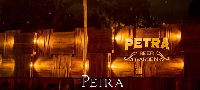
Petra Beer Garden
Viamonte 266, San Martín
Bar
read more
8.135 km
El Rodeo Quincho Parrilla
Unnamed Road
Bar
read more
8.484 km
Malandra Resto-Bar
Avenida Mitre 169, San Martín
Bar
read more
8.692 km
POPULUS BAR DE AMIGO
Avenida Mitre, San Martín
Bar
read more
9.373 km
Cervecería GUALTA
San Martín
Bar
read more
11.793 km
BACCO Abasto de Bebidas
Galpon San Roque
Bar
read more
15.595 km
Ypf
Los Álamos
Bar
read more
15.694 km
Renata Platos y Bar
Maipú
Bar
read more
17.9 km
Speedway El Santo
Maipú
Bar
read more
17.912 km
El Santo Disco
Juan Isidro Maza 1369, Rodeo del Medio
Bar
read more
📑
all categories
Accounting
Administrative area level 1
Administrative area level 2
Airport
Amusement park
Aquarium
Art gallery
Atm
Bakery
Bank
Bar
Beauty salon
Bicycle store
Book store
Bowling alley
Bus station
Cafe
Campground
Car dealer
Car rental
Car repair
Car wash
Casino
Cemetery
Church
City hall
Clothing store
Colloquial area
Convenience store
Country
Courthouse
Dentist
Department store
Doctor
Electrician
Electronics store
Embassy
Establishment
Finance
Fire station
Florist
Food
Funeral home
Furniture store
Gas station
General contractor
Grocery or supermarket
Gym
Hair care
Hardware store
Health
Hindu Temple
Home goods store
Hospital
Insurance agency
Intersection
Jewelry store
Laundry
Lawyer
Library
Light rail station
Liquor store
Local government office
Locality
Locksmith
Lodging
Meal delivery
Meal takeaway
Mosque
Movie rental
Movie theater
Moving company
Museum
Natural feature
Neighborhood
Night club
Painter
Park
Parking
Pet store
Pharmacy
Physiotherapist
Place of worship
Plumber
Point of interest
Police
Political
Post office
Premise
Real estate agency
Restaurant
Roofing contractor
Route
Rv park, camping
School
Shoe store
Shopping mall
Spa
Stadium
Storage
Store
Subpremise
Subway station
Supermarket
Synagogue
Taxi stand
Train station
Transit station
Travel agency
University
Veterinary care
Zoo
sublocality level 1
sublocality level 3
↑