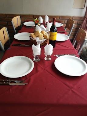
Bar nearby Ramona
Argentina
Bar nearby Ramona
Ramona
Camargo, C1414, Comuna 15, Buenos Aires, AR Argentina
contacts phone
:
+54
Latitude:
-34.6034311
, Longitude:
-58.4375416
larger map & directions
read more
nearest Bar
123 m
Cervecería La Rubia
AAN, Avenida Warnes 100
Bar
read more
267 m
KAIO
Lavalleja 289, C1414DTE
Bar
read more
371 m
la esquina de Joaco
Avenida Warnes 301
Bar
read more
405 m
Bar Lorena
C1414AQF, Juan Ramirez de Velazco 212
Bar
read more
405 m
Bar Lorena
C1414AQF, Juan Ramirez de Velasco 212
Bar
read more
424 m
DRINKING TIME
C1414DPI, Aráoz 419, Buenos Aires
Bar
read more
510 m
Caffé del Doge Argentina - Villa Crespo
Avenida Estado de Israel 4841
Bar
read more
546 m
Wally Cerveceria Artesanal
Murillo 605
Bar
read more
589 m
Paseo del Sol
Leopoldo Marechal 810
Bar
read more
624 m
MUDA BAR
Acevedo 327
Bar
read more
651 m
Kinky
AON, Vera 662, Buenos Aires
Bar
read more
685 m
Futu Sushi
C1414DNT, Avenida Raúl Scalabrini Ortíz 622
Bar
read more
726 m
El Desalmadero (Folklore)
Avenida Raúl Scalabrini Ortíz 670
Bar
read more
751 m
Fotobar SRL
Juan B. Ambrosetti 726
Bar
read more
783 m
Don Ricardo Restobar
C1405BIL, Juan B. Ambrosetti 702
Bar
read more
798 m
Adela Ex Cosimo
660,, Río de Janeiro 658
Bar
read more
883 m
Cuchi
Juan Ramirez de Velasco 812
Bar
read more
890 m
La Cueva
Juan Ramírez de Velazco 801
Bar
read more
981 m
José Bar
Yatay 1071
Bar
read more
997 m
Del Norte
Avenida Corrientes 4390
Bar
read more
1.049 km
Restó-Bar Demmy
Potosí 4277
Bar
read more
1.177 km
Pinta en Casa
Río de Janeiro 209, C1405CCB
Bar
read more
1.233 km
Carioca
Avenida Córdoba 4302
Bar
read more
1.257 km
Milonga del Pez Cañón
BAB, Avenida Córdoba 4379
Bar
read more
1.304 km
Dambar
1218, DTZ, Lavalleja C1414DTZ, Buenos Aires
Bar
read more
📑
all categories
Accounting
Administrative area level 1
Administrative area level 2
Airport
Amusement park
Aquarium
Art gallery
Atm
Bakery
Bank
Bar
Beauty salon
Bicycle store
Book store
Bowling alley
Bus station
Cafe
Campground
Car dealer
Car rental
Car repair
Car wash
Casino
Cemetery
Church
City hall
Clothing store
Colloquial area
Convenience store
Country
Courthouse
Dentist
Department store
Doctor
Electrician
Electronics store
Embassy
Establishment
Finance
Fire station
Florist
Food
Funeral home
Furniture store
Gas station
General contractor
Grocery or supermarket
Gym
Hair care
Hardware store
Health
Hindu Temple
Home goods store
Hospital
Insurance agency
Intersection
Jewelry store
Laundry
Lawyer
Library
Light rail station
Liquor store
Local government office
Locality
Locksmith
Lodging
Meal delivery
Meal takeaway
Mosque
Movie rental
Movie theater
Moving company
Museum
Natural feature
Neighborhood
Night club
Painter
Park
Parking
Pet store
Pharmacy
Physiotherapist
Place of worship
Plumber
Point of interest
Police
Political
Post office
Premise
Real estate agency
Restaurant
Roofing contractor
Route
Rv park, camping
School
Shoe store
Shopping mall
Spa
Stadium
Storage
Store
Subpremise
Subway station
Supermarket
Synagogue
Taxi stand
Train station
Transit station
Travel agency
University
Veterinary care
Zoo
sublocality level 1
sublocality level 3
↑