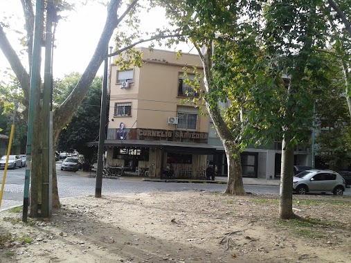
Bar nearby Restaurante CORNELIO SAAVEDRA
Argentina
Bar nearby Restaurante CORNELIO SAAVEDRA
Restaurante CORNELIO SAAVEDRA
3599, Besares, C1430, Comuna 12, Buenos Aires, AR Argentina
contacts phone
:
+54
Latitude:
-34.5497254
, Longitude:
-58.482515
larger map & directions
read more
nearest Bar
240 m
FM Bar de artistas
Avenida Melián 4002
Bar
read more
322 m
Bar del Parque
C1430ACO, Avenida García del Río 3586
Bar
read more
590 m
Beltran Bar
ASR 3702, Capitán General Ramón Freire
Bar
read more
594 m
30 y Pico
Pico 3599, C1430CWC
Bar
read more
615 m
Cerveceria los Beltran
Jaramillo 3278, C1429CSB
Bar
read more
651 m
Esquina Taki Bar
Avenida García del Río 3003, Buenos Aires
Bar
read more
685 m
Rusticana Bar & Picadas
Estomba 3677
Bar
read more
693 m
Birren
Tronador 4709, C1430DNK
Bar
read more
743 m
Cepa wine
Zapiola 4690
Bar
read more
752 m
AntiDomingo
Pinto 4860
Bar
read more
841 m
Aquiles
Núñez 3299
Bar
read more
841 m
Granada
Núñez 3299
Bar
read more
845 m
Quintana
Núñez 3299,1429
Bar
read more
860 m
Brown Bar
Avenida García del Río 2900-2802
Bar
read more
864 m
Brown Bar Saavedra
DER, Avenida García del Río 2802
Bar
read more
885 m
La Camorra
Avenida García del Río 4410
Bar
read more
1.04 km
Autooloco
B1602EIW, Aristóbulo del Valle 2533, Florida
Bar
read more
1.066 km
Vinoteca Valle Fértil
Roque Pérez 3231
Bar
read more
1.154 km
Hairless Pub
2455, Arias
Bar
read more
1.16 km
Tomago
Arias 2451
Bar
read more
1.16 km
Beer67
Arias 2451
Bar
read more
1.161 km
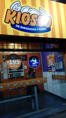
Kiosco De Empanadas Pizas
Avenida Cabildo 4648, C1429ADU
Bar
read more
1.215 km
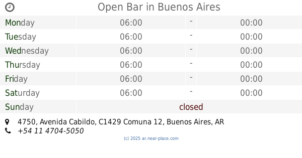
Open Bar
Avenida Cabildo 4750
Bar
read more
1.219 km
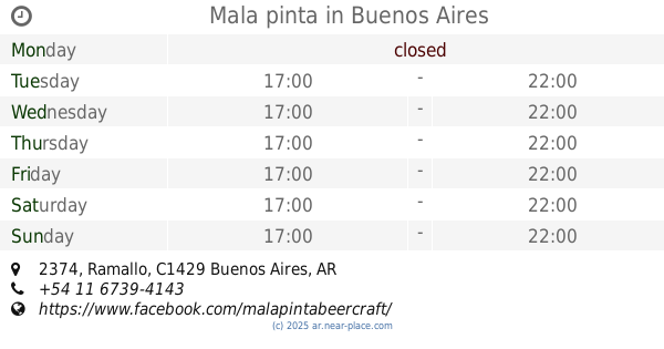
Mala pinta
Ramallo 2374
Bar
read more
1.252 km
Boedo
Capitán General Ramón Freire 3151
Bar
read more
📑
all categories
Accounting
Administrative area level 1
Administrative area level 2
Airport
Amusement park
Aquarium
Art gallery
Atm
Bakery
Bank
Bar
Beauty salon
Bicycle store
Book store
Bowling alley
Bus station
Cafe
Campground
Car dealer
Car rental
Car repair
Car wash
Casino
Cemetery
Church
City hall
Clothing store
Colloquial area
Convenience store
Country
Courthouse
Dentist
Department store
Doctor
Electrician
Electronics store
Embassy
Establishment
Finance
Fire station
Florist
Food
Funeral home
Furniture store
Gas station
General contractor
Grocery or supermarket
Gym
Hair care
Hardware store
Health
Hindu Temple
Home goods store
Hospital
Insurance agency
Intersection
Jewelry store
Laundry
Lawyer
Library
Light rail station
Liquor store
Local government office
Locality
Locksmith
Lodging
Meal delivery
Meal takeaway
Mosque
Movie rental
Movie theater
Moving company
Museum
Natural feature
Neighborhood
Night club
Painter
Park
Parking
Pet store
Pharmacy
Physiotherapist
Place of worship
Plumber
Point of interest
Police
Political
Post office
Premise
Real estate agency
Restaurant
Roofing contractor
Route
Rv park, camping
School
Shoe store
Shopping mall
Spa
Stadium
Storage
Store
Subpremise
Subway station
Supermarket
Synagogue
Taxi stand
Train station
Transit station
Travel agency
University
Veterinary care
Zoo
sublocality level 1
sublocality level 3
↑